Wyoming State Water Plan
Wyoming State Water Plan
Wyoming Water Development Office
6920 Yellowtail Rd
Cheyenne, WY 82002
Phone: 307-777-7626

Wyoming Water Development Office
6920 Yellowtail Rd
Cheyenne, WY 82002
Phone: 307-777-7626


Introduction
As authorized by the Wyoming Water Development Commission in its contract scope of work, this planning document presents current and proposed future uses of water in Wyoming's Wind/Bighorn River Basin. Uses to be inventoried include agricultural, municipal, industrial, environmental, and recreation. Both surface and ground water uses, as
well as overall water quality are described. Given current uses, the availability of surface and
ground water to meet future requirements is estimated. To lay the groundwork for future water development, a review of the current institutional and legal framework facing such projects is presented. Finally, thoughts are
given to guide implementation of the water planning process. The intent of this summary report is to describe the planning study in sufficient detail for the reader to gain a general understanding of the investigations that were performed and the results of those investigations. For
detailed information on a specific topic the reader is directed to the technical memorandum prepared for that topic.
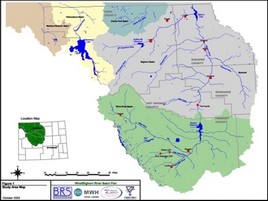
HTML or PDF (4,237kb) Final Report for the 2003 Wind/Bighorn Basin Plan
HTML or PDF (674kb) This basin plan documents current water uses, surface and ground water availability, and projects future use and/or demand for water, based upon various planning scenarios.
HTML or PDF (838kb) The majority of the appropriated water in the WBHB has been appropriated for the irrigation of land. Therefore, an estimate of water used for irrigation is central in the development of a comprehensive water use inventory for the WBHB. Mapping the irrigated lands within the WBHB is a principal task in developing the water use inventory.
HTML or PDF (1,389kb) The availability of surface water was determined through the construction and use of a spreadsheet simulation model that calculates water availability based on the physical amount of streamflow less historical diversions, compact requirements and minimum flows. The availability of ground water was primarily performed based on a review of existing information throughout the study area.
HTML or PDF (958kb) Water demand is a function of environmental, economic, demographic, cultural and institutional variables. Among these, the first three are primary variables, but all must be considered if realistic projections are to be made. Credible projections also demand good data, both quantitative and qualitative.
HTML or PDF (578kb) The list of opportunities compiled under this task is intended to be used by individuals and organizations that need to develop a water supply to satisfy their specific needs. A long list of future water use opportunities was developed with input from the Basin Advisory Group (BAG), and is included here as Appendix A.
PDF (669kb) Access the 2003 Wind/Bighorn River Basin Executive Summary here
There are 48 spreadsheet workbooks, one for each of three hydrologic conditions and twelve distinct areas:
For further information including both a user's guide and engineering documentation of the models please refer to the Spreadsheet Model Development and Calibration.
Steps for Downloading the Models
The three workbooks (wet, dry and normal years) for each area are yoked together with a simple menu-driven graphical user interface (GUI), effectively creating four area models. In addition, the spreadsheet models are stored as zipped Microsoft Excel files using WinZip compression software. An evaluation version of WinZip may be downloaded at http://www.winzip.com/download.htm
| Spreadsheet Models | |
| Clarks Fork Model | 2585 kb compressed 13757 kb uncompressed |
| Greybull Model | 4273 kb compressed 23087 kb uncompressed |
| Little Wind Model | 2638 kb compressed 13609 kb uncompressed |
| Lower Bighorn Model | 3195 kb compressed 16728 kb uncompressed |
| Lower Wind Model | 4038 kb compressed 22351 kb uncompressed |
| Madison Model | 761 kb compressed 2717 kb uncompressed |
| Nowood Model | 4171 kb compressed 22825 kb uncompressed |
| Owl Creek Model | 2978 kb compressed 15490 kb uncompressed |
| Shoshone Model | 6036 kb compressed 34218 kb uncompressed |
| Upper Bighorn Model | 3348 kb compressed 17739 kb uncompressed |
| Upper Wind Model | 5236 kb compressed 29300 kb uncompressed |
| Yellowstone Model | 1261 kb compressed 5822 kb uncompressed |
The memoranda may be viewed in either HTML or PDF. The PDF version requires Adobe Acrobat® Reader. If you do not already have this program on your computer, please visit Adobe's Website to download a free copy.
| HTML | Technical Memoranda | |
| 83 kb | 155 kb | Tab 1 - Summary of Wyoming Water Law |
| 52 kb | 238 kb | Tab 2 - Summary of Interstate Compacts and Decrees |
| 26 kb | 113 kb | Tab 3 - Institutional Considerations |
| 312 kb | 802 kb | Tab 4 - Agricultural Water Use and Diversion Requirements |
| 436 kb | 2343 kb | Tab 5 - Mapping and Water Rights Data |
| 169 kb | 694 kb | Tab 6 - Municipal Uses |
| 3194 kb |
Figure 1 - Municipal Wells above 50 GPM |
|
| 181 kb | 331 kb | Tab 7 - Domestic Uses |
| 3298 kb | Figure 1 - Domestic Wells | |
| 17 kb | 139 kb | Tab 8 -
Industrial and Mining Uses |
| 175 kb | 1212 kb | Tab 9 -
Environmental and Recreational Uses |
| 512 kb | 252 kb | Tab 10 - Water Use from Storage |
| 16 kb | 46 kb | Tab 11 -
Wind River Range Glaciers |
| 22 kb | 90 kb | Tab 12 - Water Conservation in the Wind/Bighorn Basin |
| None |
None | Tab 13 - Empty |
| 1738 kb | 2377 kb | Tab 14 - Surface Water Hydrology |
| None | 1326 kb |
Appendices A, B, C |
| 3370 kb | 2099 kb | Tab 15 -
Spreadsheet Model Development and Calibration |
| None | 5993 kb |
Appendices A, B, C, D |
| 113 kb | 212 kb | Tab 16 - Available Surface Water Determination |
| None | 1091 kb |
Appendices A, B, C |
| 4447 kb | 2043 kb | Tab 17 - Available Groundwater Determination |
| 3019 kb |
Appendix B - Water Well Locations |
|
| 1735 kb |
Appendix C - Hydrogeologic Data |
|
| 1343 kb |
Appendix D - Aquifer Sensitivity |
|
| 1966 kb |
Appendix E - Hydrographs |
|
| 200 kb | 576 kb | Tab 18 - Socioeconomic Factors and Water Demand |
| 124 kb | 435 kb | Tab 19 - Agricultural Water Demand and Projections |
| 81 kb | 102 kb | Tab 20 - Municipal and Domestic Water Demand and Projections |
| 64 kb | 100 kb | Tab 21 - Industrial and Mining Water Demand and Projections |
| 15 kb | 100 kb | Tab 22 - Recreational and Environmental Demand and Projections |
| 25 kb | 106 kb | Tab 23 - Future Water Use Opportunities: Screening Criteria |
| 48 kb | 508 kb | Tab 24 - Future Water Use
Opportunities: Project Summaries |
| 18 kb | 97 kb | Tab 25 - Opportunities to Enhance and Protect Water Quality |
| None | 251 kb |
Bibliography of Previous Water Use Studies |
| Click for listing | Irrigation Diversion Operation and Description | |