Wyoming State Water Plan
Wyoming State Water Plan
Wyoming Water Development Office
6920 Yellowtail Rd
Cheyenne, WY 82002
Phone: 307-777-7626

Wyoming Water Development Office
6920 Yellowtail Rd
Cheyenne, WY 82002
Phone: 307-777-7626


| SUBJECT: |
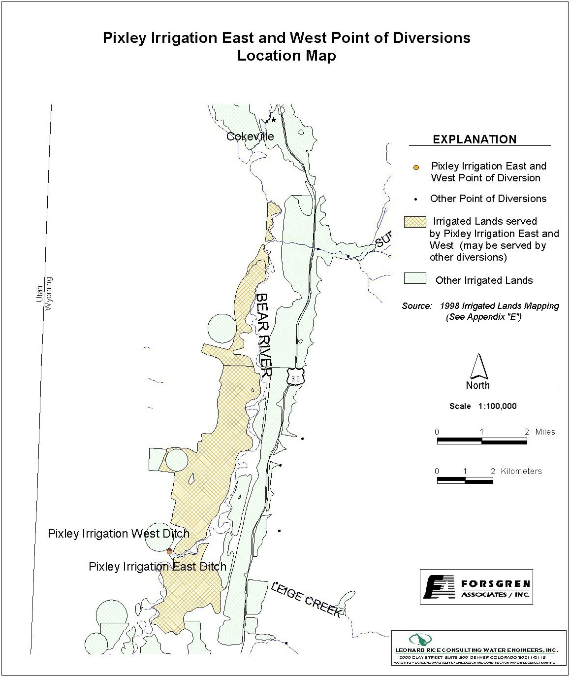
Appendix D Key Structures and Diversions PIXLEY DAM |
| PREPARED BY: | Bear River Basin Planning Team |
| DATE: | August 7, 2000 |
| Diversion Description: The Pixley Dam is a significant reference structure in the Bear River Compact. Water passing over the Pixley dam is divided between Wyoming (43%) and Idaho (57%). | 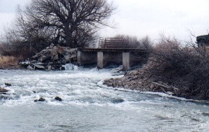 Downstream view of Pixley Dam |
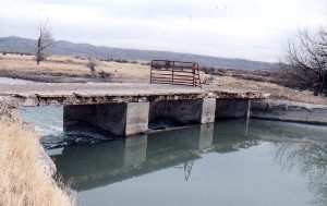 Upstream view of Pixley Dam | |
|
Conveyance Description: Open channel conveyances.
Direct Flow Water Rights:2
| Priority Date | Permit Number |
Permitted Use | Permitted Acres |
Flow (CFS) |
Cumulative (CFS) |
Comments |
|---|---|---|---|---|---|---|
| Pixley Irrigation (East) | ||||||
| -1880 | Terr | Irrigation | 1255 | 17.92 | 17.92 | |
| Pixley Irrigation (West) | ||||||
| -1880 | Terr | Irrigation | 886 | 12.65 | 12.65 | |
| -1881 | Terr | Irrigation | 798 | 11.4 | 24.05 | |
| 10-17-1882 | Terr | Irrigation | 315 | 4.50 | 28.55 | |
| 08-03-1907 | 1761E | Irrigation | 6 | 0.08 | 28.93 | |
| 04-24-1930 | 5718E | Irrigation | 206.2 | 2.95 | 31.58 | |
| 04-24-1930 | 5719E | Irrigation | 436.74 | 6.24 | 37.82 | |
Associated Storage Rights:
| Reservoir | Shareholder | Volume/Shares (Acre-ft) |
Comments |
|---|---|---|---|
| Woodruff Narrows | Buckley Brothers | 107 | |
| Woodruff Narrows | Madylon Gooding | 284 | |
| Woodruff Narrows | Margaret McKinnon | 172 | |
| Woodruff Narrows | Lynn & Willa McKinnon | 262 | |
| Woodruff Narrows | Evan & Dottie Pope | 969 | |
| Woodruff Narrows | Thompson Land & Livestock | 625 |
Irrigation Practices: Lands are primarily flood irrigated.3
Crop Types / Consumptive Use: Water is primarily used to irrigate meadow grasses.3
Other Operational Information: The Pixley diversions are not regulated due to their unique association with the Pixley dam as a defining structure of the Bear River Compact. (The Compact does not require flows through the Pixley Dam from the Upper Division to the Lower Division.)
References: