Wyoming State Water Plan
Wyoming State Water Plan
Wyoming Water Development Office
6920 Yellowtail Rd
Cheyenne, WY 82002
Phone: 307-777-7626

Wyoming Water Development Office
6920 Yellowtail Rd
Cheyenne, WY 82002
Phone: 307-777-7626


| SUBJECT: |
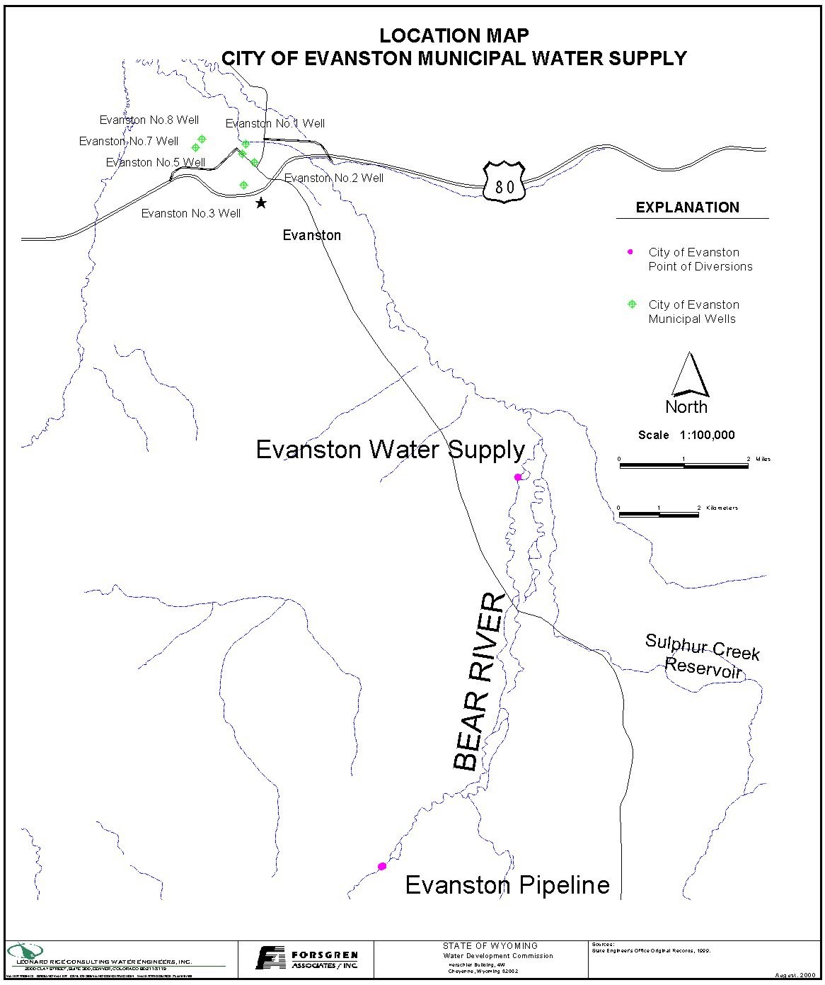
Appendix D Key Structures and Diversions EVANSTON PIPELINE DIVERSION |
| PREPARED BY: | Bear River Basin Planning Team |
| DATE: | August 7, 2000 |
| Diversion Description: The Evanston headgate structure consists of a permanent notched concrete cut-off wall constructed across the river. The wall can be raised during low flows using boards. Historically this has not been required. The water is divererted into a concrete settling basin approximately 142 feet wide by 250 feet long. The headwall of the basin has a trash rack and a series of inlet gates (three (3) 4’ x 6’ slide gates and nine (9) 24-inch canal gates) at varying elevations to control inflow. Water is delivered from the basin to control building located about 600 feet downstream through a 36-inch steel pipe. Flow is measured at that building using a Parshall Flume. | 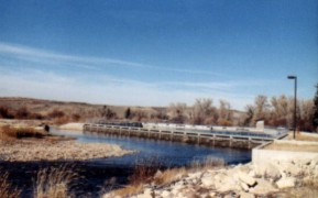 Evanston Intake Facility on the Bear River |
 Evanston Intake Settling Basin |
The facility also includes an infiltration gallery with approximatley 3300 linear feet of
12-inch diameter perforated pipe under the river. The inflitration gallery is located
immediately upstream of the cut-off wall an has an estimated capacity of approximately 8
CFS. Water is delivered from the gallery to the control building through a 24-inch pipe.
Flow is measured in that building using a second Parshall Flume.
The Evanston Pipeline and Diversion facilities were constructed and placed in service in 1989.2 |
| |
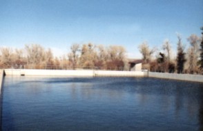
| Conveyance Description: Water is conveyed through 24,000 feet of 36-inch steel pipeline north to a junction vault located on the north side of Highway 150 . From the junction vault, water can be conveyed to and from Sulphur Creek Reservoir through 11,200 feet of 36-inch steel pipeline. Water is also conveyed from the junction vault to the City of Evanston through approximately 7 miles of 30-inch steel pipeline. The junction vault is metered to record water delivery to and from the reservoir as well as delivery to the city.3 |  Construction Photo of Evanston Pipeline junction vault |
Direct Flow Water Rights:1
| Priority Date | Permit Number |
Permitted Use | Permitted Acres |
Flow (CFS) |
Cumulative (CFS) |
Comments |
|---|---|---|---|---|---|---|
| -1869 | Terr | Irrigation, RR | 4.50 | 0.60 | 0.60 | PL, Pump, Tank at Evanston |
| 03-28-1875 | Terr | Municipal | 63.02 A/F | 0.33 | 0.93 | Evanston Ditch (May-Sept) |
| 03-28-1875 | Terr | Municipal | 94.50 A/F | 0.45 | 1.38 | Evanston Ditch (May-Sept) |
| 03-28-1875 | Terr | Municipal | 76.06 A/F | 0.39 | 1.77 | Evanston Ditch (May-Sept) |
| 03-28-1875 | Terr | Municipal | 106.05 A/F | 0.50 | 2.27 | Evanston Ditch (May-Sept) |
| -1875 | Terr | Irrigation, Municipal, Storage | 4.00 | 6.27 | Evanston Water Supply Ditch | |
| 08-28-1893 | 563 | Irrigation, Municipal, Dom., Storage | 3.00 | 9.27 | Evanston Water Supply Ditch | |
| 03-29-1901 | 693E | Municipal | 178.5 A/F | 0.85 | 10.12 | Enl Anderson (May 15-Sept) |
| 01-11-1902 | 3643 | RR | 0.27 | 10.39 | PL, Windmill, Pump, Tanks at Mills | |
| 09-22-1915 | 3520E | Municipal | 99.27 A/F | 0.51 | 10.90 | Evanston Water Ditch (May-Sept) |
| 09-22-1915 | 3520E | Municipal | 143.85 A/F | 0.69 | 11.59 | Evanston Water Ditch (May 15-Sept) |
| 09-28-1933 | 4942E | Municipal | 52.50 A/F | 0.25 | 11.84 | Evanston Water Supply Ditch (May 15-Sept) |
| 04-17-1974 | 24325 | Municipal | 7.55 | 19.39 | ||
| 02-01-1988 | 6911E | RS | 14060.3 A/F | Enl Sulphur Creek Reservoir |
Associated Storage Rights:
| Reservoir | Shareholder | Volume (Acre-ft) |
Est. % of Shares Used this Diversion3 | Comments |
|---|---|---|---|---|
| Sulphur Creek | City of Evanston | 12,837 | 100% |
Irrigation Practices: Not Applicable. Water is all municipal use.
Estimated Diversion Efficiency: Not Applicable.
Crop Types / Consumptive Use: Not Applicable
Return Flows: Evanston utilizes a mechanical water treatment plant that discharges wastewater into the Yellow Creek tributary of the Bear River. Recorded average wastewater effluent for the past 7 years (1993-1999) was 1.41 MGD (4.33 AFD). Average annual wastewater effluent is 504 MG or 1,547 acre-feet.
Other Operational Information: The Evanston Pipeline and Intake Facility was not placed in service until 1989. Prior to this time, the City of Evanston utilized the Evanston Water Supply Ditch to meet their municipal needs. See Evanston Municipal Water Use Memo in Appendix “J”.
References:
Monthly Diversion Records
Evanston Pipeline (City of Evanston)
| YEAR | MAY | JUNE | JULY | AUGUST | SEPTEMBER | ||||||||||
|---|---|---|---|---|---|---|---|---|---|---|---|---|---|---|---|
| Total of Daily Ave for Month | Average CFS |
Monthly Total Ac-Ft |
Total of Daily Ave for Month | Average CFS |
Monthly Total Ac-Ft |
Total of Daily Ave for Month | Average CFS |
Monthly Total Ac-Ft |
Total of Daily Ave for Month | Average CFS |
Monthly Total Ac-Ft |
Total of Daily Ave for Month | Average CFS |
Monthly Total Ac-Ft | |
| 1970 | |||||||||||||||
| 1971 | |||||||||||||||
| 1972 | |||||||||||||||
| 1973 | |||||||||||||||
| 1974 | |||||||||||||||
| 1975 | |||||||||||||||
| 1976 | |||||||||||||||
| 1977 | |||||||||||||||
| 1978 | |||||||||||||||
| 1979 | |||||||||||||||
| 1980 | |||||||||||||||
| 1981 | |||||||||||||||
| 1982 | |||||||||||||||
| 1983 | |||||||||||||||
| 1984 | |||||||||||||||
| 1985 | |||||||||||||||
| 1986 | |||||||||||||||
| 1987 | |||||||||||||||
| 1988 | |||||||||||||||
| *1989 | 4.4 | 273.1 | 7.3 | 433.8 | 12.5 | 767.8 | 10.4 | 640.8 | 7.4 | 437.5 | |||||
| *1990 | 6.5 | 402.5 | 9.1 | 539.6 | 11.9 | 734.2 | 10.8 | 664.4 | 7.5 | 449.1 | |||||
| *1991 | 4.2 | 256.1 | 7.8 | 463.1 | 11.4 | 699.5 | 8.3 | 511.8 | 6.1 | 361.5 | |||||
| *1992 | 7.3 | 447.6 | 10.1 | 600.6 | 10.6 | 650.3 | 11.2 | 690.7 | 7.3 | 434.5 | |||||
| 1993 | 149 | 4.8 | 295.5 | 246 | 8.2 | 487.9 | 280 | 9.0 | 555.4 | 247 | 8.0 | 489.9 | 228 | 7.6 | 452.2 |
| 1994 | 210 | 6.8 | 416.5 | 350 | 11.7 | 694.2 | 402 | 13.0 | 797.4 | 334 | 10.8 | 662.5 | 238 | 7.9 | 472.1 |
| 1995 | 120 | 3.9 | 238.0 | 184 | 6.1 | 365.0 | 324 | 10.5 | 642.6 | 360 | 11.6 | 714.0 | 284 | 9.5 | 563.3 |
| 1996 | 180 | 5.8 | 357.0 | 323 | 10.8 | 640.7 | 385 | 12.4 | 763.6 | 400 | 12.9 | 793.4 | 271 | 9.0 | 537.5 |
| 1997 | 188.5 | 6.1 | 373.9 | 264.6 | 8.8 | 524.8 | 420.2 | 13.6 | 833.5 | 333.1 | 10.7 | 660.7 | 231.2 | 7.7 | 458.6 |
| 1998 | 179.2 | 5.8 | 355.4 | 220.2 | 7.3 | 436.8 | 375.4 | 12.1 | 744.6 | 346.5 | 11.2 | 687.3 | 239.9 | 8.0 | 475.8 |
| 1999 | 140 | 4.5 | 277.7 | 283 | 9.4 | 561.3 | 375 | 12.1 | 743.8 | 333 | 10.7 | 660.5 | 233 | 7.8 | 462.1 |
| AVERAGES | 5.5 | 335.8 | 8.8 | 522.5 | 11.7 | 721.2 | 10.6 | 652.4 | 7.8 | 464.0 | |||||