Wyoming State Water Plan
Wyoming State Water Plan
Wyoming Water Development Office
6920 Yellowtail Rd
Cheyenne, WY 82002
Phone: 307-777-7626

Wyoming Water Development Office
6920 Yellowtail Rd
Cheyenne, WY 82002
Phone: 307-777-7626


| SUBJECT: |
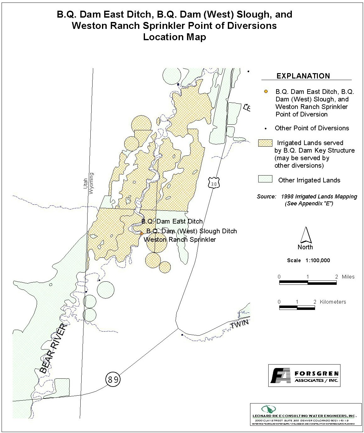
Appendix D Key Structures and Diversions B.Q. DAM |
| PREPARED BY: | Bear River Basin Planning Team |
| DATE: | August 7, 2000 |
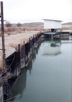
| Diversion Description: The B.Q. Dam serves as the diversion structure for the B.Q. Slough (West) Ditch, the B.Q. East Ditch, the B.Q. McFarland Ditch, and the Weston Ranch Pumps. The dam structure consists of steel piling with boards to control the height. There are no control gates on any of the diversions. | 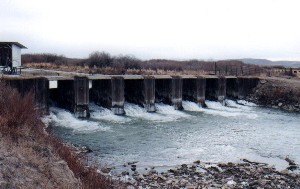 Downstream side of B.Q. Dam structure |
 Upstream side of B.Q. dam (looking east) - Weston Ranch Pump facility can be seen at the back near the east bank | |
| |
| Conveyance Description: Open channel canal and pressure pipe (Weston Pumps).1 |
Direct Flow Water Rights:2
| Priority Date | Permit Number |
Permitted Use | Permitted Acres |
Flow (CFS) |
Cumulative (CFS) |
Comments |
|---|---|---|---|---|---|---|
| B.Q. Dam Slough (West) | ||||||
| 04-01-1883 | Terr | Irrigation | 2005 | 28.64 | 28.64 | |
| 09-04-1992 | 7151E | Irrigation | 34.13 | .49 | 29.13 | |
| 09-04-1992 | 7152E | Irrigation | 156.22 | 2.23 | 31.36 | |
| B.Q. Dam East | ||||||
| 05-00-1878 | Terr | Irrigation | 2480 | 35.42 | 35.42 | |
| McFarland | ||||||
| 06-12-1901 | 3264 | Irrigation | 80 | 1.14 | 1.14 | |
| 06-12-1901 | 3254 | Irrigation | 40 | 0.57 | 1.71 | |
| 06-12-1901 | 3264 | Irrigation | 240 | 3.42 | 5.13 | |
| Weston Ranch Pumps | ||||||
| 06-12-1998 | 32304 | Irrigation | 410.5 | 5.86 | 5.86 | Pivots 1 & 2 |
Associated Storage Rights:
| Reservoir | Shareholder | Volume/Shares (Acre-ft) |
Comments |
|---|---|---|---|
| Woodruff Narrows | Lloyd & LaRee Cornia | 219 | BQ Dam Slough (West) |
| Woodruff Narrows | Fred Allen Feller | 334 | BQ Dam Slough (West) |
| Woodruff Narrows | A. Blain Hoffman | 164 | BQ Dam Slough (West) |
| Woodruff Narrows | Lanny K. Putnam | 219 | BQ Dam Slough (West) |
| Woodruff Narrows | Roland & Linda Willis | 125 | BQ Dam Slough (West) |
| Woodruff Narrows | Ben & Dale Weston | 685 | Weston Pumps |
| Woodruff Narrows | Kay Thornock | 393 | |
| Woodruff Narrows | Russell Thornock | 765 | |
| Woodruff Narrows | Roland & Linda Willis | 737 | BQ Dam Slough (West) |
Irrigation Practices: Land is primarily flood irrigated. The Weston pump facility feeds center- pivot sprinklers.3
Crop Types / Consumptive Use: Water is primarily used to irrigate meadow grasses. The Weston pivots are used to irrigate alfalfa, oats, and barley (crops are rotated).3
Other Operational Information: The B.Q. diversions are typically not regulated due to their relatively close upstream proximity to the Pixley dam. (The Bear River Compact does not require that was pass the Pixley Dam for the Upper Division to the Lower Division.) The BQ irrigators typically pull the dam about July 10th to dry up meadows.
References: