|
| Gaging Stations (2007) |
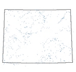 |
| This dataset contains the locations only for those USGS and SEO gages that were used in the 7 individual basin plans to model available flow. |
|
| Metadata |
Scale: 1:24,000 |
State Engineer's Office/USGS |
| Shapefile |
Compressed: 34kb |
GCS North American Datum of 1927 |
Point/Decimal Degrees |
|
| Opportunities (2007) |
 |
| General locations of potential future water use opportunities. |
|
| Metadata |
Scale: 1:24,000 |
Various |
| Shapefile |
Compressed: 14kb |
GCS North American Datum of 1927 |
Point/Decimal Degrees |
|
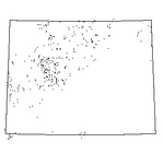
| Points of Diversion (2007) |
 |
| This dataset contains the locations of all points of diversion for the irrigated lands mapped for the state of Wyoming. The point of diversion is also referred to as the service area point with all irrigated lands primarily served by that point defining the physical boundaries of the service area. |
|
| Metadata |
Scale: 1:24,000 |
State Engineer's Office |
| Shapefile |
Compressed: 176kb |
GCS North American Datum of 1927 |
Point/Decimal Degrees |
|
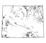
| Wells (2007) |
 |
| Statewide coverage of SEO permit and USGS investigations wells as presented in the individual basin plans. The SEO wells are typically located only to the nearest quarter quarter Section (40 acre parcel). Attributes in the original basin plans that were carried over originated from the Wyoming State Engineers Office or the USGS depending on the type of well. Individual basin plans or the original data sources may contain additional well data, e.g. chemical analyses and serial water-level measurements for USGS wells. |
|
| Metadata |
Scale: 1:24,000 |
State Engineer's Office |
| Shapefile |
Compressed: 4,679kb |
GCS North American Datum of 1927 |
Point/Decimal Degrees |
|
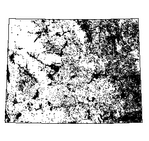
| Irrigated Lands (2007) |
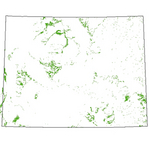 |
| This dataset contains the irrigated lands mapped for the entire state of Wyoming. In some basins man induced irrigation or subirrigation was delineated and described in the CLASSFCTN field or in the ISLAND field where the value equals 2 |
|
| Metadata |
Scale: 1:24,000 |
WWC/Greenwood Mapping |
| Shapefile |
Compressed: 18,944kb |
GCS North American Datum of 1927 |
Polygon/Decimal Degrees |
|
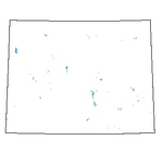
| Reservoirs (2007) |
 |
|
| Metadata |
Scale: 1:24,000 |
U.S. Geological Survey |
| Shapefile |
Compressed: 892kb |
GCS North American Datum of 1927 |
Polygon/Decimal Degrees |
