Wyoming State Water Plan
Wyoming State Water Plan
Wyoming Water Development Office
6920 Yellowtail Rd
Cheyenne, WY 82002
Phone: 307-777-7626

Wyoming Water Development Office
6920 Yellowtail Rd
Cheyenne, WY 82002
Phone: 307-777-7626


| SUBJECT: |
Appendix J Storage Operation and Description CLOUD PEAK |
| PREPARED BY: | HKM Engineering Inc. |
| DATE: | March 2002 |
KEY STORAGE FACILITIES
| Reservoir: | CLOUD PEAK | |||||||||||||||||||||||||||||||||||||||||||||||||||||||||||||||||||||||||||||||||||||||||||||||||||||||||||||||||||||||||||||||||||||||||||||||||||||||||||||
| Date: | 20 Feb. 2001 | |||||||||||||||||||||||||||||||||||||||||||||||||||||||||||||||||||||||||||||||||||||||||||||||||||||||||||||||||||||||||||||||||||||||||||||||||||||||||||||
| Note: | This reservoir began as a natural lake on the main stem of South Piney Creek. It was expanded with dams and Cloud Peak has been considered and operated as part of Willow Park reservoir. | 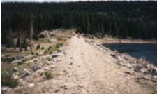 | ||||||||||||||||||||||||||||||||||||||||||||||||||||||||||||||||||||||||||||||||||||||||||||||||||||||||||||||||||||||||||||||||||||||||||||||||||||||||||||
| Location: | SESE 9,T51N,R85W | |||||||||||||||||||||||||||||||||||||||||||||||||||||||||||||||||||||||||||||||||||||||||||||||||||||||||||||||||||||||||||||||||||||||||||||||||||||||||||||
| Owner: | ROCK CREEK AND PINEY RES. & DITCH CO. | |||||||||||||||||||||||||||||||||||||||||||||||||||||||||||||||||||||||||||||||||||||||||||||||||||||||||||||||||||||||||||||||||||||||||||||||||||||||||||||
| Year of Construction: | 1896 | |||||||||||||||||||||||||||||||||||||||||||||||||||||||||||||||||||||||||||||||||||||||||||||||||||||||||||||||||||||||||||||||||||||||||||||||||||||||||||||
| Enlargement History: | 1933 (with a re-survey and subsequent filing in 1961), 1968 | |||||||||||||||||||||||||||||||||||||||||||||||||||||||||||||||||||||||||||||||||||||||||||||||||||||||||||||||||||||||||||||||||||||||||||||||||||||||||||||
| Total Storage: | 4620 acre-feet | |||||||||||||||||||||||||||||||||||||||||||||||||||||||||||||||||||||||||||||||||||||||||||||||||||||||||||||||||||||||||||||||||||||||||||||||||||||||||||||
| Active Storage: | 3570 acre-feet | |||||||||||||||||||||||||||||||||||||||||||||||||||||||||||||||||||||||||||||||||||||||||||||||||||||||||||||||||||||||||||||||||||||||||||||||||||||||||||||
| Dead Storage: | Information not available. The dead storage is considerable because Cloud Peak was originally a natural mountain lake. | |||||||||||||||||||||||||||||||||||||||||||||||||||||||||||||||||||||||||||||||||||||||||||||||||||||||||||||||||||||||||||||||||||||||||||||||||||||||||||||
| Area/Capacity Data: | (Source: undated table on file with State Engineer's Office, Water Div. II) | |||||||||||||||||||||||||||||||||||||||||||||||||||||||||||||||||||||||||||||||||||||||||||||||||||||||||||||||||||||||||||||||||||||||||||||||||||||||||||||
| ||||||||||||||||||||||||||||||||||||||||||||||||||||||||||||||||||||||||||||||||||||||||||||||||||||||||||||||||||||||||||||||||||||||||||||||||||||||||||||||
| Dam Construction Type: | Earth Fill | |||||||||||||||||||||||||||||||||||||||||||||||||||||||||||||||||||||||||||||||||||||||||||||||||||||||||||||||||||||||||||||||||||||||||||||||||||||||||||||
| End-of-Month Storage Records: | No | |||||||||||||||||||||||||||||||||||||||||||||||||||||||||||||||||||||||||||||||||||||||||||||||||||||||||||||||||||||||||||||||||||||||||||||||||||||||||||||
| Water Rights: | ((Source: Tabulation of Adjudicated Surface Water Rights of the State of Wyoming, Water Division Number Two, Oct. 1999.) | |||||||||||||||||||||||||||||||||||||||||||||||||||||||||||||||||||||||||||||||||||||||||||||||||||||||||||||||||||||||||||||||||||||||||||||||||||||||||||||
| ||||||||||||||||||||||||||||||||||||||||||||||||||||||||||||||||||||||||||||||||||||||||||||||||||||||||||||||||||||||||||||||||||||||||||||||||||||||||||||||
| Designated Use: | Irrigation | |||||||||||||||||||||||||||||||||||||||||||||||||||||||||||||||||||||||||||||||||||||||||||||||||||||||||||||||||||||||||||||||||||||||||||||||||||||||||||||
| Recreational Use: | Fishing | |||||||||||||||||||||||||||||||||||||||||||||||||||||||||||||||||||||||||||||||||||||||||||||||||||||||||||||||||||||||||||||||||||||||||||||||||||||||||||||
| Associated Irrigation Diversions: | Because of its high elevation and connection to Piney Creek irrigators through the South Fork of Piney Creek and connection with Rock and South Piney Ditch, Cloud Peak Reservoir provides water to a number of irrigators. | |||||||||||||||||||||||||||||||||||||||||||||||||||||||||||||||||||||||||||||||||||||||||||||||||||||||||||||||||||||||||||||||||||||||||||||||||||||||||||||
(Source: Carmine LoGuidice, Div. II water commissioner/hydrographer)
| ||||||||||||||||||||||||||||||||||||||||||||||||||||||||||||||||||||||||||||||||||||||||||||||||||||||||||||||||||||||||||||||||||||||||||||||||||||||||||||||
| Operational Discussion: | Cloud Peak Reservoir has been considered a unit with Willow Park Reservoir downstream. In the past, operators have been able to store water higher than the top of the dam, thanks to snow drifting across the spillway and ice buildup on the dam. As a result, operators tend to empty the reservoir's active capacity into Willow Park toward the end of the season to avoid carrying water into the next year. Water commissioners point out that operators prefer to drain the reservoir for winter as much as possible (to avoid buildup and possible overtopping) or not drain it at all (to store more water than is apparently possible). | |||||||||||||||||||||||||||||||||||||||||||||||||||||||||||||||||||||||||||||||||||||||||||||||||||||||||||||||||||||||||||||||||||||||||||||||||||||||||||||
First release timing, Cloud Peak Reservoir
| ||||||||||||||||||||||||||||||||||||||||||||||||||||||||||||||||||||||||||||||||||||||||||||||||||||||||||||||||||||||||||||||||||||||||||||||||||||||||||||||
| Operators end irrigation releases from the dam on Oct. 1 (the end of the water year). Through an agreement with the U.S. Forest Service, operators release approx. 5 cfs for winter flows. | ||||||||||||||||||||||||||||||||||||||||||||||||||||||||||||||||||||||||||||||||||||||||||||||||||||||||||||||||||||||||||||||||||||||||||||||||||||||||||||||
| References: | Carmine LoGuidice, water commissioner, interview, State Engineer's Office, Sheridan, Wyoming, 13 Feb. 2001 | |||||||||||||||||||||||||||||||||||||||||||||||||||||||||||||||||||||||||||||||||||||||||||||||||||||||||||||||||||||||||||||||||||||||||||||||||||||||||||||
| Active Dams, State Engineer's Office Safety of Dams Engineering Div. Database, transmitted by Larry Stockdale, Safety of Dams engineering consultant, 16 Feb. 2001. | ||||||||||||||||||||||||||||||||||||||||||||||||||||||||||||||||||||||||||||||||||||||||||||||||||||||||||||||||||||||||||||||||||||||||||||||||||||||||||||||
| Tabulation of Adjudicated Surface Water Rights of the State of Wyoming, Water Division Number Two, Oct. 1999, database transmitted by Rebecca Mathisen, SEO Technical Services Division administrator, 8 Sept. 2000. | ||||||||||||||||||||||||||||||||||||||||||||||||||||||||||||||||||||||||||||||||||||||||||||||||||||||||||||||||||||||||||||||||||||||||||||||||||||||||||||||

Net Evaporation from Cloud Peak Reservoir:
| Lewis Annual Evaporation (in.) | 46 |
| Total Storage (acre-feet) | 4,620 |
| Jan | Feb | Mar | Apr | May | Jun | Jul | Aug | Sep | Oct | Nov | Dec | ||
| Average percent of total storage | 56.72 | 57.55 | 57.87 | 60.80 | 71.16 | 72.71 | 68.17 | 64.03 | 57.62 | 57.03 | 58.79 | 60.84 | |
| Generated storage (acre-feet) | 2621 | 2659 | 2674 | 2809 | 3288 | 3359 | 3149 | 2958 | 2662 | 2635 | 2716 | 2811 | |
| Corresponding area (acres) | 165.86 | 165.86 | 165.86 | 165.86 | 165.86 | 165.86 | 165.86 | 165.86 | 165.86 | 165.86 | 165.86 | 165.86 | Calculations: |
| Monthly Lewis Evap. (inches) | 1.242 | 1.15 | 1.794 | 3.68 | 5.29 | 6.026 | 7.866 | 7.176 | 5.29 | 3.496 | 1.794 | 1.196 | |
| Monthly Precipitation (inches) | 2.25 | 2.25 | 3.25 | 3.75 | 4.25 | 3.25 | 1.75 | 1.25 | 2.25 | 2.25 | 2.25 | 1.75 | |
| Net Evaporation (inches) | 0 | 0 | 0 | 0 | 1.04 | 2.776 | 6.116 | 5.926 | 3.04 | 1.246 | 0 | 0 | TOTAL |
| Net Evaporation (acre-feet) | 0 | 0 | 0 | 0 | 14 | 38 | 85 | 82 | 42 | 17 | 0 | 0 | 278 |