Wyoming State Water Plan
Wyoming State Water Plan
Wyoming Water Development Office
6920 Yellowtail Rd
Cheyenne, WY 82002
Phone: 307-777-7626

Wyoming Water Development Office
6920 Yellowtail Rd
Cheyenne, WY 82002
Phone: 307-777-7626


| SUBJECT: |
Appendix A Irrigation Diversion Operation and Description BIG GOOSE CREEK |
| PREPARED BY: | HKM Engineering Inc. |
| DATE: | March 2002 |
BIG GOOSE CREEK
ALLIANCE DITCH DIVERSION
BIG GOOSE & BEAVER DITCH DIVERSION, NOS. 1 & 2
GRINNELL DITCH DIVERSION ON BIG GOOSE CREEK
PARK DIVERSION DITCH
PK (PATRICK) DITCH DIVERSION
SHERIDAN CITY INTAKES - BIG GOOSE CANYON DIVERSION
BIG GOOSE CREEK DRAINAGE
INTRODUCTION
BACKGROUND
The Big Goose flows out of the east slope of the Bighorn Mountains, between the Little Goose drainage to the south and the Wolf Creek drainage to the north. In Sheridan, it joins the Little Goose, then commences north to join the Tongue River east of Ranchester. The Big Goose.s upper reaches include a number of reservoirs, many of which are shared with Little Goose users through transbasin diversions like the Peralta Ditch.
CHARACTERISTICS
State Engineer.s Office water commissioners/hydrographers set a maximum loss on the creek at 10 percent (head to mouth), thanks in part to the creek.s steep descent to the valley.
Available reservoir storage water in the Big Goose drainage helps moderate changes in irrigation practices from dry years to wet years. Return flows are reduced in dry years in comparison to wet or average years, requiring water commissioners to maintain more water in the main stem to serve downstream demands.
In addition, irrigators are tending toward more conservation of the water they use, increasing the use of sprinkler irrigation. This has the effect of reducing return flows to the creek.
The Big Goose drainage very seldom goes into regulation.
Water commissioners allow 15-20 cfs of diversion into the Little Goose drainage via the Peralta Ditch and Park Diversion to enhance flows in the Little Goose as long as there is ample supply in Big Goose Creek.
USAGE
The Big Goose.s diversions are primarily used for agricultural irrigation but are also used to supply stock, municipal, and industrial demands.
Stored Water Use
Water commissioners estimate that irrigators on the Big Goose typically begin to use their stored water according to the following timing:
| Wet Year | Average Year | Dry Year |
|---|---|---|
| End of July | Mid-July | June |
Agriculture
Growers in the Big Goose drainage tend to plant acreage as approximately 50 percent grass hay and 50 percent alfalfa.
Irrigation Practices
Irrigation practices are broken out per diversion in the following diversion memoranda.
The typical irrigation season runs from April 15-May 1 (depending on whether the spring runoff is delayed by a cold weather) to early October (depending on when the first snows fall and the ground freezes). Post season irrigation is not practiced in the Big Goose drainage as a rule because reservoirs are shut off on the first of October.
Double Appropriation
Irrigation water rights with priority dates of March 1, 1945 or earlier are entitled to an additional 1cfs per 70 acres under Wyoming.s surplus water statutes. Whenever the supply in a stream exceeds the amount required to satisfy all existing appropriations established prior to March 1, 1985, the stream is said to be in an excess flow condition and water right holders with priorities between March 2, 1945 and March 1, 1985 may use an additional 1 cfs for each 70 acres irrigated.
On the Big Goose, this practice is limited primarily by the condition of ditches. Many of the ditches are not capable of carrying all of the water an irrigator could use.
| % of appropriation | % of ditches in drainage capable of flow |
|---|---|
| 200 | 20 |
| 150 | 60 | 100-150 | 90 |
Permitted Uses
Permits granted for water appropriation are granted for specific uses. The following pages contain tables of permits and their associated uses. The following table provides a key to those uses:
| Code | Use |
|---|---|
| Chem | Chemical |
| Com | Commercial |
| Cul | Culinary |
| D | Domestic |
| Drl | Drilling |
| Eng | Steam Engines |
| Fire | Fire Protection |
| Fish | Fish Propogation |
| F.C. | Flood Control |
| I | Irrigation |
| Ind | Industrial |
| I.F. | Instream Flow |
| Mech | Mechanical |
| Mfg | Manufacturing |
| Mil | Milling |
| Min | Mining |
| Misc | Miscellaneous |
| Mun | Municipal |
| Oil | Oil Refining or Production |
| P.C. | Pollution Control |
| Power | Power Development |
| R.R. | Railroad |
| Rec | Recreational |
| Ref | Refining |
| Res. Supply | Supply Facility for a Reservoir |
| S | Stock |
| T | Transportation |
WATER RIGHTS
Two water rights summary tables are provided for each diversion serving irrigation referenced here. The first, included in the body of the diversion synopsis, refers to the rights on record with the State Engineer.s Office and is derived from that office.s Tabulation of Adjudicated Surface Water Rights of the State of Wyoming, Water Division Number Two (Oct. 1999).
Because this rights summary is pulled directly from the SEO Tab, the rights cited follow the SEO.s priority order:
| Hierarchy | Format of right | Example |
|---|---|---|
| 1 | Day, Month, Year | 05-15-1884 |
| 2 | Month and Year | 05-00-1884 |
| 3 | Specified Season and Year | Spring 1884 |
| 4 | Year Only | 1884 |
| 5 | Before Year | Before 1884 |
Board orders or court orders may also establish a specific priority.
Irrigated Lands Water Rights Database
The second table, which follows the diversion synopsis, is taken from the irrigated lands water rights database developed for the basin plan. It can be used as a reference with the following caveats: It only lists water rights associated with the irrigated lands polygons mapped by HKM. The table does not include nonirrigation rights devoted to reservoir supply, municipal, fish propagation, etc. The rights on this table are associated only with those irrigated lands identified through the course of this study, both actively irrigated and currently idle.
| Column Heading Key | ||
| PerNo | Permit Number | "Terr" denotes a territorial right. |
| PerSfx | Permit Suffix | D = direct flow |
| E = enlargement | ||
| R = reservoir | ||
| Facility Name | Parantheses denote the former means of conveyance for the water right. | |
| Unit | Flow or volume | CFS = cubic feet per second |
| AF = acre-feet | ||
| GPM = gallons per minute | ||
| SupTyp | Supply Type | OS = original supply |
| SS = supplement supply, for lands having an original supply from another source. | ||
| Sec = secondary supply, for water stored in a reservoir | ||
| Status | Status of adjudication | Adj = adjudicated |
| Una = unadjudicated | ||
| Source | Source water | Parantheses denote the permit number of the related storage right. |
Schematic diagram of the Big Goose drainage:
KEY DIVERSIONS
| Diversion: | ALLIANCE DITCH DIVERSION | |||||||||||||||||||||||||||||||||||||||||||||||||||||||||||||||||||||||||||||||||||||||||||||||||||||||||||||||||||||||||||||||||||||||||||||||||||||||||||||||||||||||||||||||||||||||||||||||||||||||||||||
| Date | 5 Sep. 2000 | |||||||||||||||||||||||||||||||||||||||||||||||||||||||||||||||||||||||||||||||||||||||||||||||||||||||||||||||||||||||||||||||||||||||||||||||||||||||||||||||||||||||||||||||||||||||||||||||||||||||||||||
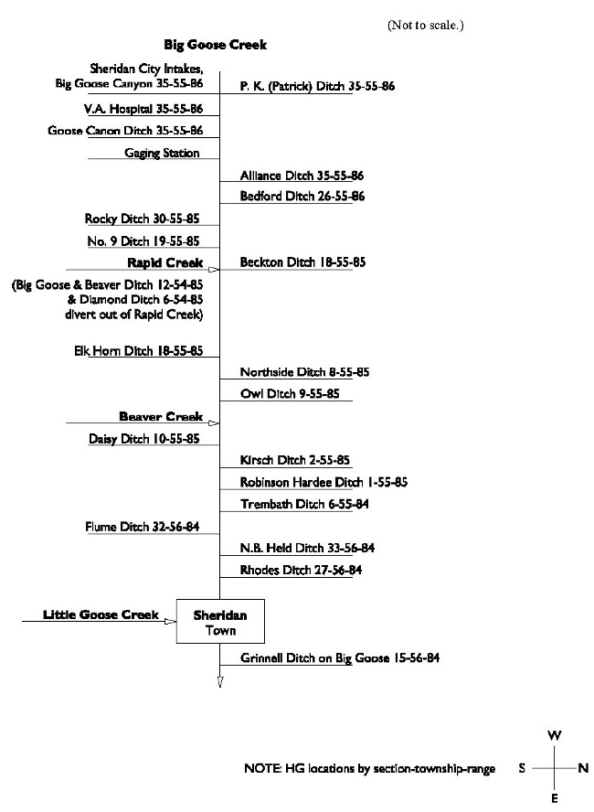
| Note: | Despite its relatively junior right, this ditch diverts all of the flow in Big Goose Creek under normal conditions, allowing return flows to satisfy downstream (and senior) rights. In addition, the ditch traverses gravel benches, resulting in higher than typical seepage losses. | 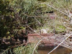 Alliance headgate. | ||||||||||||||||||||||||||||||||||||||||||||||||||||||||||||||||||||||||||||||||||||||||||||||||||||||||||||||||||||||||||||||||||||||||||||||||||||||||||||||||||||||||||||||||||||||||||||||||||||||||||||
| Diversion Description: | Headgate consists of a single, 3.5 x 2.5-foot steel gate in steel slides operated with a Waterman-type screw, mounted in a steel headwall. Water is carried through a 3.5-foot corrugated metal pipe directly behind the headgate. | |||||||||||||||||||||||||||||||||||||||||||||||||||||||||||||||||||||||||||||||||||||||||||||||||||||||||||||||||||||||||||||||||||||||||||||||||||||||||||||||||||||||||||||||||||||||||||||||||||||||||||||
| Diversion Location: | The alliance Ditch diversion is located on the main stem of the Big Goose,
well down stream of the canyon. | |||||||||||||||||||||||||||||||||||||||||||||||||||||||||||||||||||||||||||||||||||||||||||||||||||||||||||||||||||||||||||||||||||||||||||||||||||||||||||||||||||||||||||||||||||||||||||||||||||||||||||||
|
 Alliance flume and recorder. | |||||||||||||||||||||||||||||||||||||||||||||||||||||||||||||||||||||||||||||||||||||||||||||||||||||||||||||||||||||||||||||||||||||||||||||||||||||||||||||||||||||||||||||||||||||||||||||||||||||||||||||
| Conveyance Description: | Open channel canal, approximately 26.4 miles long. | |||||||||||||||||||||||||||||||||||||||||||||||||||||||||||||||||||||||||||||||||||||||||||||||||||||||||||||||||||||||||||||||||||||||||||||||||||||||||||||||||||||||||||||||||||||||||||||||||||||||||||||
| Direct Flow Water Rights: | The summary of direct flow rights follows: | |||||||||||||||||||||||||||||||||||||||||||||||||||||||||||||||||||||||||||||||||||||||||||||||||||||||||||||||||||||||||||||||||||||||||||||||||||||||||||||||||||||||||||||||||||||||||||||||||||||||||||||
Note: The point of diversion and means of conveyance for 3.85 cfs of Permit No. 83 have been changed to the P.K. (Patrick) Ditch. | ||||||||||||||||||||||||||||||||||||||||||||||||||||||||||||||||||||||||||||||||||||||||||||||||||||||||||||||||||||||||||||||||||||||||||||||||||||||||||||||||||||||||||||||||||||||||||||||||||||||||||||||
| Associated Storage Rights: | Irrigators use water stored in Park, Sawmill, and Dome Lake No. 1 reservoirs. | |||||||||||||||||||||||||||||||||||||||||||||||||||||||||||||||||||||||||||||||||||||||||||||||||||||||||||||||||||||||||||||||||||||||||||||||||||||||||||||||||||||||||||||||||||||||||||||||||||||||||||||
| Irrigation Practices: | Irrigators apply water diverted through approximately 50 percent sprinkler and 50 percent ditch-flood practices. | |||||||||||||||||||||||||||||||||||||||||||||||||||||||||||||||||||||||||||||||||||||||||||||||||||||||||||||||||||||||||||||||||||||||||||||||||||||||||||||||||||||||||||||||||||||||||||||||||||||||||||||
| Return Flows: | Estimated percentage of total diversion developing into return flows: | |||||||||||||||||||||||||||||||||||||||||||||||||||||||||||||||||||||||||||||||||||||||||||||||||||||||||||||||||||||||||||||||||||||||||||||||||||||||||||||||||||||||||||||||||||||||||||||||||||||||||||||
| ||||||||||||||||||||||||||||||||||||||||||||||||||||||||||||||||||||||||||||||||||||||||||||||||||||||||||||||||||||||||||||||||||||||||||||||||||||||||||||||||||||||||||||||||||||||||||||||||||||||||||||||
| Losses: | Approximately 40 percent by end | |||||||||||||||||||||||||||||||||||||||||||||||||||||||||||||||||||||||||||||||||||||||||||||||||||||||||||||||||||||||||||||||||||||||||||||||||||||||||||||||||||||||||||||||||||||||||||||||||||||||||||||
| References: | Div. II superintendent Mike Whitaker, State Engineer.s Office, Interview, 5 Sept. 2000 | |||||||||||||||||||||||||||||||||||||||||||||||||||||||||||||||||||||||||||||||||||||||||||||||||||||||||||||||||||||||||||||||||||||||||||||||||||||||||||||||||||||||||||||||||||||||||||||||||||||||||||||
Irrigated Lands Water Rights Database
| PerNo | PerSfx | Facility Name | Priority | Acres | Amount | Unit | SupTyp | Status | Source |
|---|---|---|---|---|---|---|---|---|---|
| Terr | D | Beck No. 1 (Alliance) | June 30, 1884 | 641.5 | 9.16 | CFS | OS | Adj | Big Goose Creek |
| 83 | D | Alliance (P.K. or Patrick) | June 29, 1891 | 2031.63 | 28.97 | CFS | SS | Adj | Big Goose Creek |
| 624 | E | Enl. Alliance | Feb. 25, 1901 | 12.5 | 0.16 | CFS | OS | Adj | Big Goose Creek |
| 640 | E | Enl. Beck #1 (Alliance) | March 30, 1901 | 50 | 0.71 | CFS | OS | Adj | Big Goose Creek |
| 642 | E | Enl. Alliance | April 1, 1901 | 45 | 0.63 | CFS | OS | Adj | Big Goose Creek |
| 761 | E | Enl. Alliance | Dec. 14, 1901 | 30 | 0.42 | CFS | OS | Adj | Big Goose Creek |
| 1063 | E | Enl. Alliance | May 26, 1903 | 40 | 0.57 | CFS | OS | Adj | Big Goose Creek |
| 1297 | E | Enl. Alliance | Nov. 23, 1904 | 35 | 0.5 | CFS | OS | Adj | Big Goose Creek |
| 1314 | E | Enl. Alliance | July 12, 1904 | 10 | 0.14 | CFS | OS | Adj | Big Goose Creek |
| 1372 | E | Enl. Alliance | March 4, 1905 | 15 | 0.21 | CFS | OS | Adj | Big Goose Creek |
| 1678 | E | Enl. Alliance & Alliance Lateral (P.K. or Patrick) | Nov. 23, 1906 | 1042.89 | 14.9 | CFS | OS | Adj | Big Goose Creek |
| 2365 | E | Enl. Ashley & Kerr/Alliance | Nov. 21, 1910 | 15 | 0.21 | CFS | OS | Adj | Big Goose Creek |
| 2490 | E | Enl. Alliance | April 6, 1911 | 12.5 | 0.18 | CFS | OS | Adj | Big Goose Creek |
| 2587 | E | Enl. Ashley & Kerr/Alliance | Dec. 2, 1911 | 35 | 0.5 | CFS | OS | Adj | Big Goose Creek |
| 2756 | E | Enl. Alliance & Alliance Lateral (P.K. or Patrick) | Dec. 24, 1912 | 25 | 0.36 | CFS | OS | Adj | Big Goose Creek |
| 2770 | E | Enl. Alliance | March 24, 1913 | 40 | 0.57 | CFS | OS | Adj | Big Goose Creek |
| 2811 | E | Enl. Alliance | April 7, 1913 | 30 | 0.43 | CFS | OS | Adj | Big Goose Creek |
| 4769 | E | Enl. Alliance | April 21, 1930 | 59 | 0 | SS | Una | Big Goose Creek | |
| 6740 | E | Enl. Alliance | July 29, 1981 | 58.4 | 0 | SS | Una | Big Goose Creek | |
| 2755 | E | Enl. Alliance | Dec. 24, 1912 | 25 | 0 | Sec | Adj | W Fk Big Goose Ck (688R & 961R) | |
| 2857 | E | Enl. Alliance | Sep. 20, 1913 | 175 | 0 | Sec | Una | West Fork Big Goose Creek (961R) |
| Name Source District Data |
Alliance Ditch Diversion Big Goose Creek 4 Total monthly flow in AF | ||||||||||||
| Water Year | Oct | Nov | Dec | Jan | Feb | Mar | Apr | May | Jun | Jul | Aug | Sep | Total |
|---|---|---|---|---|---|---|---|---|---|---|---|---|---|
| 1970 | |||||||||||||
| 1971 | 0.00 | 0.00 | 684.69 | 1157.35 | 1241.06 | 1030.49 | 742.83 | 4856.42 | |||||
| 1972 | 0.00 | 0.00 | 447.35 | 1456.07 | 1283.42 | 1392.00 | 961.65 | 5540.49 | |||||
| 1973 | 24.83 | 0.00 | 115.83 | 1486.81 | 1497.92 | 1200.59 | 958.41 | 5284.39 | |||||
| 1974 | 0.00 | 0.00 | 782.68 | 1441.59 | 1498.11 | 1454.28 | 1099.24 | 6275.90 | |||||
| 1975 | 0.00 | 0.00 | 0.00 | 412.54 | 1195.24 | 1495.93 | 1043.11 | 4146.82 | |||||
| 1976 | 0.00 | 0.00 | 850.81 | 1578.64 | 1456.66 | 1231.73 | 1075.24 | 6193.08 | |||||
| 1977 | 0.00 | 0.00 | 809.65 | 1550.28 | 1165.69 | 1031.21 | 700.52 | 5257.35 | |||||
| 1978 | 0.00 | 0.00 | 0.00 | 648.59 | 1600.26 | 1529.45 | 1244.83 | 5023.13 | |||||
| 1979 | |||||||||||||
| 1980 | 0.00 | 0.00 | 1116.00 | 1490.00 | 976.00 | 992.00 | 804.00 | 5378.00 | |||||
| 1981 | 0.00 | 161.00 | 917.00 | 1206.00 | 1106.00 | 878.00 | 635.00 | 4903.00 | |||||
| 1982 | 0.00 | 0.00 | 342.00 | 1130.00 | 1270.00 | 1350.00 | 1070.00 | 5162.00 | |||||
| 1983 | 0.00 | 0.00 | 274.00 | 986.00 | 1510.00 | 1160.00 | 942.00 | 4872.00 | |||||
| 1984 | 0.00 | 0.00 | 0.00 | 626.57 | 1500.93 | 1392.71 | 1307.84 | 4828.05 | |||||
| 1985 | 0.00 | 0.00 | 1124.39 | 125.02 | 1088.15 | 1174.33 | 820.04 | 4331.93 | |||||
| 1986 | 0.00 | 0.00 | 1040.64 | 1518.29 | 1448.39 | 1297.63 | 900.47 | 6205.42 | |||||
| 1987 | 0.00 | 0.00 | 1470.00 | 1616.00 | 1574.00 | 1232.00 | 1338.00 | 7230.00 | |||||
| 1988 | 0.00 | 0.00 | 738.00 | 1905.00 | 1395.00 | 1045.00 | 1046.00 | 6129.00 | |||||
| 1989 | 0.00 | 0.00 | 1093.90 | 1682.40 | 1544.80 | 1306.80 | 1268.80 | 6896.70 | |||||
| 1990 | 0.00 | 0.00 | 224.40 | 1563.40 | 1604.00 | 1460.60 | 1077.60 | 5930.00 | |||||
| 1991 | 0.00 | 0.00 | 172.90 | 1328.20 | 1342.50 | 1404.90 | 840.30 | 5088.80 | |||||
| 1992 | 0.00 | 51.00 | 1411.50 | 1427.20 | 1159.60 | 1284.40 | 1060.70 | 6394.40 | |||||
| 1993 | 0.00 | 0.00 | 787.70 | 1118.50 | 953.50 | 1144.20 | 1032.10 | 5036.00 | |||||
| 1994 | 0.00 | 0.00 | 465.80 | 1466.10 | 1227.90 | 1033.50 | 821.00 | 5064.30 | |||||
| 1995 | 0.00 | 0.00 | 0.00 | 571.10 | 1307.20 | 1034.50 | 1178.80 | 4091.60 | |||||
| 1996 | 0.00 | 0.00 | 35.80 | 1308.70 | 1363.80 | 1073.40 | 855.60 | 4637.30 | |||||
| 1997 | 0.00 | 0.00 | 297.70 | 1142.00 | 1149.50 | 1252.60 | 877.30 | 4719.10 | |||||
| 1998 | 0.00 | 0.00 | 902.20 | 1501.60 | 1669.60 | 1575.80 | 1192.70 | 6841.90 | |||||
| 1999 | 0.00 | 0.00 | 199.40 | 1270.90 | 1484.40 | 1683.00 | 1439.00 | 6076.70 | |||||
| Mean | 0.89 | 7.57 | 582.30 | 1239.82 | 1345.13 | 1255.04 | 1011.90 | 5442.64 | |||||
| Max | 24.83 | 161.00 | 1470.00 | 1905.00 | 1669.60 | 1683.00 | 1439.00 | 7230.00 | |||||
| Min | 0.00 | 0.00 | 0.00 | 125.02 | 953.50 | 878.00 | 635.00 | 4091.60 | |||||
| Name Source District Data |
Alliance Ditch Diversion Big Goose Creek 4 First & Last Dates, Max. Days | ||
| Water Year | First Date of Measurement | Last Date of Measurement | Maximum Days Missing |
|---|---|---|---|
| 1970 | |||
| 1971 | 12-May | 30-Sep | 0 |
| 1972 | 17-May | 02-Oct | 0 |
| 1973 | 29-May | 27-Sep | 0 |
| 1974 | 13-May | 30-Sep | 0 |
| 1975 | 10-Jun | 30-Sep | 0 |
| 1976 | 11-May | 30-Sep | 0 |
| 1977 | 12-May | 30-Sep | 0 |
| 1978 | 11-Jun | 30-Sep | 0 |
| 1979 | |||
| 1980 | 06-May | 30-Sep | 0 |
| 1981 | 23-Apr | 30-Sep | 0 |
| 1982 | 18-May | 30-Sep | 0 |
| 1983 | 23-May | 30-Sep | 0 |
| 1984 | 14-Jun | 30-Sep | 0 |
| 1985 | 07-May | 30-Sep | 0 |
| 1986 | 03-May | 30-Sep | 0 |
| 1987 | 05-May | 30-Sep | 0 |
| 1988 | 12-May | 30-Sep | 0 |
| 1989 | 01-May | 30-Sep | 0 |
| 1990 | 22-May | 30-Sep | 0 |
| 1991 | 21-May | 30-Sep | 0 |
| 1992 | 28-Apr | 30-Sep | 0 |
| 1993 | 10-May | 30-Sep | 0 |
| 1994 | 20-May | 30-Sep | 0 |
| 1995 | 07-Jun | 30-Sep | 0 |
| 1996 | 29-May | 30-Sep | 0 |
| 1997 | 21-May | 30-Sep | 0 |
| 1998 | 13-May | 30-Sep | 0 |
| 1999 | 25-May | 30-Sep | 0 |
| Avg. | 17-May | 29-Sep | 0 |
| Earliest | 23-Apr | 27-Sep | 0 |
| Latest | 14-Jun | 02-Oct | 0 |
KEY DIVERSIONS
| Diversion: | BIG GOOSE & BEAVER DITCH DIVERSIONS, NOS. 1 & 2 | |||||||||||||||||||||||||||||||||||||||||||||||||||||||||||||||||||||||||||||||||||||||||||||||||||||||||||||||||||||||||||||||||||||||||||||||||||||||||||||||||||||||||||||||||||||||||||||||||||||||||||||||||||||||||||||||||||||||||||||||||||||||||||||||||||||||||||||||||||||||||||
| Date | 5 Sep. 2000 |  Big Goose & Beaver Ditch | ||||||||||||||||||||||||||||||||||||||||||||||||||||||||||||||||||||||||||||||||||||||||||||||||||||||||||||||||||||||||||||||||||||||||||||||||||||||||||||||||||||||||||||||||||||||||||||||||||||||||||||||||||||||||||||||||||||||||||||||||||||||||||||||||||||||||||||||||||||||||||
| Diversion Description: | Headgate consists of a two, 10 x 4.5-foot steel gates in steel sliders operated with Waterman-type screws, mounted in a concrete headwall with a bypass gate for the continuation of Rapid Creek. | |||||||||||||||||||||||||||||||||||||||||||||||||||||||||||||||||||||||||||||||||||||||||||||||||||||||||||||||||||||||||||||||||||||||||||||||||||||||||||||||||||||||||||||||||||||||||||||||||||||||||||||||||||||||||||||||||||||||||||||||||||||||||||||||||||||||||||||||||||||||||||
| Diversion Location: | The Big Goose & Beaver diversion is located on Rapid Creek, just upstream of that stream.s confluence with the Big Goose. | |||||||||||||||||||||||||||||||||||||||||||||||||||||||||||||||||||||||||||||||||||||||||||||||||||||||||||||||||||||||||||||||||||||||||||||||||||||||||||||||||||||||||||||||||||||||||||||||||||||||||||||||||||||||||||||||||||||||||||||||||||||||||||||||||||||||||||||||||||||||||||
| ||||||||||||||||||||||||||||||||||||||||||||||||||||||||||||||||||||||||||||||||||||||||||||||||||||||||||||||||||||||||||||||||||||||||||||||||||||||||||||||||||||||||||||||||||||||||||||||||||||||||||||||||||||||||||||||||||||||||||||||||||||||||||||||||||||||||||||||||||||||||||||
| Conveyance Description: | Open channel canal. No. 1 (from East Fork Big Goose to Rapid Creek) is approximately 2.4 miles long. No. 2 (from Rapid to Beaver creeks) is approximately 7.8 miles long. | 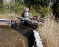 Big Goose & Beaver Ditch Flume | ||||||||||||||||||||||||||||||||||||||||||||||||||||||||||||||||||||||||||||||||||||||||||||||||||||||||||||||||||||||||||||||||||||||||||||||||||||||||||||||||||||||||||||||||||||||||||||||||||||||||||||||||||||||||||||||||||||||||||||||||||||||||||||||||||||||||||||||||||||||||||
| Direct Flow Water Rights: | The summary of direct flow rights follows: | |||||||||||||||||||||||||||||||||||||||||||||||||||||||||||||||||||||||||||||||||||||||||||||||||||||||||||||||||||||||||||||||||||||||||||||||||||||||||||||||||||||||||||||||||||||||||||||||||||||||||||||||||||||||||||||||||||||||||||||||||||||||||||||||||||||||||||||||||||||||||||
| ||||||||||||||||||||||||||||||||||||||||||||||||||||||||||||||||||||||||||||||||||||||||||||||||||||||||||||||||||||||||||||||||||||||||||||||||||||||||||||||||||||||||||||||||||||||||||||||||||||||||||||||||||||||||||||||||||||||||||||||||||||||||||||||||||||||||||||||||||||||||||||
| Associated Storage Rights: | The Big Goose & Beaver ditches convey Park Reservoir water. | |||||||||||||||||||||||||||||||||||||||||||||||||||||||||||||||||||||||||||||||||||||||||||||||||||||||||||||||||||||||||||||||||||||||||||||||||||||||||||||||||||||||||||||||||||||||||||||||||||||||||||||||||||||||||||||||||||||||||||||||||||||||||||||||||||||||||||||||||||||||||||
| Irrigation Practices: | Irrigators tend to use approximately 40 percent sprinklers and 60 percent ditch-flood irrigation to deliver water to their crops. | |||||||||||||||||||||||||||||||||||||||||||||||||||||||||||||||||||||||||||||||||||||||||||||||||||||||||||||||||||||||||||||||||||||||||||||||||||||||||||||||||||||||||||||||||||||||||||||||||||||||||||||||||||||||||||||||||||||||||||||||||||||||||||||||||||||||||||||||||||||||||||
| Return Flows: | Estimated percentage of total diversion developing into return flows: | |||||||||||||||||||||||||||||||||||||||||||||||||||||||||||||||||||||||||||||||||||||||||||||||||||||||||||||||||||||||||||||||||||||||||||||||||||||||||||||||||||||||||||||||||||||||||||||||||||||||||||||||||||||||||||||||||||||||||||||||||||||||||||||||||||||||||||||||||||||||||||
| ||||||||||||||||||||||||||||||||||||||||||||||||||||||||||||||||||||||||||||||||||||||||||||||||||||||||||||||||||||||||||||||||||||||||||||||||||||||||||||||||||||||||||||||||||||||||||||||||||||||||||||||||||||||||||||||||||||||||||||||||||||||||||||||||||||||||||||||||||||||||||||
| Losses: | 20 percent by the end of the ditch | |||||||||||||||||||||||||||||||||||||||||||||||||||||||||||||||||||||||||||||||||||||||||||||||||||||||||||||||||||||||||||||||||||||||||||||||||||||||||||||||||||||||||||||||||||||||||||||||||||||||||||||||||||||||||||||||||||||||||||||||||||||||||||||||||||||||||||||||||||||||||||
| References: | Div. II superintendent Mike Whitaker, State Engineer.s Office, Interview, 5 Sept. 2000 | |||||||||||||||||||||||||||||||||||||||||||||||||||||||||||||||||||||||||||||||||||||||||||||||||||||||||||||||||||||||||||||||||||||||||||||||||||||||||||||||||||||||||||||||||||||||||||||||||||||||||||||||||||||||||||||||||||||||||||||||||||||||||||||||||||||||||||||||||||||||||||
Irrigated Lands Water Rights Database
| PerNo | PerSfx | Facility Name | Priority | Acres | Amount | Unit | SupTyp | Status | Source |
|---|---|---|---|---|---|---|---|---|---|
| Terr | D | Big Goose & Beaver (Peralta, Colorado Colony) | Aug 29, 1885 | 6430 | 92.01 | CFS | OS | Adj | East Fork Big Goose Creek |
| Terr | D | Peralta (Colorado Colony, Red Hill, Big Goose & Beaver) | Nov. 1, 1885 | 3971.5 | 56.7 | CFS | OS | Adj | Cross Creek |
| Terr | D | Peralta (Big Goose & Beaver) | Nov. 1, 1885 | 70.5 | 1 | CFS | OS | Adj | East Fork Big Goose Creek |
| Terr | D | Rapid Creek Canon No. 2 (Big Goose & Beaver) | Nov. 1, 1885 | 70 | 1 | CFS | OS | Adj | Rapid Creek |
| 1486 | D | Snively (Big Goose & Beaver) | May 20, 1897 | 781 | 11.16 | CFS | OS | Adj | East Fork Big Goose Creek |
| 1205 | E | Enl. Big Goose & Beaver | Nov. 16, 1903 | 55 | 0.78 | CFS | OS | Adj | East Fork Big Goose Creek |
| 16678 | D | Big Goose & Beaver No. 5 | Sep. 22, 1923 | 115 | 0 | SS | Adj | Beaver Creek | |
| 19394 | D | Big Goose & Beaver Lateral | June 29, 1940 | 88 | 1.26 | CFS | OS | Adj | Jackson Creek |
| 21803 | D | Big Goose & Beaver | Dec. 19, 1956 | 300 | 0 | SS | Adj | Rapid Creek | |
| 5937 | E | Enl. Big Goose & Beaver | March 15, 1957 | 91 | 0 | SS | Adj | Rapid Creek | |
| 6482 | E | Enl. Big Goose & Beaver | July 11, 1973 | 33.4 | 0 | SS | Una | East Fork Big Goose Creek |
| Name Source District Data |
Big Goose & Beaver No.1 Ditch Diversion East Fork Big Goose Creek 4 Total monthly flow in AF | ||||||||||||
| Water Year | Oct | Nov | Dec | Jan | Feb | Mar | Apr | May | Jun | Jul | Aug | Sep | Total |
|---|---|---|---|---|---|---|---|---|---|---|---|---|---|
| 1970 | |||||||||||||
| 1971 | 287.62 | 3377.97 | 4530.05 | 2370.44 | 1069.49 | 11635.57 | |||||||
| 1972 | 0.00 | 4640.92 | 4009.39 | 3264.39 | 1845.62 | 13760.32 | |||||||
| 1973 | 0.00 | 3773.95 | 3342.94 | 2836.96 | 2319.67 | 12273.52 | |||||||
| 1974 | 0.00 | 3183.87 | 3775.54 | 2878.01 | 1052.43 | 10889.85 | |||||||
| 1975 | 0.00 | 496.07 | 4672.86 | 3163.24 | 870.54 | 9202.71 | |||||||
| 1976 | 0.00 | 4761.12 | 3980.43 | 2727.47 | 1775.01 | 13244.03 | |||||||
| 1977 | 0.00 | 4167.87 | 2115.17 | 2103.67 | 898.79 | 9285.50 | |||||||
| 1978 | 0.00 | 0.00 | 3079.67 | 3333.42 | 1816.66 | 8229.75 | |||||||
| 1979 | |||||||||||||
| 1980 | 1650.00 | 4223.00 | 2624.00 | 1086.00 | 1435.00 | 11018.00 | |||||||
| 1981 | 2799.00 | 907.00 | 531.00 | ||||||||||
| 1982 | 373.00 | 2990.00 | 3480.00 | 2910.00 | 1110.00 | 10863.00 | |||||||
| 1983 | 0.00 | 2540.00 | 3390.00 | 2400.00 | 730.00 | 9060.00 | |||||||
| 1984 | 0.00 | 0.00 | 3683.89 | 2492.66 | 588.25 | 6764.80 | |||||||
| 1985 | 1416.54 | 4052.48 | 2717.49 | 1453.31 | 702.03 | 10341.85 | |||||||
| 1986 | 247.14 | 4104.30 | 3589.48 | 2380.42 | 461.70 | 10783.04 | |||||||
| 1987 | 1931.00 | 3645.00 | 2252.00 | 2482.00 | 1693.00 | 12003.00 | |||||||
| 1988 | 578.00 | 4546.00 | 2439.00 | 875.00 | 0.00 | 8438.00 | |||||||
| 1989 | 1432.84 | 4222.20 | 4147.90 | 2580.70 | 812.90 | 13196.54 | |||||||
| 1990 | 0.00 | 3461.40 | 4321.40 | 3054.90 | 1164.80 | 12002.50 | |||||||
| 1991 | 0.00 | 3322.30 | 3239.70 | 1919.60 | 782.30 | 9263.90 | |||||||
| 1992 | 2227.80 | 3278.20 | 2243.80 | 2609.40 | 1264.90 | 11624.10 | |||||||
| 1993 | 701.20 | 3753.50 | 4069.50 | 2831.70 | 1482.90 | 12838.80 | |||||||
| 1994 | 1871.90 | 3726.00 | 2334.90 | 1598.70 | 1147.70 | 10679.20 | |||||||
| 1995 | 0.00 | 1292.40 | 4110.10 | 2254.90 | 1160.80 | 8818.20 | |||||||
| 1996 | 0.00 | 2978.30 | 3087.40 | 2015.30 | 592.60 | 8673.60 | |||||||
| 1997 | 0.00 | 3597.50 | 3659.70 | 2401.90 | 1642.70 | 11301.80 | |||||||
| 1998 | 1475.30 | 4250.00 | 3299.90 | 2667.20 | 2199.90 | 13892.30 | |||||||
| 1999 | 0.00 | 3150.70 | 3461.90 | 1905.60 | 972.60 | 9490.80 | |||||||
| Mean | 606.83 | 3242.04 | 3394.74 | 2339.42 | 1147.26 | 10724.99 | |||||||
| Max | 2799.00 | 4761.12 | 4672.86 | 3333.42 | 2319.67 | 13892.30 | |||||||
| Min | 0.00 | 0.00 | 2115.17 | 875.00 | 0.00 | 6764.80 | |||||||
| Name Source District Data |
Big Goose & Beaver No.1 Ditch Diversion East Fork Big Goose Creek 4 First & Last Dates, Max. Days | ||
| Water Year | First Date of Measurement | Last Date of Measurement | Maximum Days Missing |
|---|---|---|---|
| 1970 | |||
| 1971 | 28-May | 30-Sep | 0 |
| 1972 | 01-Jun | 30-Sep | 0 |
| 1973 | 04-Jun | 30-Sep | 0 |
| 1974 | 09-Jun | 30-Sep | 0 |
| 1975 | 20-Jun | 30-Sep | 0 |
| 1976 | 02-Jun | 30-Sep | 0 |
| 1977 | 01-Jun | 30-Sep | 0 |
| 1978 | 01-Jul | 30-Sep | 0 |
| 1979 | |||
| 1980 | 21-May | 30-Sep | 0 |
| 1981 | 01-May | 30-Sep | 60 |
| 1982 | 23-May | 30-Sep | 0 |
| 1983 | 06-Jun | 30-Sep | 0 |
| 1984 | 03-Jul | 19-Sep | 11 |
| 1985 | 21-May | 26-Sep | 0 |
| 1986 | 28-May | 15-Sep | 0 |
| 1987 | 07-May | 28-Sep | 0 |
| 1988 | 23-May | 28-Aug | 0 |
| 1989 | 17-May | 30-Sep | 0 |
| 1990 | 06-Jun | 30-Sep | 0 |
| 1991 | 05-Jun | 29-Sep | 0 |
| 1992 | 13-May | 30-Sep | 0 |
| 1993 | 25-May | 30-Sep | 0 |
| 1994 | 16-May | 30-Sep | 0 |
| 1995 | 20-Jun | 29-Sep | 0 |
| 1996 | 06-Jun | 30-Sep | 0 |
| 1997 | 05-Jun | 30-Sep | 0 |
| 1998 | 18-May | 28-Sep | 0 |
| 1999 | 01-Jun | 30-Sep | 0 |
| Avg. | 30-May | 27-Sep | 3 |
| Earliest | 01-May | 28-Aug | 0 |
| Latest | 03-Jul | 30-Sep | 60 |
| Name Source District Data |
Big Goose & Beaver No.2 Ditch Diversion Rapid Creek 4 Total monthly flow in AF | ||||||||||||
| Water Year | Oct | Nov | Dec | Jan | Feb | Mar | Apr | May | Jun | Jul | Aug | Sep | Total |
|---|---|---|---|---|---|---|---|---|---|---|---|---|---|
| 1970 | |||||||||||||
| 1971 | 0.00 | 0.00 | 0.00 | 1593.04 | 2991.07 | 1982.48 | 908.83 | 7475.42 | |||||
| 1972 | 0.00 | 0.00 | 724.16 | 3220.76 | 3198.35 | 2778.44 | 1443.45 | 11365.16 | |||||
| 1973 | 45.02 | 0.00 | 131.70 | 3351.27 | 2515.44 | 2115.97 | 1703.80 | 9863.20 | |||||
| 1974 | 0.00 | 0.00 | 277.29 | 3415.93 | 2281.39 | 2002.71 | 626.78 | 8604.10 | |||||
| 1975 | 0.00 | 0.00 | 285.42 | 1611.57 | 2832.79 | 2250.05 | 653.95 | 7633.78 | |||||
| 1976 | 0.00 | 0.00 | 833.65 | 3247.34 | 2733.22 | 1890.25 | 1159.73 | 9864.19 | |||||
| 1977 | 0.00 | 0.00 | 1408.66 | 2682.84 | 1579.24 | 1500.30 | 516.04 | 7687.08 | |||||
| 1978 | 0.00 | 0.00 | 0.00 | 754.31 | 1852.36 | 2302.41 | 1326.94 | 6236.02 | |||||
| 1979 | |||||||||||||
| 1980 | 0.00 | 0.00 | 2124.00 | 3009.00 | 1868.00 | 866.00 | 968.00 | 8835.00 | |||||
| 1981 | 0.00 | 249.00 | 2233.00 | 2145.00 | 1849.00 | 503.00 | 271.00 | 7250.00 | |||||
| 1982 | 0.00 | 0.00 | 716.00 | 3020.00 | 2910.00 | 2240.00 | 660.00 | 9546.00 | |||||
| 1983 | 0.00 | 0.00 | 391.00 | 2540.00 | 2590.00 | 1690.00 | 434.00 | 7645.00 | |||||
| 1984 | 0.00 | 0.00 | 0.00 | 1732.63 | 2941.27 | 2151.80 | 761.33 | 7587.03 | |||||
| 1985 | 0.00 | 0.00 | 2220.49 | 3062.92 | 2192.92 | 1262.87 | 492.50 | 9231.70 | |||||
| 1986 | 0.00 | 0.00 | 689.13 | 2777.42 | 2654.26 | 2216.05 | 583.35 | 8920.21 | |||||
| 1987 | 0.00 | 256.00 | 2133.00 | 3091.00 | 1997.00 | 2107.00 | 1394.00 | 10978.00 | |||||
| 1988 | 0.00 | 67.00 | 1249.00 | 2792.00 | 1570.00 | 542.00 | 0.00 | 6220.00 | |||||
| 1989 | 0.00 | 0.00 | 1119.90 | 3106.00 | 3015.70 | 1778.10 | 508.80 | 9528.50 | |||||
| 1990 | 0.00 | 0.00 | 313.70 | 2065.50 | 2971.10 | 2227.80 | 1038.80 | 8616.90 | |||||
| 1991 | 0.00 | 0.00 | 0.00 | 2014.90 | 2511.30 | 1450.10 | 625.40 | 6601.70 | |||||
| 1992 | 0.00 | 0.00 | 2009.90 | 3077.70 | 2227.10 | 2266.20 | 964.90 | 10545.80 | |||||
| 1993 | 0.00 | 0.00 | 897.20 | 3045.20 | 2447.40 | 1941.90 | 1265.10 | 9596.70 | |||||
| 1994 | 0.00 | 0.00 | 1388.90 | 2931.90 | 2187.00 | 1609.90 | 1158.30 | 9276.00 | |||||
| 1995 | 0.00 | 0.00 | 0.00 | 1188.50 | 2511.80 | 2067.20 | 1151.00 | 6918.50 | |||||
| 1996 | 0.00 | 0.00 | 148.90 | 2503.50 | 2617.00 | 1685.00 | 653.30 | 7607.70 | |||||
| 1997 | 0.00 | 0.00 | 434.00 | 2735.30 | 2463.10 | 2090.40 | 1409.50 | 9132.30 | |||||
| 1998 | 0.00 | 0.00 | 1640.90 | 3343.20 | 2700.60 | 2634.70 | 2270.30 | 12589.70 | |||||
| 1999 | 0.00 | 0.00 | 0.00 | 2301.20 | 2539.40 | 1534.00 | 829.50 | 7204.10 | |||||
| Mean | 1.61 | 20.43 | 834.64 | 2584.28 | 2455.28 | 1845.95 | 920.66 | 8662.85 | |||||
| Max | 45.02 | 256.00 | 2233.00 | 3415.93 | 3198.35 | 2778.44 | 2270.30 | 12589.70 | |||||
| Min | 0.00 | 0.00 | 0.00 | 754.31 | 1570.00 | 503.00 | 0.00 | 6220.00 | |||||
| Name Source District Data |
Big Goose & Beaver No.2 Ditch Diversion Rapid Creek 4 First & Last Dates, Max. Days | ||
| Water Year | First Date of Measurement | Last Date of Measurement | Maximum Days Missing |
|---|---|---|---|
| 1970 | |||
| 1971 | 16-Jun | 30-Sep | 0 |
| 1972 | 15-May | 02-Oct | 0 |
| 1973 | 30-May | 27-Sep | 0 |
| 1974 | 27-May | 30-Sep | 0 |
| 1975 | 27-May | 30-Sep | 0 |
| 1976 | 20-May | 30-Sep | 0 |
| 1977 | 10-May | 30-Sep | 0 |
| 1978 | 19-Jun | 30-Sep | 0 |
| 1979 | |||
| 1980 | 01-May | 30-Sep | 0 |
| 1981 | 23-Apr | 30-Sep | 0 |
| 1982 | 07-May | 30-Sep | 0 |
| 1983 | 23-May | 30-Sep | 0 |
| 1984 | 14-Jun | 30-Sep | 0 |
| 1985 | 02-May | 30-Sep | 0 |
| 1986 | 19-May | 19-Sep | 0 |
| 1987 | 25-Apr | 28-Sep | 0 |
| 1988 | 28-Apr | 25-Aug | 0 |
| 1989 | 19-May | 30-Sep | 0 |
| 1990 | 23-May | 30-Sep | 0 |
| 1991 | 10-Jun | 29-Sep | 0 |
| 1992 | 09-May | 30-Sep | 0 |
| 1993 | 13-May | 30-Sep | 0 |
| 1994 | 16-May | 30-Sep | 0 |
| 1995 | 20-Jun | 29-Sep | 0 |
| 1996 | 16-May | 30-Sep | 0 |
| 1997 | 23-May | 30-Sep | 0 |
| 1998 | 05-May | 28-Sep | 0 |
| 1999 | 05-Jun | 30-Sep | 0 |
| Avg. | 20-May | 28-Sep | 0 |
| Earliest | 23-Apr | 25-Aug | 0 |
| Latest | 20-Jun | 02-Oct | 0 |
KEY DIVERSIONS
| Diversion: | GRINNELL DITCH DIVERSION ON BIG GOOSE CREEK AKA: Grinnell Livestock Co. (on Big Goose Creek) | |||||||||||||
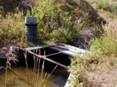
| Date | 5 Sep. 2000 | 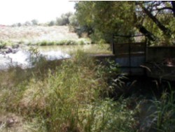 Grinnell Ditch Headgate & Dam | ||||||||||||
| Note: | The Grinnell Ditch.s supplementary rights reverted back to their original appropriation from Wolf Creek in 2000. | |||||||||||||
| Diversion Description: | Headgate consists of four, 2.8 x 2-foot rectangular steel gates in steel slides operated with Waterman-type screws, mounted in a concrete-and- rock headwall. The headgate is adjacent to a similarly constructed bypass gate used to control head on the main gates. All gates appear in good condition. | |||||||||||||
| Diversion Location: | The Grinnell Ditch diversion is located on the main stem of Big Goose Creek, below the confluence of the Big Goose and Little Goose creeks and downstream of Sheridan. | 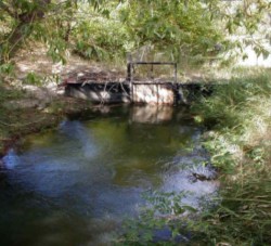 Grinnell Ditch 2nd Headgate | ||||||||||||
| ||||||||||||||
| Conveyance Description: | Open channel canal, approximately 4.0 miles long traversing silt/clay substrate. | |||||||||||||
| Direct Flow Water Rights: | The summary of direct flow rights follows: | |||||||||||||
| ||||||||||||||
| Associated Storage Rights: | Windy Reservoir (6567R) | |||||||||||||
| Irrigation Practices: | Irrigators tend to use 65 percent sprinklers and 35 percent ditch-flood irrigation to water their crops. | |||||||||||||
| Return Flows: | Estimated percentage of total diversion developing into return flows: | |||||||||||||
| ||||||||||||||
| Losses: | Approximately 20 percent by end of the ditch | |||||||||||||
| References: | Div. II superintendent Mike Whitaker, State Engineer.s Office, Interview, 5 Sept. 2000 | |||||||||||||
Irrigated Lands Water Rights Database
| PerNo | PerSfx | Facility Name | Priority | Acres | Amount | Unit | SupTyp | Status | Source |
|---|---|---|---|---|---|---|---|---|---|
| Terr | D | Grinnell Live Stock Co. | Sep. 17, 1980 | 525 | 7.5 | CFS | OS | Adj | Big Goose Creek |
| Name Source District Data |
Grinnell Ditch Diversion on Big Goose Creek Big Goose Creek 4 Total monthly flow in AF | ||||||||||||
| Water Year | Oct | Nov | Dec | Jan | Feb | Mar | Apr | May | Jun | Jul | Aug | Sep | Total |
|---|---|---|---|---|---|---|---|---|---|---|---|---|---|
| 1970 | |||||||||||||
| 1971 | |||||||||||||
| 1972 | |||||||||||||
| 1973 | |||||||||||||
| 1974 | 340.74 | 581.41 | 922.15 | ||||||||||
| 1975 | |||||||||||||
| 1976 | |||||||||||||
| 1977 | |||||||||||||
| 1978 | |||||||||||||
| 1979 | |||||||||||||
| 1980 | |||||||||||||
| 1981 | |||||||||||||
| 1982 | |||||||||||||
| 1983 | |||||||||||||
| 1984 | |||||||||||||
| 1985 | |||||||||||||
| 1986 | |||||||||||||
| 1987 | |||||||||||||
| 1988 | |||||||||||||
| 1989 | |||||||||||||
| 1990 | |||||||||||||
| 1991 | |||||||||||||
| 1992 | |||||||||||||
| 1993 | |||||||||||||
| 1994 | |||||||||||||
| 1995 | |||||||||||||
| 1996 | |||||||||||||
| 1997 | |||||||||||||
| 1998 | |||||||||||||
| 1999 | |||||||||||||
| Mean | 340.74 | 581.41 | 922.15 | ||||||||||
| Max | 340.74 | 581.41 | 922.15 | ||||||||||
| Min | 340.74 | 581.41 | 922.15 | ||||||||||
| Name Source District Data |
Grinnell Ditch Diversion on Big Goose Creek Big Goose Creek 4 First & Last Dates, Max. Days | ||
| Water Year | First Date of Measurement | Last Date of Measurement | Maximum Days Missing |
|---|---|---|---|
| 1970 | |||
| 1971 | |||
| 1972 | |||
| 1973 | |||
| 1974 | 05-Jul | 31-Aug | 0 |
| 1975 | |||
| 1976 | |||
| 1977 | |||
| 1978 | |||
| 1979 | |||
| 1980 | |||
| 1981 | |||
| 1982 | |||
| 1983 | |||
| 1984 | |||
| 1985 | |||
| 1986 | |||
| 1987 | |||
| 1988 | |||
| 1989 | |||
| 1990 | |||
| 1991 | |||
| 1992 | |||
| 1993 | |||
| 1994 | |||
| 1995 | |||
| 1996 | |||
| 1997 | |||
| 1998 | |||
| 1999 | |||
| Avg. | 05-Jul | 31-Aug | 0 |
| Earliest | 05-Jul | 31-Aug | 0 |
| Latest | 05-Jul | 31-Aug | 0 |
KEY DIVERSIONS
| Diversion: | PARK DIVERSION DITCH AKA: Park Reservoir Diversion, Park Diversion below Park Reservoir | |||||
| Date | 5 Sep. 2000 | |||||
| Note: | The Park Diversion Ditch represents a transbasin diversion, conveying water from the East Fork of Big Goose Creek to Willow Creek, a tributary of Little Goose Creek. | |||||
| Diversion Description: | Headgate consists of a single, large concrete structure built as part of the Park Reservoir outlet. | |||||
| Diversion Location: | The Park Diversion Ditch is located at the outlet of Park Reservoir, in the headwaters of Big Goose Creek. It conveys water from just below Park Reservoir to Willow Creek, which joins the Little Goose. | |||||
| ||||||
| Conveyance Description: | Open channel canal, approximately 1.5 miles long. | |||||
| Direct Flow Water Rights: | None. The structure was built to accommodate transfers of stored water from Park Reservoir into the Little Goose Creek drainage. | |||||
| Associated Storage Rights: | Park, Bighorn, and Cross Creek reservoir water can be conveyed through the Park Diversion Ditch. | |||||
| Irrigation Practices: | No irrigation diversions occur along this ditch. | |||||
| Return Flows: | The lack of irrigation obviates return flows. | |||||
| Losses: | Information not available | |||||
| References: | Div. II superintendent Mike Whitaker, State Engineer.s Office, Interview, 5 Sept. 2000 |
| Name Source District Data |
Park Diversion Ditch East Fork of Big Goose Creek 4 Total monthly flow in AF | ||||||||||||
| Water Year | Oct | Nov | Dec | Jan | Feb | Mar | Apr | May | Jun | Jul | Aug | Sep | Total |
|---|---|---|---|---|---|---|---|---|---|---|---|---|---|
| 1970 | |||||||||||||
| 1971 | 0.00 | 0.00 | 1460.37 | 2852.82 | 815.64 | 5128.83 | |||||||
| 1972 | 0.00 | 1443.27 | 1399.79 | 2405.16 | 1499.11 | 6747.33 | |||||||
| 1973 | 0.00 | 624.00 | 1349.75 | 2845.88 | 1719.07 | 6538.70 | |||||||
| 1974 | 0.00 | 1481.65 | 1321.39 | 2384.73 | 1472.13 | 6659.90 | |||||||
| 1975 | 0.00 | 0.00 | 1374.15 | 2229.62 | 2525.55 | 6129.32 | |||||||
| 1976 | 0.00 | 2018.08 | 1320.79 | 2772.89 | 1548.89 | 7660.65 | |||||||
| 1977 | 0.00 | 1497.74 | 1816.86 | 1953.32 | 961.78 | 6229.70 | |||||||
| 1978 | 0.00 | 0.00 | 107.35 | 1142.48 | 1504.66 | 2754.49 | |||||||
| 1979 | |||||||||||||
| 1980 | |||||||||||||
| 1981 | |||||||||||||
| 1982 | 0.00 | 0.00 | 1190.00 | 2780.00 | 1460.00 | 5430.00 | |||||||
| 1983 | 0.00 | 2600.00 | 1570.00 | 1780.00 | 1230.00 | 7180.00 | |||||||
| 1984 | 0.00 | 1216.54 | 1983.94 | 1848.13 | 1458.27 | 6506.88 | |||||||
| 1985 | 261.64 | 545.46 | 1903.66 | 1277.87 | 519.14 | 4507.77 | |||||||
| 1986 | 0.00 | 1025.85 | 1298.50 | 1612.35 | 654.44 | 4591.14 | |||||||
| 1987 | 327.00 | 901.00 | 570.00 | 1246.00 | 628.00 | 3672.00 | |||||||
| 1988 | 0.00 | 1074.00 | 2060.00 | 1724.00 | 616.00 | 5474.00 | |||||||
| 1989 | 0.00 | 142.40 | 520.20 | 2148.30 | 1412.40 | 4223.30 | |||||||
| 1990 | 0.00 | 1369.50 | 1625.60 | 1987.60 | 1172.50 | 6155.20 | |||||||
| 1991 | 0.00 | 957.70 | 1449.90 | 2303.50 | 974.20 | 5685.30 | |||||||
| 1992 | 0.00 | 159.10 | 352.80 | 1382.90 | 1558.20 | 3453.00 | |||||||
| 1993 | 0.00 | 474.20 | 436.40 | 1518.80 | 1548.10 | 3977.50 | |||||||
| 1994 | 259.20 | 770.10 | 1486.70 | 1782.50 | 1495.50 | 5794.00 | |||||||
| 1995 | 0.00 | 0.00 | 169.40 | 1293.10 | 1307.00 | 2769.50 | |||||||
| 1996 | 0.00 | 379.60 | 1345.40 | 1630.30 | 1249.00 | 4604.30 | |||||||
| 1997 | 0.00 | 156.80 | 196.80 | 464.10 | 1692.90 | 2510.60 | |||||||
| 1998 | 2.40 | 987.00 | 1598.70 | 1477.90 | 1573.20 | 5639.20 | |||||||
| 1999 | 0.00 | 433.10 | 747.20 | 1555.00 | 880.60 | 3615.90 | |||||||
| Mean | 32.70 | 779.12 | 1179.06 | 1861.51 | 1287.55 | 5139.94 | |||||||
| Max | 327.00 | 2600.00 | 2060.00 | 2852.82 | 2525.55 | 7660.65 | |||||||
| Min | 0.00 | 0.00 | 107.35 | 464.10 | 519.14 | 2510.60 | |||||||
| Name Source District Data |
Park Diversion Ditch East Fork of Big Goose Creek 4 First & Last Dates, Max. Days | ||
| Water Year | First Date of Measurement | Last Date of Measurement | Maximum Days Missing |
|---|---|---|---|
| 1970 | |||
| 1971 | 01-Jul | 30-Sep | 0 |
| 1972 | 10-Jun | 30-Sep | 0 |
| 1973 | 25-Jun | 24-Sep | 0 |
| 1974 | 13-Jun | 30-Sep | 0 |
| 1975 | 08-Jul | 30-Sep | 0 |
| 1976 | 07-Jun | 28-Sep | 0 |
| 1977 | 03-Jun | 30-Sep | 0 |
| 1978 | 26-Jul | 30-Sep | 0 |
| 1979 | |||
| 1980 | |||
| 1981 | |||
| 1982 | 14-Jul | 30-Sep | 0 |
| 1983 | 01-Jun | 30-Sep | 0 |
| 1984 | 01-Jun | 30-Sep | 0 |
| 1985 | 25-May | 25-Sep | 0 |
| 1986 | 04-Jun | 15-Sep | 0 |
| 1987 | 16-May | 26-Sep | 0 |
| 1988 | 01-Jun | 30-Sep | 0 |
| 1989 | 23-Jun | 30-Sep | 0 |
| 1990 | 06-Jun | 30-Sep | 0 |
| 1991 | 05-Jun | 29-Sep | 0 |
| 1992 | 23-Jun | 30-Sep | 0 |
| 1993 | 03-Jun | 30-Sep | 0 |
| 1994 | 16-May | 27-Sep | 0 |
| 1995 | 17-Jul | 29-Sep | 0 |
| 1996 | 12-Jun | 30-Sep | 0 |
| 1997 | 01-Jun | 30-Sep | 0 |
| 1998 | 26-May | 30-Sep | 0 |
| 1999 | 01-Jun | 29-Sep | 0 |
| Avg. | 12-Jun | 28-Sep | 0 |
| Earliest | 16-May | 15-Sep | 0 |
| Latest | 26-Jul | 30-Sep | 0 |
KEY DIVERSIONS
| Diversion: | PK (PATRICK) DITCH DIVERSION | |||||||||||||||||||||||||||||||||||||||||||||||||||||||
| Date | 5 Sep. 2000 | 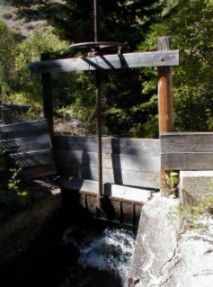 PK Ditch Headgate | ||||||||||||||||||||||||||||||||||||||||||||||||||||||
| Note: | The PK Ditch crosses a number of gravel seams, losing much water in conveyance. The recent acquisition of the PK Ranch by the Nature Conservancy and Bob Barry has meant increased sprinkler usage and a heightened interest in water conservation and instream flows. The two new owners have approximately 2,000 acre-feet of storage between them. | |||||||||||||||||||||||||||||||||||||||||||||||||||||||
| Diversion Description: | Headgate consists of a single, 4.2 x 3.5-foot steel gate in a wooden frame operated with a Waterman-type screw, mounted in a concrete headwall. | |||||||||||||||||||||||||||||||||||||||||||||||||||||||
| Diversion Location: | The PK Ditch diversion is located on the main stem of the Big Goose, adjacent to the City of Sheridan.s intake. These diversions represent the first diversions on lower Big Goose. | |||||||||||||||||||||||||||||||||||||||||||||||||||||||
| ||||||||||||||||||||||||||||||||||||||||||||||||||||||||
| Conveyance Description: | Open channel canal, approximately 22.2 miles long. | |||||||||||||||||||||||||||||||||||||||||||||||||||||||
| Direct Flow Water Rights: | The summary of direct flow rights follows: | |||||||||||||||||||||||||||||||||||||||||||||||||||||||
| ||||||||||||||||||||||||||||||||||||||||||||||||||||||||
| Associated Storage Rights: | Irrigators on the PK use stored water from Park, Dome Lake No. 1, and Sawmill reservoirs. | |||||||||||||||||||||||||||||||||||||||||||||||||||||||
| Irrigation Practices: | Irrigators tend to use approximately 60 percent sprinklers and 40 percent ditch-flood irrigation to serve their crops. | |||||||||||||||||||||||||||||||||||||||||||||||||||||||
| Return Flows: | Estimated percentage of return flows: | |||||||||||||||||||||||||||||||||||||||||||||||||||||||
| ||||||||||||||||||||||||||||||||||||||||||||||||||||||||
| Losses: | Approximately 35 percent by end of the ditch. | |||||||||||||||||||||||||||||||||||||||||||||||||||||||
| References: | Div. II superintendent Mike Whitaker, State Engineer.s Office, Interview, 5 Sept. 2000 | |||||||||||||||||||||||||||||||||||||||||||||||||||||||
Irrigated Lands Water Rights Database
| PerNo | PerSfx | Facility Name | Priority | Acres | Amount | Unit | SupTyp | Status | Source |
|---|---|---|---|---|---|---|---|---|---|
| Terr | D | P.K. or Patrick | Aug. 17, 1887 | 1855 | 26.5 | CFS | OS | Adj | Big Goose Creek |
| 83 | D | Alliance (P.K. or Patrick) | June 29, 1891 | 2031.63 | 28.97 | CFS | OS | Adj | Big Goose Creek |
| 1669 | E | Enl. Patrick | July 20, 1906 | 160 | 2.28 | CFS | OS | Adj | Big Goose Creek |
| 1678 | E | Enl. Alliance (P.K. or Patrick) | Nov. 23, 1906 | 1042.89 | 14.9 | CFS | OS | Adj | Big Goose Creek |
| 2756 | E | Enl. Alliance & Alliance Lateral (P.K. or Patrick) | Dec. 24, 1912 | 25 | 0.36 | CFS | OS | Adj | Big Goose Creek |
| 4803 | E | Enl. Patrick, Enl. P.K. | Jan. 15, 1932 | 781.4 | 0 | SS | Una | Big Goose Creek | |
| 4803 | E | Enl. Patrick, Enl. P.K. | Jan. 15, 1932 | 669.4 | 9.56 | CFS | OS | Una | Big Goose Creek |
| Name Source District Data |
PK (Patrick) Ditch Diversion Big Goose Creek 4 Total monthly flow in AF | ||||||||||||
| Water Year | Oct | Nov | Dec | Jan | Feb | Mar | Apr | May | Jun | Jul | Aug | Sep | Total |
|---|---|---|---|---|---|---|---|---|---|---|---|---|---|
| 1970 | |||||||||||||
| 1971 | 0.00 | 0.00 | 0.00 | 0.00 | 2551.54 | 2249.25 | 1674.05 | 6474.84 | |||||
| 1972 | 0.00 | 1.27 | 1191.67 | 2509.29 | 2590.61 | 2331.37 | 1992.20 | 10616.41 | |||||
| 1973 | 73.79 | 0.00 | 0.00 | 2161.78 | 2642.58 | 2605.49 | 1643.90 | 9127.54 | |||||
| 1974 | 0.00 | 0.00 | 1225.19 | 2359.34 | 2549.55 | 2358.35 | 1871.60 | 10364.03 | |||||
| 1975 | 0.00 | 0.00 | 208.66 | 1801.78 | 2307.37 | 2462.68 | 2297.25 | 9077.74 | |||||
| 1976 | 0.00 | 0.00 | 1466.18 | 2229.62 | 2335.54 | 2304.00 | 2047.73 | 10383.07 | |||||
| 1977 | 0.00 | 0.00 | 1637.35 | 2346.84 | 2014.81 | 1698.64 | 1468.16 | 9165.80 | |||||
| 1978 | 0.00 | 0.00 | 138.29 | 1692.10 | 2415.87 | 2238.15 | 1028.43 | 7512.84 | |||||
| 1979 | |||||||||||||
| 1980 | 0.00 | 0.00 | 2388.00 | 2390.00 | 2056.00 | 1805.00 | 1196.00 | 9835.00 | |||||
| 1981 | 0.00 | 306.00 | 1500.00 | 1750.00 | 3445.00 | 1612.00 | 1237.00 | 9850.00 | |||||
| 1982 | 0.00 | 0.00 | 1640.00 | 2190.00 | 1970.00 | 2390.00 | 1520.00 | 9710.00 | |||||
| 1983 | 0.00 | 0.00 | 620.00 | 2230.00 | 2350.00 | 1970.00 | 1720.00 | 8890.00 | |||||
| 1984 | 0.00 | 0.00 | 0.00 | 1393.31 | 2289.00 | 2562.28 | 291.32 | 6535.91 | |||||
| 1985 | 0.00 | 0.00 | 2081.90 | 2383.21 | 2198.67 | 1845.51 | 1388.97 | 9898.26 | |||||
| 1986 | 0.00 | 0.00 | 1779.81 | 2130.00 | 2261.50 | 2122.19 | 922.33 | 9215.83 | |||||
| 1987 | 0.00 | 0.00 | 1653.00 | 1942.00 | 2163.00 | 2204.00 | 1695.00 | 9657.00 | |||||
| 1988 | 0.00 | 0.00 | 1337.00 | 2206.00 | 2286.00 | 1820.00 | 975.00 | 8624.00 | |||||
| 1989 | 0.00 | 246.20 | 1367.70 | 2068.90 | 2009.60 | 1912.90 | 1328.80 | 8934.10 | |||||
| 1990 | 0.00 | 0.00 | 553.80 | 1719.60 | 2122.80 | 1965.60 | 1640.90 | 8002.70 | |||||
| 1991 | 0.00 | 0.00 | 340.70 | 1810.90 | 1976.90 | 1920.00 | 1197.20 | 7245.70 | |||||
| 1992 | 0.00 | 0.00 | 1180.70 | 1563.30 | 1282.50 | 1828.50 | 1146.80 | 7001.80 | |||||
| 1993 | 0.00 | 0.00 | 772.00 | 1195.90 | 1671.60 | 2020.10 | 1504.40 | 7164.00 | |||||
| 1994 | 0.00 | 0.00 | 1126.60 | 2096.90 | 1970.70 | 1632.50 | 1433.00 | 8259.70 | |||||
| 1995 | 0.00 | 0.00 | 202.00 | 1397.00 | 2024.90 | 2253.20 | 803.30 | 6680.40 | |||||
| 1996 | 0.00 | 0.00 | 1.50 | 1181.60 | 2037.00 | 1924.50 | 1357.60 | 6502.20 | |||||
| 1997 | 0.00 | 0.00 | 238.20 | 1155.70 | 1449.60 | 1559.60 | 1267.60 | 5710.70 | |||||
| 1998 | 0.00 | 0.00 | 1219.50 | 1506.00 | 1980.00 | 1889.30 | 1702.60 | 8297.40 | |||||
| 1999 | 0.00 | 0.00 | 180.00 | 1193.00 | 2027.00 | 2228.00 | 1682.00 | 7310.00 | |||||
| Mean | 2.64 | 19.77 | 930.35 | 1807.29 | 2177.84 | 2062.61 | 1429.76 | 8430.25 | |||||
| Max | 73.79 | 306.00 | 2388.00 | 2509.29 | 3445.00 | 2605.49 | 2297.25 | 10616.41 | |||||
| Min | 0.00 | 0.00 | 0.00 | 0.00 | 1282.50 | 1599.60 | 291.32 | 5710.70 | |||||
| Name Source District Data |
PK (Patrick) Ditch Diversion Big Goose Creek 4 First & Last Dates, Max. Days | ||
| Water Year | First Date of Measurement | Last Date of Measurement | Maximum Days Missing |
|---|---|---|---|
| 1970 | |||
| 1971 | 01-Jul | 30-Sep | 0 |
| 1972 | 27-Apr | 02-Oct | 0 |
| 1973 | 01-Jun | 27-Sep | 0 |
| 1974 | 14-May | 30-Sep | 0 |
| 1975 | 28-May | 30-Sep | 0 |
| 1976 | 07-May | 30-Sep | 0 |
| 1977 | 09-May | 30-Sep | 0 |
| 1978 | 26-May | 22-Sep | 0 |
| 1979 | |||
| 1980 | 01-May | 30-Sep | 0 |
| 1981 | 23-Apr | 30-Sep | 0 |
| 1982 | 06-May | 30-Sep | 0 |
| 1983 | 23-May | 30-Sep | 0 |
| 1984 | 04-Jun | 05-Sep | 0 |
| 1985 | 01-May | 30-Sep | 0 |
| 1986 | 01-May | 30-Sep | 0 |
| 1987 | 05-May | 30-Sep | 0 |
| 1988 | 09-May | 30-Sep | 0 |
| 1989 | 21-Apr | 30-Sep | 0 |
| 1990 | 15-May | 30-Sep | 0 |
| 1991 | 21-May | 30-Sep | 0 |
| 1992 | 16-May | 30-Sep | 0 |
| 1993 | 19-May | 30-Sep | 0 |
| 1994 | 06-May | 30-Sep | 0 |
| 1995 | 23-May | 30-Sep | 0 |
| 1996 | 30-May | 30-Sep | 0 |
| 1997 | 19-May | 30-Sep | 0 |
| 1998 | 06-May | 30-Sep | 0 |
| 1999 | 26-May | 30-Sep | 0 |
| Avg. | 15-May | 28-Sep | 0 |
| Earliest | 21-Apr | 05-Sep | 0 |
| Latest | 01-Jul | 02-Oct | 0 |
KEY DIVERSIONS
| Diversion: | SHERIDAN CITY INTAKES - BIG GOOSE CANYON DIVERSION AKA: Sheridan Intake Ditch | |||||||||||||||||||||||||||||||
| Date | 5 Sep. 2000 | 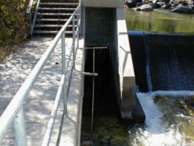 Sheridan intake facilities | ||||||||||||||||||||||||||||||
| Diversion Description: | Diversion dam and intake facility consist of a concrete structure keyed into the limestone bedrock in the Big Goose Channel, a sand trap bar and weir, and two 24-inch pipelines to carry water by gravity into Sheridan. | |||||||||||||||||||||||||||||||
| Diversion Location: | The Sheridan Intake diversion is located on Big Goose Creek, adjacent to the PK Ditch. These diversions represent the first diversions below the mountain. | |||||||||||||||||||||||||||||||
| ||||||||||||||||||||||||||||||||
| Conveyance Description: | Underground pipeline, approximately 1 mile long (to Big Goose Water Treatment Plant). | |||||||||||||||||||||||||||||||
| Direct Flow Water Rights: | The summary of direct flow rights follows: | |||||||||||||||||||||||||||||||
| ||||||||||||||||||||||||||||||||
| Associated Storage Rights: | The City of Sheridan uses water stored in Twin Lakes Reservoir. | |||||||||||||||||||||||||||||||
| Irrigation Practices: | The intake is devoted entirely to non-irrigation uses. | |||||||||||||||||||||||||||||||
| Return Flows: | Sheridan.s wastewater treatment plant discharges an average of 2.5 mgd, or 3.9 cfs into Big Goose Creek. In June, 1995, it had a peak discharge of 11 mgd, or 17 cfs. | |||||||||||||||||||||||||||||||
| Losses: | None | |||||||||||||||||||||||||||||||
| References: | Div. II superintendent Mike Whitaker, State Engineer.s Office,
Interview, 5 Sept. 2000 Sheridan Utilities Master Plan, HKM Engineering, June 1998, Sheridan, Wyoming | |||||||||||||||||||||||||||||||
| Name Source District Data |
Sheridan City Intakes - Big Goose Canyon Diversion Big Goose Creek 4 Total monthly flow in AF | ||||||||||||
| Water Year | Oct | Nov | Dec | Jan | Feb | Mar | Apr | May | Jun | Jul | Aug | Sep | Total |
|---|---|---|---|---|---|---|---|---|---|---|---|---|---|
| 1970 | |||||||||||||
| 1971 | 307.60 | 320.37 | 743.72 | 731.29 | 514.51 | ||||||||
| 1972 | 342.01 | 326.46 | 302.66 | 339.37 | 360.18 | 406.77 | 496.98 | 510.33 | 550.97 | 430.75 | |||
| 1973 | |||||||||||||
| 1974 | |||||||||||||
| 1975 | |||||||||||||
| 1976 | |||||||||||||
| 1977 | |||||||||||||
| 1978 | |||||||||||||
| 1979 | |||||||||||||
| 1980 | 408.00 | 332.00 | 340.00 | 390.00 | 392.00 | 438.00 | 415.00 | 523.00 | 620.00 | 596.00 | 609.00 | 501.00 | 5564.00 |
| 1981 | 445.00 | 353.00 | 343.00 | 342.00 | 313.00 | 348.00 | 409.00 | 560.00 | 524.00 | 716.00 | 534.00 | 531.00 | 5418.00 |
| 1982 | 440.00 | 310.00 | 320.00 | 430.00 | 390.00 | 430.00 | 420.00 | 500.00 | 470.00 | 640.00 | 670.00 | 540.00 | 5560.00 |
| 1983 | 472.00 | 448.00 | 413.00 | 365.00 | 329.00 | 359.00 | 352.00 | 389.00 | 540.00 | 614.00 | 649.00 | 485.00 | 5415.00 |
| 1984 | 323.71 | 301.73 | 317.97 | 336.16 | 318.29 | 348.40 | 337.33 | 410.88 | 515.69 | 652.29 | 608.89 | 585.49 | 5056.83 |
| 1985 | 392.53 | 328.66 | 338.38 | 336.44 | 355.40 | 364.21 | 345.84 | 602.90 | 638.59 | 715.00 | 729.27 | 556.71 | 5703.93 |
| 1986 | 345.31 | 325.77 | 348.06 | 366.83 | 331.24 | 381.03 | 413.92 | 516.64 | 661.62 | 730.32 | 753.43 | 622.62 | 5796.79 |
| 1987 | 511.92 | 276.79 | 459.30 | 438.25 | 254.40 | 417.10 | 458.41 | 678.40 | 731.30 | 737.20 | 762.40 | 522.60 | 6248.07 |
| 1988 | 455.00 | 394.00 | 394.00 | 396.00 | 372.00 | 400.00 | 434.00 | 510.00 | 798.00 | 885.00 | 831.00 | 352.00 | 6221.00 |
| 1989 | 307.80 | 299.60 | 328.13 | 323.30 | 335.60 | 384.90 | 325.00 | 395.80 | 716.10 | 750.50 | 803.40 | 497.70 | 5467.83 |
| 1990 | 366.70 | 295.60 | 309.30 | 316.40 | 291.10 | 332.80 | 333.20 | 386.20 | 550.10 | 769.40 | 736.50 | 553.50 | 5240.80 |
| 1991 | 375.20 | 353.10 | 361.30 | 359.40 | 326.60 | 398.60 | 387.00 | 386.80 | 516.80 | 789.20 | 738.00 | 529.00 | 5521.00 |
| 1992 | 389.70 | 373.40 | 355.00 | 316.60 | 290.50 | 323.10 | 364.90 | 574.00 | 661.20 | 677.30 | 806.20 | 568.90 | 5700.80 |
| 1993 | 532.00 | 490.90 | 415.90 | 394.40 | 375.40 | 435.70 | 385.00 | 477.80 | 532.40 | 703.50 | 714.00 | 656.70 | 6113.70 |
| 1994 | 619.00 | 522.30 | 552.00 | 475.90 | 404.30 | 475.90 | 414.60 | 565.70 | 768.10 | 904.20 | 801.00 | 716.80 | 7219.80 |
| 1995 | 557.80 | 466.70 | 446.20 | 451.70 | 404.80 | 405.60 | 436.60 | 495.00 | 594.30 | 724.20 | 919.20 | 778.50 | 6680.60 |
| 1996 | 591.00 | 525.40 | 551.00 | 553.20 | 459.30 | 481.70 | 478.20 | 492.20 | 656.40 | 1058.50 | 936.60 | 680.90 | 7464.40 |
| 1997 | 624.00 | 473.20 | 510.30 | 1151.70 | 675.70 | 660.50 | 419.20 | 494.90 | 446.60 | 748.80 | 724.10 | 663.50 | 7592.50 |
| 1998 | 462.00 | 368.80 | 308.90 | 318.60 | 298.90 | 303.60 | 297.20 | 738.80 | 784.60 | 1102.80 | 904.60 | 823.10 | 6711.90 |
| 1999 | 608.00 | 559.20 | 580.10 | 573.60 | 426.00 | 441.40 | 476.10 | 516.90 | 701.00 | 1031.90 | 928.10 | 614.80 | 7457.10 |
| Mean | 455.65 | 385.99 | 395.82 | 426.76 | 364.10 | 403.28 | 393.46 | 505.79 | 615.42 | 763.64 | 747.32 | 578.41 | 6107.70 |
| Max | 624.00 | 559.20 | 580.10 | 1151.70 | 675.70 | 660.50 | 478.20 | 738.80 | 798.00 | 1102.80 | 936.60 | 823.10 | 7592.50 |
| Min | 307.80 | 276.79 | 308.90 | 316.40 | 254.40 | 303.60 | 297.20 | 386.20 | 446.60 | 510.33 | 534.00 | 352.00 | 5056.83 |
| Name Source District Data |
Sheridan City Intakes - Big Goose Canyon Diversion Big Goose Creek 4 First & Last Dates, Max. Days | ||
| Water Year | First Date of Measurement | Last Date of Measurement | Maximum Days Missing |
|---|---|---|---|
| 1970 | |||
| 1971 | 01-Nov | 30-Sep | 166 |
| 1972 | 01-Oct | 30-Sep | 61 |
| 1973 | |||
| 1974 | |||
| 1975 | |||
| 1976 | |||
| 1977 | |||
| 1978 | <|||
| 1979 | |||
| 1980 | 01-Oct | 30-Sep | 0 |
| 1981 | 01-Oct | 30-Sep | 0 |
| 1982 | 01-Oct | 30-Sep | 0 |
| 1983 | 01-Oct | 30-Sep | 0 |
| 1984 | 01-Oct | 30-Sep | 0 |
| 1985 | 01-Oct | 30-Sep | 0 |
| 1986 | 01-Oct | 30-Sep | 0 |
| 1987 | 01-Oct | 30-Sep | 0 |
| 1988 | 01-Oct | 30-Sep | 0 |
| 1989 | 01-Oct | 30-Sep | 0 |
| 1990 | 01-Oct | 30-Sep | 0 |
| 1991 | 01-Oct | 30-Sep | 0 |
| 1992 | 01-Oct | 30-Sep | 0 |
| 1993 | 01-Oct | 30-Sep | 0 |
| 1994 | 01-Oct | 30-Sep | 0 |
| 1995 | 01-Oct | 30-Sep | 0 |
| 1996 | 01-Oct | 30-Sep | 0 |
| 1997 | 01-Oct | 30-Sep | 0 |
| 1998 | 01-Oct | 30-Sep | 0 |
| 1999 | 01-Oct | 30-Sep | 0 |
| Avg. | 02-Oct | 30-Sep | 10 |
| Earliest | 01-Oct | 30-Sep | 0 |
| Latest | 01-Nov | 30-Sep | 166 |