Wyoming State Water Plan
Wyoming State Water Plan
Wyoming Water Development Office
6920 Yellowtail Rd
Cheyenne, WY 82002
Phone: 307-777-7626

Wyoming Water Development Office
6920 Yellowtail Rd
Cheyenne, WY 82002
Phone: 307-777-7626


| SUBJECT: |
Appendix J Storage Operation and Description KEYHOLE |
| PREPARED BY: | HKM Engineering Inc. |
| DATE: | March 2002 |
KEY STORAGE FACILITIES
| Reservoir: | KEYHOLE | |||||||||||||||||||||||||||||||||||||||||||||||||||||||||||||||||||||||||||||||||||||||||||||||||||||||||||||||||||||||||||||||||||||
| Date: | 12 Feb. 2001 | 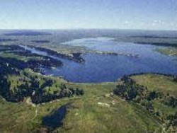 | ||||||||||||||||||||||||||||||||||||||||||||||||||||||||||||||||||||||||||||||||||||||||||||||||||||||||||||||||||||||||||||||||||||
| Location: | NWNW 27,T51N,R66W | |||||||||||||||||||||||||||||||||||||||||||||||||||||||||||||||||||||||||||||||||||||||||||||||||||||||||||||||||||||||||||||||||||||
| Owner: | United States Bureau of Reclamation | |||||||||||||||||||||||||||||||||||||||||||||||||||||||||||||||||||||||||||||||||||||||||||||||||||||||||||||||||||||||||||||||||||||
| Year of Construction: | 1952 | |||||||||||||||||||||||||||||||||||||||||||||||||||||||||||||||||||||||||||||||||||||||||||||||||||||||||||||||||||||||||||||||||||||
| Total Storage: | 634,639 acre-feet | |||||||||||||||||||||||||||||||||||||||||||||||||||||||||||||||||||||||||||||||||||||||||||||||||||||||||||||||||||||||||||||||||||||
| Active Storage: | 185,801 acre-feet | |||||||||||||||||||||||||||||||||||||||||||||||||||||||||||||||||||||||||||||||||||||||||||||||||||||||||||||||||||||||||||||||||||||
| Inactive Storage: | 7,226 acre-feet | |||||||||||||||||||||||||||||||||||||||||||||||||||||||||||||||||||||||||||||||||||||||||||||||||||||||||||||||||||||||||||||||||||||
| Dead Storage: | 726 acre-feet | |||||||||||||||||||||||||||||||||||||||||||||||||||||||||||||||||||||||||||||||||||||||||||||||||||||||||||||||||||||||||||||||||||||
| Inviolate Flood Control Storage: | 140,462 acre-feet | |||||||||||||||||||||||||||||||||||||||||||||||||||||||||||||||||||||||||||||||||||||||||||||||||||||||||||||||||||||||||||||||||||||
| Dam Construction Type: | Zoned earth fill | |||||||||||||||||||||||||||||||||||||||||||||||||||||||||||||||||||||||||||||||||||||||||||||||||||||||||||||||||||||||||||||||||||||
| Area/Capacity Table: | (Source: 1978 Area Capacity Tables, computed 3/3/81, U.S. Bureau of Reclamation, Rapid City, South Dakota.) | |||||||||||||||||||||||||||||||||||||||||||||||||||||||||||||||||||||||||||||||||||||||||||||||||||||||||||||||||||||||||||||||||||||
Area Table (acres, elevations in 1-ft. increments)
| ||||||||||||||||||||||||||||||||||||||||||||||||||||||||||||||||||||||||||||||||||||||||||||||||||||||||||||||||||||||||||||||||||||||
Volume Table (acre-feet, elevations in 1-ft. increments)
| ||||||||||||||||||||||||||||||||||||||||||||||||||||||||||||||||||||||||||||||||||||||||||||||||||||||||||||||||||||||||||||||||||||||
From permit map:Approximately 70,000 acre-feet of the original 200,000 acre-feet of Normal Water Surface elevation may ultimately be filled with sediment. | ||||||||||||||||||||||||||||||||||||||||||||||||||||||||||||||||||||||||||||||||||||||||||||||||||||||||||||||||||||||||||||||||||||||
| Outlet: | Concrete-lined, horseshoe-shaped tunnel, 9.5 feet x 8.25 feet high through the left abutment. Release capacities of about 1,480 cubic feet per second are controlled by two vertical lift, high-pressure hydraulic slide gates. | |||||||||||||||||||||||||||||||||||||||||||||||||||||||||||||||||||||||||||||||||||||||||||||||||||||||||||||||||||||||||||||||||||||
| Spillway: | Uncontrolled concrete crest and concrete-lined open channel at the right abutment at 4099.3 feet, 19.25 feet wide, with a capacity of 11,000 cfs. | |||||||||||||||||||||||||||||||||||||||||||||||||||||||||||||||||||||||||||||||||||||||||||||||||||||||||||||||||||||||||||||||||||||
| End-of-Month Storage Records: | Yes | |||||||||||||||||||||||||||||||||||||||||||||||||||||||||||||||||||||||||||||||||||||||||||||||||||||||||||||||||||||||||||||||||||||
| Water Rights: | (Source: Tabulation of Adjudicated Surface Water Rights of the State of Wyoming, Water Division Number Two, Oct. 1999) | |||||||||||||||||||||||||||||||||||||||||||||||||||||||||||||||||||||||||||||||||||||||||||||||||||||||||||||||||||||||||||||||||||||
| ||||||||||||||||||||||||||||||||||||||||||||||||||||||||||||||||||||||||||||||||||||||||||||||||||||||||||||||||||||||||||||||||||||||
| Ninety percent of conservation storage (193,753 acre-feet) is reserved for South Dakota. This services approximately 57,200 irrigable acres in the vicinity of Belle Fourche and Newell, South Dakota A portion of South Dakota's allocation currently has no contract and is maintained in the U.S. (federal) account. | ||||||||||||||||||||||||||||||||||||||||||||||||||||||||||||||||||||||||||||||||||||||||||||||||||||||||||||||||||||||||||||||||||||||
| Of Wyoming's portion (10 percent of active storage), 18,080 acre- feet have been purchased by the Crook County Irrigation District. The remaining 500 acre-feet were purchased by Shattuck Hills. Wyoming's 10 percent of active storage is reserved in the Belle Fourche Compact. | ||||||||||||||||||||||||||||||||||||||||||||||||||||||||||||||||||||||||||||||||||||||||||||||||||||||||||||||||||||||||||||||||||||||
| Designated Use: | Flood control, irrigation, stock and fire protection, and other uses | |||||||||||||||||||||||||||||||||||||||||||||||||||||||||||||||||||||||||||||||||||||||||||||||||||||||||||||||||||||||||||||||||||||
| Recreational Use: | Fishing, boating, camping, swimming | |||||||||||||||||||||||||||||||||||||||||||||||||||||||||||||||||||||||||||||||||||||||||||||||||||||||||||||||||||||||||||||||||||||
| Associated Irrigation Diversions: | All irrigation diversions downstream of Keyhole Reservoir on the Belle Fourche are affected. Eighteen Wyoming irrigators are members of the Crook County Irrigation District, which owns the majority of the 10 percent share of the conservation pool discussed above. | |||||||||||||||||||||||||||||||||||||||||||||||||||||||||||||||||||||||||||||||||||||||||||||||||||||||||||||||||||||||||||||||||||||
| Associated Industrial Diversions: | None | |||||||||||||||||||||||||||||||||||||||||||||||||||||||||||||||||||||||||||||||||||||||||||||||||||||||||||||||||||||||||||||||||||||
| Operational Discussion: | From the U.S. Bureau of Reclamation web page http://gphyd0.gp.usbr.gov/aop/um/97/KEYRUS97.HTM [new link 10/2009 HERE] | |||||||||||||||||||||||||||||||||||||||||||||||||||||||||||||||||||||||||||||||||||||||||||||||||||||||||||||||||||||||||||||||||||||
The flood control space at Keyhole Reservoir is all located above an ungated spillway. The spillway capacity is 11,000 cfs at maximum water surface elevation. The downstream safe channel capacity is 3,000 cfs. Formulas for forecasting inflows have not been developed. Research by the Soil Conservation Service during water years 1992 through 1994 show that inflow forecasting to Keyhole Reservoir is not reliable since there is no consistent snowpack and precipitation is highly cyclical. No further efforts to develop forecast models are planned. | ||||||||||||||||||||||||||||||||||||||||||||||||||||||||||||||||||||||||||||||||||||||||||||||||||||||||||||||||||||||||||||||||||||||
| Releases are made upon requests from the Crook County Irrigation District in Wyoming and the Belle Fourche Irrigation District in South Dakota. | ||||||||||||||||||||||||||||||||||||||||||||||||||||||||||||||||||||||||||||||||||||||||||||||||||||||||||||||||||||||||||||||||||||||
| References: | U.S. Bureau of Reclamation web page http://gphyd0.gp.usbr.gov/aop/um/97/KEYRUS97.HTM [new link 10/2009 HERE] | |||||||||||||||||||||||||||||||||||||||||||||||||||||||||||||||||||||||||||||||||||||||||||||||||||||||||||||||||||||||||||||||||||||
| Map to Accompany Application, Keyhole Reservoir, United States of America Department of the Interior Bureau of Reclamation, Billings, Montana, 18 Aug. 1965. | ||||||||||||||||||||||||||||||||||||||||||||||||||||||||||||||||||||||||||||||||||||||||||||||||||||||||||||||||||||||||||||||||||||||
Net evaporative loss for Keyhole Reservoir:
Historical End of Month Contents:
| Jan | Feb | Mar | Apr | May | Jun | Jul | Aug | Sep | Oct | Nov | Dec | |
| 1970 | 121,365 | 123,588 | 126,445 | 131,275 | 138,859 | 138,375 | 130,281 | 121,048 | 118,763 | 120,984 | 120,413 | 120,413 |
| 1971 | 117,730 | 122,889 | 137,754 | 161,420 | 168,271 | 173,321 | 165,512 | 156,038 | 153,367 | 117,304 | 117,000 | 117,061 |
| 1972 | 157,052 | 176,613 | 179,144 | 178,301 | 180,197 | 183,794 | 180,373 | 176,528 | 170,543 | 157,130 | 156,818 | 156,818 |
| 1973 | 167,297 | 167,459 | 168,514 | 172,646 | 172,815 | 171,465 | 164,781 | 157,754 | 157,286 | 167,540 | 167,216 | 167,297 |
| 1974 | 162,122 | 167,297 | 168,271 | 167,946 | 166,323 | 161,966 | 151,344 | 142,333 | 139,342 | 157,286 | 156,272 | 156,584 |
| 1975 | 137,892 | 137,892 | 144,203 | 151,568 | 156,974 | 158,378 | 151,344 | 141,037 | 136,097 | 138,514 | 137,961 | 137,823 |
| 1976 | 134,094 | 138,030 | 139,688 | 140,606 | 141,325 | 151,643 | 147,297 | 140,821 | 133,749 | 134,508 | 133,610 | 133,818 |
| 1977 | 131,407 | 131,937 | 135,820 | 144,059 | 142,908 | 140,102 | 129,221 | 115,359 | 113,503 | 131,606 | 131,407 | 131,010 |
| 1978 | 112,281 | 112,689 | 152,093 | 153,142 | 189,922 | 172,731 | 172,140 | 165,187 | 158,768 | 114,143 | 112,049 | 112,223 |
| 1979 | 157,130 | 157,598 | 168,109 | 171,380 | 167,054 | 162,122 | 157,832 | 152,692 | 147,822 | 157,208 | 155,882 | 156,662 |
| 1980 | 143,196 | 147,597 | 149,096 | 148,871 | 143,700 | 139,549 | 128,029 | 107,769 | 106,044 | 145,355 | 143,772 | 143,484 |
| 1981 | 102,176 | 102,176 | 103,595 | 94,799 | 74,774 | 62,473 | 55,188 | 47,192 | 42,657 | 102,983 | 101,644 | 102,016 |
| 1982 | 41,688 | 45,345 | 46,687 | 47,162 | 56,759 | 62,621 | 60,573 | 56,828 | 55,935 | 42,062 | 41,662 | 41,608 |
| 1983 | 61,299 | 66,857 | 68,063 | 68,573 | 68,456 | 66,741 | 56,828 | 51,399 | 50,508 | 58,221 | 59,496 | 59,890 |
| 1984 | 51,271 | 53,351 | 65,513 | 66,896 | 79,346 | 90,492 | 85,718 | 82,481 | 80,425 | 51,143 | 51,048 | 51,207 |
| 1985 | 79,302 | 79,257 | 82,434 | 82,481 | 77,489 | 73,386 | 62,954 | 57,487 | 56,003 | 79,346 | 79,391 | 79,391 |
| 1986 | 55,940 | 56,828 | 64,379 | 67,674 | 74,313 | 74,695 | 68,065 | 62,327 | 63,963 | 55,462 | 55,359 | 55,769 |
| 1987 | 66,513 | 69,091 | 84,445 | 87,741 | 92,604 | 90,247 | 83,741 | 79,442 | 78,639 | 66,088 | 66,513 | 66,552 |
| 1988 | 77,233 | 79,800 | 83,413 | 83,507 | 81,064 | 71,777 | 63,219 | 55,666 | 53,417 | 77,756 | 77,364 | 77,233 |
| 1989 | 52,732 | 53,090 | 58,224 | 59,002 | 61,486 | 57,561 | 48,922 | 41,033 | 40,511 | 52,960 | 52,601 | 52,699 |
| 1990 | 40,667 | 46,103 | 50,132 | 51,435 | 53,385 | 48,492 | 40,458 | 32,950 | 31,510 | 40,071 | 40,096 | 40,380 |
| 1991 | 30,862 | 31,442 | 31,680 | 32,752 | 46,780 | 48,461 | 40,876 | 32,884 | 30,376 | 31,119 | 30,883 | 30,904 |
| 1992 | 30,059 | 30,249 | 30,692 | 30,482 | 27,035 | 25,701 | 25,001 | 19,619 | 18,990 | 29,786 | 30,038 | 30,017 |
| 1993 | 18,672 | 18,704 | 25,190 | 32,025 | 50,894 | 67,752 | 69,485 | 70,364 | 68,184 | 18,594 | 18,578 | 18,594 |
| 1994 | 69,761 | 81,064 | 102,593 | 103,840 | 105,409 | 101,411 | 94,389 | 87,011 | 85,432 | 68,184 | 68,302 | 68,933 |
| 1995 | 93,059 | 93,159 | 96,156 | 96,734 | 109,998 | 111,524 | 110,818 | 107,855 | 105,971 | 92,196 | 92,703 | 92,601 |
| 1996 | 108,488 | 119,212 | 147,732 | 149,183 | 153,369 | 151,650 | 146,976 | 144,126 | 141,694 | 107,109 | 107,740 | 108,026 |
| 1997 | 148,381 | 162,861 | 181,888 | 186,602 | 183,966 | 182,067 | 180,995 | 178,414 | 175,336 | 141,036 | 140,817 | 142,378 |
| 1998 | 173,421 | 175,772 | 183,061 | 180,995 | 178,769 | 179,210 | 181,712 | 181,620 | 178,323 | 173,595 | 172,560 | 173,075 |
| 1999 | 177,353 | 178,591 | 182,160 | 185,875 | 179,923 | 186,241 | 179,923 | 177,267 | 174,727 | 184,870 | 177,616 | 176,851 |
| Historical Ave. Vol. (af) | 100,681 | 104,218 | 111,906 | 114,299 | 117,472 | 116,865 | 111,133 | 104,751 | 102,263 | 100,472 | 99,894 | 100,044 |
| Corresponding Area (acres) | 5,303 | 5,544 | 5,785 | 5,785 | 6,026 | 6,026 | 5,785 | 5,544 | 5,303 | 5,303 | 5,303 | 5,303 |
| Lewis Annual Evaporation (in.) | 43 |
| Total Storage (acre-feet) | 634,639 |
Calculations:
| Monthly Lewis Evap. (inches) | 1.161 | 1.075 | 1.677 | 3.44 | 4.945 | 5.633 | 7.353 | 6.708 | 4.945 | 3.268 | 1.677 | 1.118 | |
| Monthly Precipitation (inches) | 0.25 | 0.25 | 0.75 | 1.75 | 2.75 | 2.75 | 1.75 | 1.25 | 1.25 | 1.25 | 0.75 | 0.75 | |
| Net Evaporation (inches) | 0.911 | 0.825 | 0.927 | 1.69 | 2.195 | 2.883 | 5.603 | 5.458 | 3.695 | 2.018 | 0.927 | 0.368 | TOTAL |
| Total Net Evaporation (acre-feet) | 403 | 381 | 447 | 815 | 1,102 | 1,448 | 2,701 | 2,522 | 1,633 | 892 | 410 | 163 | 12,915 |