Wyoming State Water Plan
Wyoming State Water Plan
Wyoming Water Development Office
6920 Yellowtail Rd
Cheyenne, WY 82002
Phone: 307-777-7626

Wyoming Water Development Office
6920 Yellowtail Rd
Cheyenne, WY 82002
Phone: 307-777-7626


Colorado River System
Consumptive Uses
and
Losses Report
1986-1990
September 1998
![]()
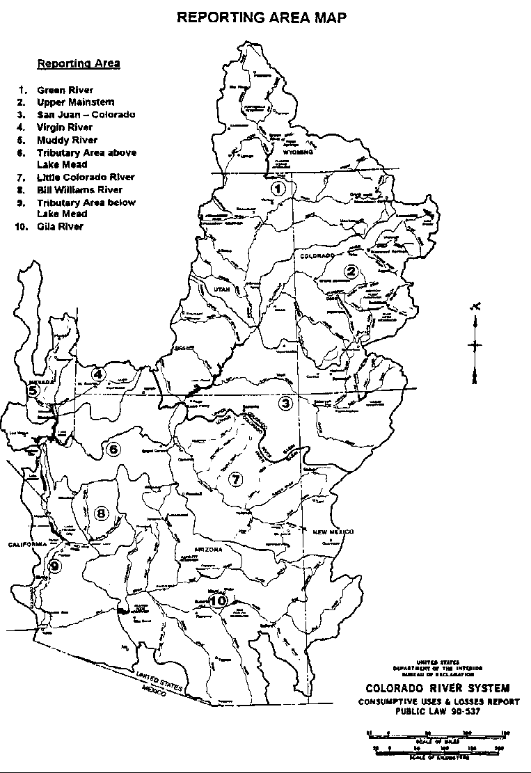
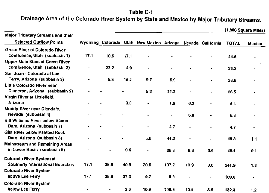
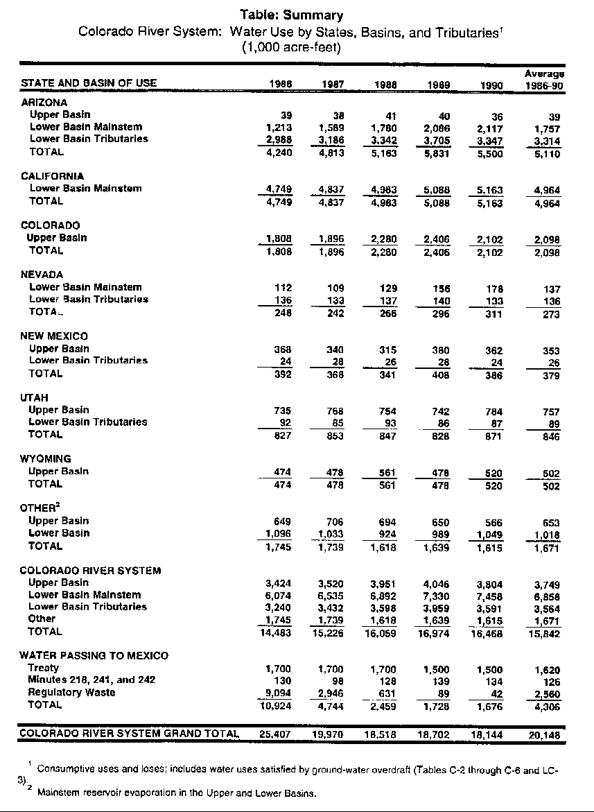
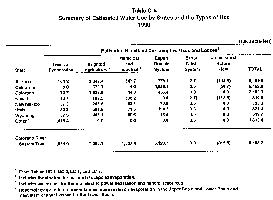
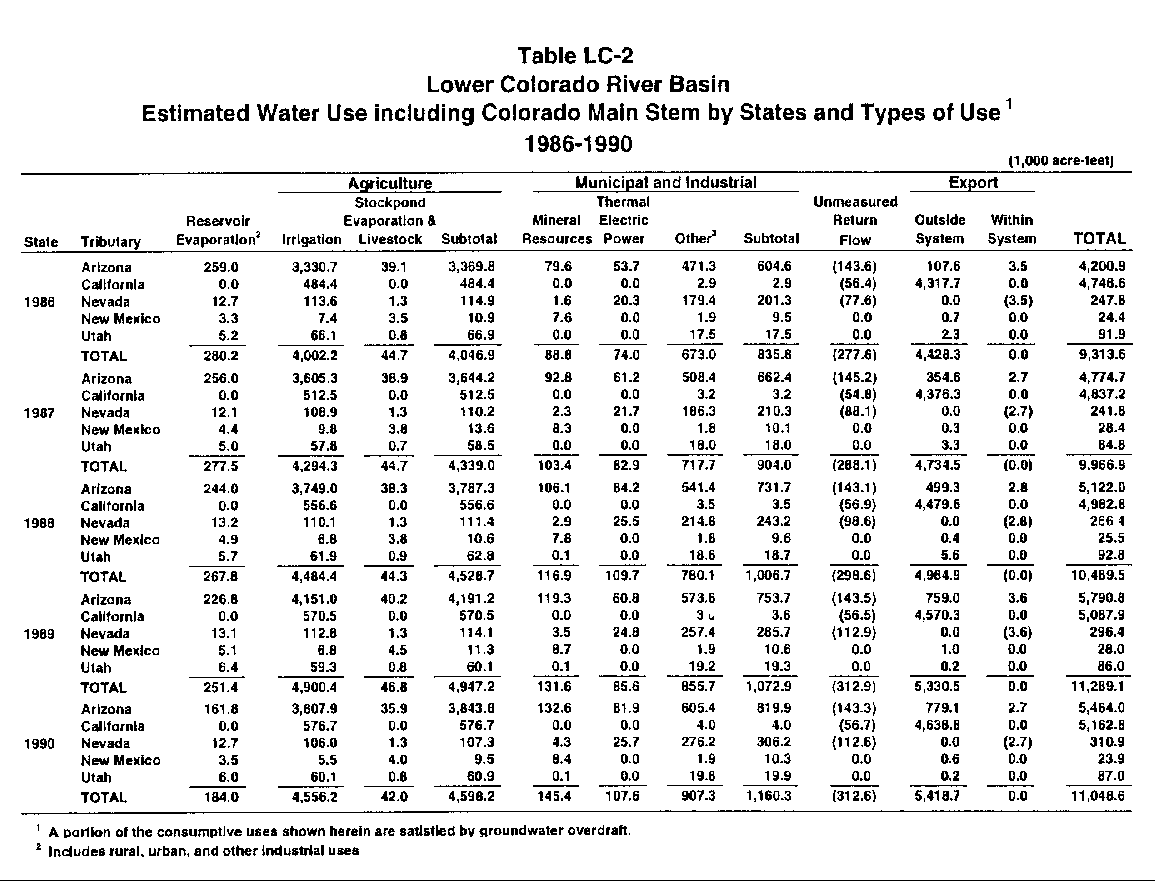
This report presents estimates of the consumptive uses and losses from the Colorado River System for each calendar year from 1986 through 1990. It includes a breakdown of the beneficial consumptive use by major types of use, by major tributary streams, and, where possible, by individual States.
The Colorado River rises in the Rocky Mountains of Colorado, flows southwesterly about 1,400 miles and terminates in the Gulf of California. Its drainage area of 242,000 square miles in this country represents one-fifteenth of the area of the United States. Its water is used for irrigation, municipal and industrial purposes, electric power generation, mineral activities, livestock, fish and wildlife, and recreation. Large amounts are exported from the system to adjoining areas. The following table summarizes annual water use from the system by basins and States, including water use supplied by ground-water overdraft. Distribution of water use by types of use from the various reporting areas is contained within the body of the report.