Wyoming State Water Plan
Wyoming State Water Plan
Wyoming Water Development Office
6920 Yellowtail Rd
Cheyenne, WY 82002
Phone: 307-777-7626

Wyoming Water Development Office
6920 Yellowtail Rd
Cheyenne, WY 82002
Phone: 307-777-7626


PDF (7,204kb) Access the 2011 Bear River Basin Update Final Report here
PDF (544kb) Access the Bear River Basin Report Table of Contents here
PDF (376kb) This update will not totally replace the 2001 plan or the supporting technical memoranda, but will provide updated information and make recommendations for the collection of additional information and data to appropriately keep the plan current.
PDF (115kb) View a description of the Presentation Tools developed during the 2011 Bear River Basin Plan Update
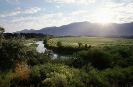
PDF (1,648kb) A description of the Bear River Basin Setting
PDF (1,070kb) Presents the Basin's total supply of surface water and groundwater and the quality of these resources.
PDF (3,559kb) Quantifies Basin water use in consumptive and nonconsumptive sectors including agriculture, industrial, municipal, rural domestic, environmental and recreation.
PDF (518kb) Provides estimates of future water uses for the Basin for all use sectors. The estimates are prepared for two different projected growth scenarios.
PDF (301kb) Presents estimates of the amount of water remaining for development considering the growth scenarios presented in Chapter 6.
PDF (308kb) Discusses Basin issues identified by the Basin Advisory Group (BAG) and strategies developed with the BAG. In addition, water use opportunities, which would help meet water demands within the Basin, are discussed.
PDF (118kb) Summarizes proposed program strategies that will guide further river basin planning in the Wyoming portion of the Bear River Basin. Recommendations for further work and data collection within the Basin are also presented.
PDF (436kb) Updated Framework Datat Tables and Wyoming Surface Water Classifications from the Wyoming Department of Environmental Quality
| Tab | Technical Memoranda | |
| 66 kb | Introduction to Volume 2 | |
| 275 kb | I | Surface Water Data Collection & Study Period Selection |
| 21,483 kb | II | Diversion Summary |
| 112 kb | III | Crop Consumptive Use |
| 1,525 kb | IV | Storage Summary |
| 7,190 kb | V | Groundwater Resources Investigation |
| 338 kb | VI | Spreadsheet Model Development |
| 56 kb | VII | Use of Bear River Spreadsheet Model |
| 59 kb | VIII | Surface Water Calibration |
| 102 kb | IX | Available Surface Water Determination |
| 308 kb | X | Climate |
| 64 kb | XI | Reservoir Evaporation |