Wyoming State Water Plan
Wyoming State Water Plan
Wyoming Water Development Office
6920 Yellowtail Rd
Cheyenne, WY 82002
Phone: 307-777-7626

Wyoming Water Development Office
6920 Yellowtail Rd
Cheyenne, WY 82002
Phone: 307-777-7626


This project is focused on developing statewide water infrastructure data. With this data, the Office can ensure consistency and accuracy and create cost savings on all future Level I projects. Outcomes include an inventory of water infrastructure by basin and a statewide GIS dataset of that infrastructure.
Timeline: July 2018 - November 2019
Contact the River Basin Planning Team
Consultant: Confluence Consulting, Inc.
Documents: Request For Proposal
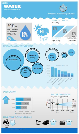
This statewide analysis provides a simplified method to assess current and future water use and availability trends. The results will provide a consistent, credible method to assess needs for supplemental water supplies. Outcomes include a medium to effectively communicate the findings to the public, the Water Development Commission, and legislators.
Timeline: July 2018-October 2019
Contact the River Basin Planning Team
Consultant: WEST, Inc.
Documents: Request For Proposal
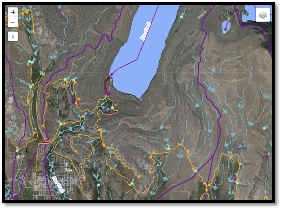
The National Hydrography Dataset (NHD) is a digital representation of the water surface features found on topographic maps. These features form a stream network and represent the water drainage network across Wyoming. This update to the NHDPlus High Resolution (NHDPlus HR) integrates other hydrographic, topographic, and watershed information at a local resolution. NHDPlus HR will form the foundation for StreamStats.
Timeline: July 2018-December 2019
Contact the River Basin Planning Team
Partner: Wyoming Geographic Information Science Center (WyGISC)
Documents: Interagency Agreement
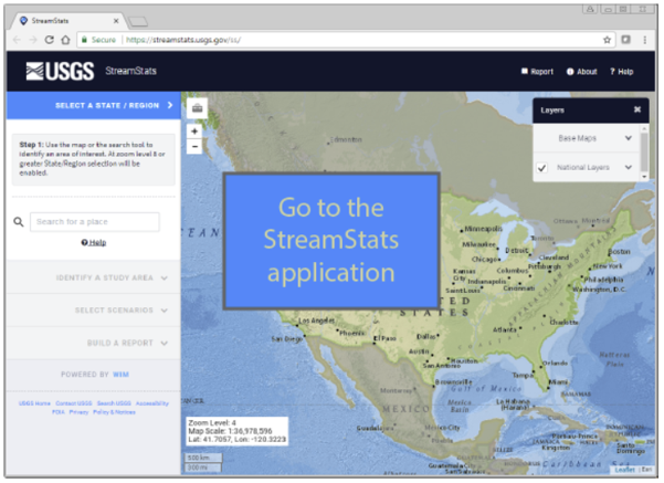
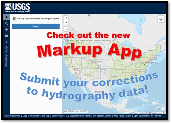
StreamStats is a web-based application for retrieving basin and streamflow characteristics. This application will provide the public an assortment of analytical tools that are useful for water resource planning and management. The StreamStats tool will assist all WWDC projects that rely on streamflow quantities and flow duration. This application will lower individual project costs and improve consistency and defensibility in work products.
Phase I and II timeline: August 2018-December 2020
Contact the River Basin Planning Team
Partner: U.S. Geological Survey
Documents: