Wyoming State Water Plan
Wyoming State Water Plan
Wyoming Water Development Office
6920 Yellowtail Rd
Cheyenne, WY 82002
Phone: 307-777-7626

Wyoming Water Development Office
6920 Yellowtail Rd
Cheyenne, WY 82002
Phone: 307-777-7626


|
BBC Consulting, Inc. Denver, CO 80209 | Boyle Engineering, Inc. Lakewood, CO 80228 |
|
Hinckley Consulting Laramie, WY 82070 | Fassett Consulting Cheyenne, WY 82003 |
|
Rendezvous Engineering Jackson, WY 83001 | Nelson Engineering Jackson, WY 83001 |
INTRODUCTION
The 2001 Wyoming Legislature authorized the Wyoming Water Development Commission (WWDC) to complete the Snake/Salt River Basin portion of the State Water Plan. According to the WWDC, the river basin planning process has the following goals:
Numerous technical memoranda were created as the background to the final report. All topics discussed in this report are covered in detail in the technical memoranda. These documents, as well as other Wyoming river basin plans, can be found electronically on the Wyoming State Water Plan homepage at http://waterplan.state.wy.us/.
The initial Snake/Salt River Basin Advisory Group meeting was held May 15, 2001 in Jackson. At that time the Basin Advisory Group (BAG) was formed, consisting of over 30 citizens from throughout the basin. The members represent a variety of interests, such as agriculture, industry, environmental, government and recreation. Their knowledge and input was invaluable to the creation of this basin plan and their efforts are much appreciated.
BASIN DESCRIPTION
The Snake River Basin is part of the Columbia River drainage that flows to the Pacific Ocean. The Snake/Salt River basin in Wyoming is a portion of the headwaters of the Snake River, and contains all of the Snake Headwaters, Gros Ventre, Greys, and Hoback sub-basins, as well as portions of the Salt, Palisades, Teton, Lower Henry's, and Upper Henry's sub-basins. The Wyoming portion of the Snake/Salt River basin covers approximately 5,100 square miles. A map of the Snake/Salt River basin planning area can be found in Figure 1. The Snake River is one of the major rivers of the West, flowing from Wyoming across Idaho before converging with the Columbia River in Washington. The basin covers all of Teton County and portions of Lincoln, Sublette, and Fremont Counties. The basin includes all of Grand Teton National Park, as well as a portion of Yellowstone National Park.
Climate in the basin can be quite variable due to the range of elevation that is present. Of the locations with recorded data, the average annual precipitation ranges from approximately 17 inches in Jackson to over 28 inches at the Snake River site near Flagg Ranch. Examples of precipitation at other populated areas include over 18 inches at Afton, nearly 24 inches at Alta, and over 20 inches at Boundurant. Mountainous areas typically have much higher average annual precipitation, with some areas at over 60 inches at the Tetons. The majority of the precipitation falls in the winter as snowfall, which then melts and flows as runoff during the spring and summer months.
The high elevation of the mountain valleys in the basin results in a fairly short growing season capable of supporting only native hay, alfalfa, and small grains. The average growing seasons are 139 days and 144 days for Jackson and Afton respectively. Also, the relative lack of precipitation during the summer results in a need for crop irrigation in order to maximize crop production.
The main water features in the Snake/Salt River basin are the rivers themselves. The Snake River is the largest in the basin, and its sizeable tributaries include the Buffalo Fork, Gros Ventre, and Hoback Rivers. The Salt and Greys Rivers are also tributary to the Snake, and join the main river at Palisades Reservoir. Numerous streams feed each of these rivers on their journey through the basin.
There are many natural lakes in the basin, which include Shoshone, Heart, and Lewis Lakes in Yellowstone National Park. There are many sizeable lakes in Grand Teton National Park, including Jackson, Jenny, Leigh, Two Ocean, and Emma Matilda Lakes. Many smaller lakes are located throughout the basin, generally on Forest Service lands.
THE SNAKE RIVER COMPACT & ROXANNA DECREE
Use of water in the state is subject to Wyoming water laws as well as interstate compacts and court decrees. These documents govern how water is diverted and used, particularly in times of low supply. The Snake River Compact, negotiated by the representatives of both Idaho and Wyoming with participation of a representative of the United States, was signed on October 10, 1949. The compact divided the waters of the Snake and Salt River watersheds between the states of Idaho and Wyoming. The compact recognizes, without restriction, all existing water rights in Wyoming and Idaho established prior to July 1, 1949. It permits Wyoming unlimited use of water for domestic and stock watering purposes, providing stock water reservoirs shall not exceed 20 acre-feet in capacity. The compact allocates to Wyoming, for all future uses, the right to divert or store 4% of the Wyoming-Idaho state line flow of the Snake River. Idaho is entitled to the remaining 96% of the flow. The use of water is limited to diversions or storage within the Snake River drainage basin unless both states agree otherwise. The compact also provides preference for domestic, stock and irrigation use of the water over storage for the generation of power.
The Roxanna Decree is a shorthand name for a 1941 United States District Court decision resolving an interstate dispute between water users in Wyoming and Idaho diverting from Teton Creek and South Leigh Creek. This decree adopted a stipulation of agreement entered into by the water user parties located within Wyoming and Idaho, dated March 20, 1940.
PALISADES RESERVOIR COMPACT
The Palisades Reservoir contract provides Wyoming with 33,000 acre-feet (AF) or 2.75% of the 1,200,000 AF of active storage space in Palisades Reservoir. Wyoming is entitled to the water accruing to this space in priority for a variety of purposes, including the compact replacement storage space obligations, subcontracting the use of storage water to others and to maintain instream flows and lake levels within Wyoming, through an exchange. Wyoming is contractually treated for the most part like any other storage spaceholder in Palisades Reservoir under contract with the Bureau, with the same general rights and obligations for the use, accounting, and administration of the storage space.
AGRICULTURAL WATER USE
Agricultural water uses consume more water than any other use in the Snake/Salt River basin. Agricultural uses mainly consist of irrigation of crops by either flood or sprinkler irrigation. The vast majority of irrigation water is diverted from surface water sources, although there are small areas served by ground water sources.
The types of crops grown in the Snake/Salt River basin are greatly influenced by climate. Typical farmland in the basin is located in the high mountain valleys where there is low to moderate precipitation. These valleys have relatively short growing seasons and long winters with significant accumulations of snow. Hard frosts have been observed in every month of the year. Because of these conditions typical crops consist of alfalfa, small grains (mainly barley with some oats), and native hay and grass. In addition to these crops, the portion of the study area that is in the Teton River sub-basin also produces a small amount of potatoes.
MUNICIPAL AND DOMESTIC WATER USE
The four municipalities and 46 other public water systems in the basin obtain their water supply from ground water wells or springs. There are no entities in the basin that obtain water from surface water sources. For the remaining population that obtains domestic water from other sources such as individual wells, ground water is also used exclusively.
INDUSTRIAL WATER USE
The use of water for industrial purposes is very limited in the Snake/Salt River Basin. Typical industries from other parts of Wyoming such as coal mines, trona mines, and natural gas and oil wells are not found in the basin, and the communities in the basin are relatively small and do not have large industrial facilities. The facilities that do exist are generally related to food processing and production, with most of the use having its roots in the dairy industry. Water for industrial use is mainly supplied through or in conjunction with municipal water systems.
RECREATIONAL WATER USE
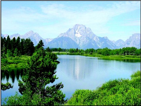
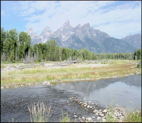
Recreation is generally considered a non-consumptive use of water. There is a significant amount of recreational activity within the Snake/Salt River basin. People travel from around the world in order to boat, fish, ski, camp, and hike in this part of Wyoming. Tourism has a major impact on the economies of the communities in the basin, with much of the tourism being linked to Grand Teton and Yellowstone National Parks. Many of the draws of these parks are water related, with the most notable water features within the basin being Jackson Lake and the Snake River. The Snake River is also a major draw throughout the Jackson Hole area as well as through the Snake River Canyon toward Alpine, sometimes referred to as the Grand Canyon of the Snake River. Thousands visit the river each year for rafting, kayaking, fishing, and other activities. In addition to the Snake River and Jackson Lake, there are numerous rivers, streams, and lakes throughout the basin that are used for recreation. Other activities that utilize or require water in some form include waterfowl hunting and winter sports such as skiing.
ENVIRONMENTAL WATER USE
Water features such as rivers, streams, and lakes are an integral part of the landscape and environment in the Snake/Salt River basin. Among the various uses of water studied as part of the basin plan, this report also looks at the use of water for environmental purposes. Many of these uses are controlled by man to maintain or improve existing conditions, while others, such as wetlands, may occur naturally and are subject to management by various means. Environmental uses and topics covered in the basin plan include maintenance flows, wetlands mapping and projects, Snake River restoration, cutthroat trout management, big game habitat, downstream salmon recovery efforts, instream flow water rights, and water quality.
MAJOR RESERVOIRS
All of the major reservoir facilities in the Snake/Salt River basin are owned and managed by the U.S. Bureau of Reclamation for irrigation and hydropower production in Idaho. Jackson Lake Dam and Grassy Lake Dam are managed as part of the Minidoka Project, which provides irrigation water for over 1 million acres of farmland in Idaho. Palisades Dam, part of the Palisades Project, is also managed in conjunction with the Minidoka Project.
AVAILABLE SURFACE WATER
Surface water availability in the Snake and Salt River basins is a matter of physical supply, availability with respect to others' uses, and basinwide compact limits. In both the Salt and Snake basins, a new appropriation in a tributary basin will be limited by local supply, and without storage, may be severely limited in some months of the year. On the other hand, overall water supply in the basin greatly exceeds current use. On the main stems of both rivers, and in the larger tributaries of the Snake, the compact is more limiting than physical supply relative to existing demand. There are locations and months in which the entire annual compact allowance could be diverted within one month. Thus the supply available to any given proposed use varies greatly across the basin, and could be impacted by concurrent development of the compact allowance elsewhere in the basin. Table 1 summarizes surface water availability.
AVAILABLE GROUND WATER
Ground water is a relatively abundant resource in the Snake/Salt River basin. Subsurface materials are saturated with water from the water table, a relatively short distance below land surface in most areas, to the depth at which there is no significant porosity to contain ground water, e.g. the crystalline basement rocks underlying the entire Snake/Salt River basin and forming the visible core of the highest mountains. The volume of pore space in this material represents the volume of ground water and is likely on the order of 100's of millions of acre-ft. Much of this water is of unusable quality (e.g. due to great depth) or is contained in formations from which ground water cannot be extracted at useful rates (e.g. thick shale units), so the useable ground water resource is vastly smaller than the total ground water in storage.
Considering only the alluvial aquifer (covering approximately 400 mi2) in the Snake/Salt River basin, and assuming an average saturated thickness of 200 feet and an effective porosity of 20%, a volume of 10 million acre-ft of useful ground water in storage is calculated. Were ground water a static, nonrenewable resource, like coal, this volume might approximate the developable resource.
Ground water is a very dynamic resource, particularly ground water of high quality occurring at depths feasible for development. Data suggest an average annual recharge rate of approximately 4 inches = 1 million ac-ft/yr spread across the 4700 mi2 of the Snake/Salt River basin. The base flows of the Salt and Greys Rivers (i.e. the streamflow that is sustained by ground water input through the period of the year without significant precipitation input) suggest average ground water output of 250 and 350 ac-ft/mi2/yr, respectively. (The Snake River basin below Jackson Lake is not considered due to the impact of reservoir modulation on base flows.) Applying a value of 300 ac-ft/mi2/yr to the entire basin suggests a total ground water output of 1.5 million ac-ft/yr, roughly comparable to the recharge-based estimate. Of course, development and consumption of this "available" ground water would leave the streams of the Snake/Salt River basin dry through much of the year.
A more detailed, ground water-model based mass balance for the alluvial aquifer between Jackson Lake and Hoback Junction was developed by San Juan and Kolm (1996). They estimated total recharge of approximately 50,000 acre-ft per year, with 25,000 acre-ft per year of ground water discharge through evapotranspiration and 25,000 acre-ft per year of discharge to streams.
In any case, the inescapable requirements of mass balance mean that additional ground water consumption causes either a decrease in ground water storage (declining ground water level/pressure), a decrease in consumption elsewhere in the hydrologic system, or depletion of surface water. There is little indication of widespread reductions in ground water levels in the study area (although long-term data are sparse).
WATER DEMAND PROJECTIONS
Water demand projections were developed utilizing an economics based approach. Using a planning period of 30 years, the various aspects of water use were projected for high, mid, and low growth scenarios. The high scenario incorporates the most growth in each of the key sectors that could potentially occur over the forecast horizon. The low scenario embodies the lowest growth (or largest contraction) reasonably likely to occur. The mid scenario represents the most realistic level of growth likely to occur. Following discussion of the various projections, Table 2 provides a summary of projected water use.
AGRICULTURAL USE PROJECTIONS
Regarding agricultural water use, the high scenario projects a slight increase mainly due to a slight increase in irrigated lands. The low scenario projects a significant decrease as agricultural lands are converted to residential use. The mid scenario projects a 13 percent decline in irrigated lands and a slight decline in the dairy industry, thus resulting in a slight decrease in agricultural water use.
MUNICIPAL/DOMESTIC USE PROJECTIONS
The job market and economy in the Snake/Salt River basin are mainly driven by tourism. Therefore growth projections regarding municipal and domestic water use are tied to projections in tourism activity. The high scenario projects growth in tourism during summer, winter, and shoulder seasons, which in turn results in an increase in both seasonal and year round residents. As a result, the population roughly triples during the planning period. The low scenario projects virtually no growth due to a prolonged economic downturn, thus resulting in only a small population increase. The mid scenario projects modest growth in tourism, resulting in a projected population of nearly double that of today.

Table I
Summary of Compact Limits to Surface Water Development
(values in acre-feet)
| |||||||||||||||||||||||||||||||||||||||||||||||||||||||||||||||||||||||||||||||||||||||||||||||||||||||||||||||||||||||||||||||||||||||||||||||||||||||||||||||||||||||||||||||
INDUSTRIAL USE PROJECTIONS
Due to the relatively small amount of industry in the basin, projections of future use have very little impact on overall future water use projections. The high scenario assumes a very slight increase in use, while the low scenario utilizes a decrease in industrial activity. The mid scenario assumes that current industrial use levels remain relatively unchanged throughout the planning period.
RECREATIONAL USE PROJECTIONS
Recreational water use in the basin is very significant, although a majority of this use is considered non-consumptive. Water that is consumed for recreational activities is mainly a result of golf course irrigation in the summer and snowmaking in the winter. The high scenario assumes four additional golf courses in the basin as well as an expansion of snowmaking facilities. The low scenario maintains current levels throughout the planning period. The mid scenario considers two new golf courses and modest snowmaking expansion.
ENVIRONMENTAL USE PROJECTIONS
This study restricted the definition of environmental uses to include only those associated with efforts aimed at restoring, maintaining, or improving the environmental services provided by the water resources. This resulted in two main categories consisting of instream flows (through maintenance flows or water rights) and wetland projects. The high scenario assumes that all planned instream flows and wetland projects are completed, resulting in an increase of nearly 400%. The low scenario includes a reduction in maintenance flows, and thus an overall reduction in use. The mid scenario sees an approval of some instream flow rights, as well as half of the proposed wetland projects. This results in an increase of approximately 300%. It must be noted that instream flows represent a significant use of water, and the flow rates assumed for this report could change drastically in the future. As a result, the projected uses presented in the report cover a very broad range. Also, while the water required for environmental uses must be available at the project location, this water can be used for other purposes downstream. This, in essence, makes these uses non-consumptive, and so they are not included with the other projected water uses.
Table 2. Summary of Current and Projected Water Use
| Use | Current Use | 2032 Projected Use (Acre-Feet/Yr) | ||
| Low | Mid | High | ||
| Agricultural | 122,427 | 95,101 | 107,446 | 128,529 |
| Municipal | 6,581 | 7,240 | 11,543 | 18,558 |
| Industrial | 48 | 24 | 48 | 49 |
| Recreational | 945 | 945 | 1335 | 1576 |
| Total | 130,001 | 103,310 | 120,372 | 148,712 |
FUTURE WATER USE OPPORTUNITIES
The long list of future water use opportunities was created with input from the Snake/Salt River Basin Advisory Group. Any and all input was welcome, and a wide variety of issues was discussed while adding items to the list, including past studies. The long list ended up with projects for uses such as irrigation, hydropower, wetlands, water storage, recreation, and others.
Following the creation of the long list the resulting list was reviewed in order to reduce the list to a collection of potential water use projects. Some items on the long list, while they may be worthy of further discussion in other circles, did not warrant further investigation as part of this basin plan. Also, projects that appeared to have a low probability of support or feasibility were dropped.
The short list of future water use opportunities consists of the remaining projects from the long list. The short list projects were then reviewed by the basin planning team and evaluated based on the short list criteria.
A list of criteria used to evaluate the short list was created as part of this basin plan. Similar criteria have been used on all of the previous basin plans, although some changes were made to better fit the situation in the Snake/Salt River basin. For example, political acceptance was looked at in addition to public acceptance, and environmental constraints were reviewed due to the large amount of federal land and the constraints placed on those lands through environmental laws. Also, a criteria regarding multiple use was added.
The following criteria were used to evaluate the short list of future water use opportunities. Each item was scored on a scale of 1 to 10, with 1 being not feasible and 10 being very feasible.
| • Water Availability | • Available Users/Sponsors |
| • Financial Feasibility | • Legal & Environmental Constraints |
| • Public & Political Acceptability | • Multiple Use Feasibility |
Evaluation of each project on the short list using the above described criteria resulted in a final number or score. Also, the Short List was broken into sub-basins, as issues that can effect the evaluation of a project in the Snake River basin will be different than those in the Salt River basin. Legal and institutional constraints, such as federal environmental laws, federal land issues, Wyoming environmental quality laws, Wyoming water law, interstate compacts, and court decrees were also reviewed for their impact on future development in the Snake/Salt River basin.
In the last decade the Snake/Salt River basin has experienced significant population growth. It is reasonable to expect this pattern to continue. This growth combined with the availability of water results in opportunities for the citizens in the basin to more fully utilize these water resources in the future.