|
| DEQ Stream Classification (2002) |
 |
| This dataset contains the Wyoming Department of Environmental Quality Stream Classification Hydrography features. |
|
| Metadata |
Scale: 1:100,000 |
Wyoming Department of Environmental Quality |
| Shapefile |
Compressed: 4,732kb |
GCS North American Datum of 1927 |
Line/Decimal Degrees |
|
| Instream Flow Segment Locations (2002) |
 |
| This dataset contains the 6 stream flow segment locations in the Powder/Tongue River Basin Planning Area. The associated permit data for each segment is also included as feature attributes. |
|
| Metadata |
Scale: 1:100,000 |
Wyoming State Engineer's Office |
| Shapefile |
Compressed: 19kb |
GCS North American Datum of 1927 |
Line/Decimal Degrees |
|
| Climate Stations (2002) |
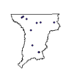 |
| This dataset contains the locations of the climate stations used for the Powder/Tongue River Basin Agricultural Water Use Determination. The dataset also contains other major communities located within the planning area. |
|
| Metadata |
Scale: 1:100,000 |
HKM Engineering Inc. |
| Shapefile |
Compressed: 8kb |
GCS North American Datum of 1927 |
Point/Decimal Degrees |
|
| Future Water Use Opportunity Project Locations (2002) |
 |
| The general locations of potential future water use opportunities are included in this dataset. |
|
| Metadata |
Scale: unknown |
HKM Engineering Inc. |
| Shapefile |
Compressed: 10kb |
GCS North American Datum of 1927 |
Point/Decimal Degrees |
|
| Irrigation Points of Diversion (2002) |
 |
| This dataset contains the locations of all points of diversion for the irrigated lands mapped for the Powder/Tongue River Basin Plan. The point of diversion is also referred to as the service area point with all irrigated lands primarily served by that point defining the physical boundaries of the service area. |
|
| Metadata |
Scale: 1:24,000 |
Wyoming State Engineer's Office |
| Shapefile |
Compressed: 64kb |
GCS North American Datum of 1927 |
Point/Decimal Degrees |
|
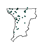
| Major Irrigation Ditch Diversion Headgate Locations (2002) |
 |
| The Major Irrigation Ditch Diversion Headgate Locations dataset contains the latitude-longitude locations for 70 selected ditch headgates within the Powder/Tongue River Basin Planning Area. This dataset contains the locations only for those ditches that were described in the "Powder/Tongue River Basin Plan Irrigation Diversion Operation and Description, Task 2A, Technical Memorandum." |
|
| Metadata |
Scale: 1:24,000 |
Wyoming State Engineer's Office |
| Shapefile |
Compressed: 11kb |
GCS North American Datum of 1927 |
Point/Decimal Degrees |
|
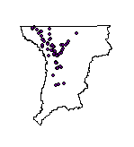
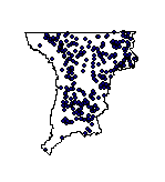
| SEO Agricultural Well Permit Locations (2002) |
 |
| Contains approximately 111 point locations of Wyoming Agricultural Well Permit Locations (yields greater than 49 gpm) on file with the Wyoming State Engineer's Office (SEO). They range in dates from the early 1900s to 2000, but are located only to the nearest 40 acre parcel. All locational information and attributes were imported from the SEO Well Permits Database stored in a MS Access database. |
|
| Metadata |
Scale: unknown |
Wyoming State Engineer's Office |
| Shapefile |
Compressed: 20kb |
GCS North American Datum of 1927 |
Point/Decimal Degrees |
|
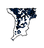
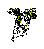
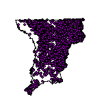
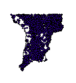
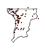
| SEO Coal Bed Methane Well Permit Locations (2002) |
 |
| Contains approximately 9393 point locations of Wyoming Coal Bed Methane (CBM) Well Permit Locations on file with the Wyoming State Engineer's Office (SEO). They range in dates from the early 1900s to 2001, but are located only to the nearest 40 acre parcel. All locational information and attributes were imported from the SEO Well Permits Database stored in a MS Access database. |
|
| Metadata |
Scale: unknown |
Wyoming State Engineer's Office |
| Shapefile |
Compressed: 406kb |
GCS North American Datum of 1927 |
Point/Decimal Degrees |
|
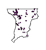
| SEO Domestic Well Permit Locations (2002) |
 |
| Contains approximately 4646 point locations of Wyoming Domestic Well Permit Locations on file with the Wyoming State Engineer's Office (SEO). They range in dates from the early 1900s to 2000, but are located only to the nearest 40 acre parcel. All locational information and attributes were imported from the SEO Well Permits Database stored in a MS Access database. |
|
| Metadata |
Scale: unknown |
Wyoming State Engineer's Office |
| Shapefile |
Compressed: 334kb |
GCS North American Datum of 1927 |
Point/Decimal Degrees |
|
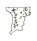
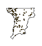
| SEO Industrial Well Permit Locations (2002) |
 |
| Contains approximately 299 point locations of Wyoming Industrial and Miscellaneous Use Well Permit Locations (yields greater than 49 gpm) on file with the Wyoming State Engineer's Office (SEO). They range in dates from the early 1900s to 2000, but are located only to the nearest 40 acre parcel. All locational information and attributes were imported from the SEO Well Permits Database stored in a MS Access database. |
|
| Metadata |
Scale: unknown |
Wyoming State Engineer's Office |
| Shapefile |
Compressed: 33kb |
GCS North American Datum of 1927 |
Point/Decimal Degrees |
|
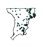
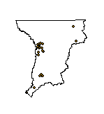
| SEO Municipal Well Permit Locations (2002) |
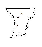 |
| Contains approximately 8 point locations of Wyoming Municipal Well Permit Locations (yields greater than 49 gpm) on file with the Wyoming State Engineer's Office (SEO). They range in dates from the early 1900s to 2000, but are located only to the nearest 40 acre parcel. All locational information and attributes were imported from the SEO Well Permits Database stored in a MS Access database. |
|
| Metadata |
Scale: unknown |
Wyoming State Engineer's Office |
| Shapefile |
Compressed: 10kb |
GCS North American Datum of 1927 |
Point/Decimal Degrees |
|
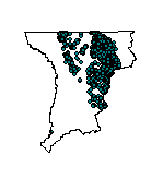
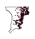
| SEO Stock Well Permit Locations (2002) |
 |
| Contains approximately 4546 point locations of Wyoming Stock Well Permit Locations on file with the Wyoming State Engineer's Office (SEO). They range in dates from the early 1900s to 2000, but are located only to the nearest 40 acre parcel. All locational information and attributes were imported from the SEO Well Permits Database stored in a MS Access database. |
|
| Metadata |
Scale: unknown |
Wyoming State Engineer's Office |
| Shapefile |
Compressed: 343kb |
GCS North American Datum of 1927 |
Point/Decimal Degrees |
|
| Stock Pond Permit Locations (2002) |
 |
| Contains approximately 3407 point locations of Wyoming Stock Pond Permit Locations on file with the Wyoming State Engineer's Office (SEO). They range in dates from the late 1800s to 2000, but are located only to the nearest 40 acre parcel. All locational information and attributes were imported from the SEO Water Right Permits Database stored in a MS Access database. |
|
| Metadata |
Scale: unknown |
Wyoming State Engineer's Office |
| Shapefile |
Compressed: 264kb |
GCS North American Datum of 1927 |
Point/Decimal Degrees |
|
| Streamflow Measurements and Estimate Locations (2002) |
 |
| The USGS and SEO Streamflow Gage Locations dataset with locations where ungaged natural flow estimates were taken contains the latitude-longitude locations for selected gages within the Powder/Tongue River Basin Planning Area. This dataset contains the locations only for those USGS and SEO gages that were used in the Powder/Tongue River Basin Plan to model available flow. The locations where natural flow was estimated for purposes of modeling available flow are also included. |
|
| Metadata |
Scale: 1:24,000 |
Wyoming State Engineer's Office |
| Shapefile |
Compressed: 13kb |
GCS North American Datum of 1927 |
Point/Decimal Degrees |
|
| Total Coalbed Methane (CBM) Produced through January 2002 (2002) |
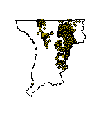 |
| The Total Coalbed Methane (CBM) Produced through January 2002 dataset contains the locations of the producing coalbed methane wells in the Powder/Tongue River Basin Planning Area with the total volume of coalbed methane (in barrels = 42 gallons) produced for the producing lifespan of each well. The data was reported by the well owners to the Wyoming Oil and Gas Conservation Commission (OGCC) each month, who then tabulate the data and post it on the internet. The OGCC locates each well by both Latitude-Longitude and Township-Range-Section-Quarter-Quarter. All locational information and attributes were imported from the OGCC Production Wells Database stored in a MS Excel spreadsheet. |
|
| Metadata |
Scale: unknown |
Wyoming Oil & Gas Conservation Commission |
| Shapefile |
Compressed: 248kb |
GCS North American Datum of 1927 |
Point/Decimal Degrees |
|
| Total Water Injected during 2000 through Conventional Oil & Gas Operations (2002) |
 |
| The Total Water Injected during 2000 through Conventional Oil and Gas Operations dataset contains the locations of the injection wells in the Powder/Tongue River Basin Planning Area with the total volume of water (in barrels = 42 gallons) injected for the year 2000. The data was reported by the well owners to the Wyoming Oil and Gas Conservation Commission (OGCC) each month, who then tabulate the data and post it on the internet. The OGCC locates each well by both Latitude-Longitude and Township-Range-Section-Quarter-Quarter. All locational information and attributes were imported from the OGCC Injection Wells Database stored in a MS Excel spreadsheet. |
|
| Metadata |
Scale: unknown |
Wyoming Oil & Gas Conservation Commission |
| Shapefile |
Compressed: 68kb |
GCS North American Datum of 1927 |
Point/Decimal Degrees |
|
| Total Water Produced during 2000 through Conventional Oil & Gas Operations (2002) |
 |
| The Total Water Produced during 2000 through Conventional Oil and Gas Operations dataset contains the locations of the production wells in the Powder/Tongue River Basin Planning Area with the total volume of water (in barrels = 42 gallons) produced for the year 2000. The data was reported by the well owners to the Wyoming Oil and Gas Conservation Commission (OGCC) each month, who then tabulate the data and post it on the internet. The OGCC locates each well by both Latitude-Longitude and Township-Range-Section-Quarter-Quarter. All locational information and attributes were imported from the OGCC Production Wells Database stored in a MS Excel spreadsheet. |
|
| Metadata |
Scale: unknown |
Wyoming Oil & Gas Conservation Commission |
| Shapefile |
Compressed: 104kb |
GCS North American Datum of 1927 |
Point/Decimal Degrees |
|
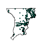
| USGS Ground Water Quality Monitoring Sites (2002) |
 |
| This dataset contains all available United States Geological Survey Ground Water Quality Measurement site locations as of March 14, 2002. The data is intended to be used as a guide to available ground water flow measurement sites, within the entire Powder/Tongue River Basin Planning Area. For site specific data, one can use this dataset to obtain the station number/name so that the actual water quality data necessary for analyses can be obtained from the USGS. A total of 327 water quality monitoring sites are available. 317 sites also monitor well water levels and 10 sites monitor spring water levels. The 327 sites included in this dataset may also be found in the "Powder/Tongue River Basin Plan - United States Geological Survey National Water Inventory System Sites" dataset. |
|
| Metadata |
Scale: 1:24,000 |
U.S. Geological Survey |
| Shapefile |
Compressed: 30kb |
GCS North American Datum of 1927 |
Point/Decimal Degrees |
|
| USGS Spring Sites (2002) |
 |
| This dataset contains all available United States Geological Survey Water Measurement spring site locations as of March 14, 2002. The data is intended to be used as a guide to available spring measurement sites, within the entire Powder/Tongue River Basin Planning Area. For site specific data, one can use this dataset to obtain the station number/name so that the spring water-level data necessary for analyses can be obtained from the USGS. A total of 29 spring sites are available. 19 sites report only water levels and 10 springs report water levels and water quality. The 29 springs may also be found in the "Powder/Tongue River Basin Plan - United States Geological Survey National Water Inventory System Sites" and the "Powder/Tongue River Basin Plan - United States Geological Survey National Water Inventory System Ground Water Quality Monitoring Sites" datasets. |
|
| Metadata |
Scale: 1:24,000 |
U.S. Geological Survey |
| Shapefile |
Compressed: 11kb |
GCS North American Datum of 1927 |
Point/Decimal Degrees |
|
| USGS Streamflow Sites (2002) |
 |
| This dataset contains all available United States Geological Survey Water Measurement streamflow site locations as of March 14, 2002. The data is intended to be used as a guide to available surface water flow measurement sites, within the entire Powder/Tongue River Basin Planning Area. For site specific data, one can use this dataset to obtain the station number/name so that the actual streamflow data necessary for analyses can be obtained from the USGS. A total of 121 streamflow measurement sites of all types are available. Daily streamflow is measured at 97 sites. Peak streamflow is measured at 102 sites (78 sites also measure daily flows). The 9 sites reporting real-time streamflows measurements (or recent daily measurements) also measure (and report) daily flows and peak flows. 40 sites also monitor stream water quality (5 real-time stations, 2 peak flow stations, 2 daily flow stations, and 31 stations reporting both daily and peak flows). One well site reports daily flows. 6 station report only daily streamflows, 38 report both daily and peak flows (but not water quality), 4 report real-time stations do not report water quality, and 22 stations report only peak streamflows. The 60 stations only reporting stream water quality (but not streamflow) and the 9 sites reporting lake/reservoir water quality are NOT included in this dataset but may be found in the "Powder/Tongue River Basin Plan - United States Geological Survey National Water Inventory System Sites" and the "Powder/Tongue River Basin Plan - United States Geological Survey National Water Inventory System Surface Water Quality Monitoring Sites" datasets. |
|
| Metadata |
Scale: 1:24,000 |
U.S. Geological Survey |
| Shapefile |
Compressed: 19kb |
GCS North American Datum of 1927 |
Point/Decimal Degrees |
|
| USGS Surface Water Monitoring Sites (2002) |
 |
| This dataset contains all available United States Geological Survey Surface Water Quality Measurement site locations as of March 14, 2002. The data is intended to be used as a guide to available surface water quality measurement sites, within the entire Powder/Tongue River Basin Planning Area. For site specific data, one can use this dataset to obtain the station number/name so that the actual water quality data necessary for analyses can be obtained from the USGS. A total of 109 surface water quality monitoring sites are available. 60 sites measure stream water quality and 9 measure lake/reservoir water quality. 5 sites reports real-time, daily, and peak streamflows in addition to water quality. 31 sites report daily and peak flows along with water quality. 2 report peak flows and 2 report daily flows in addition to water quality. The 109 sites included in this dataset may also be found in the "Powder/Tongue River Basin Plan - United States Geological Survey National Water Inventory System Sites" dataset. |
|
| Metadata |
Scale: 1:24,000 |
U.S. Geological Survey |
| Shapefile |
Compressed: 18kb |
GCS North American Datum of 1927 |
Point/Decimal Degrees |
|
| USGS Water Measurement Locations (2002) |
 |
| The USGS and SEO Streamflow Gage Locations dataset with locations where ungaged natural flow estimates were taken contains the latitude-longitude locations for selected gages within the Powder/Tongue River Basin Planning Area. This dataset contains the locations only for those USGS and SEO gages that were used in the Powder/Tongue River Basin Plan to model available flow. The locations where natural flow was estimated for purposes of modeling available flow are also included. |
|
| Metadata |
Scale: 1:24,000 |
U.S. Geological Survey |
| Shapefile |
Compressed: 128kb |
GCS North American Datum of 1927 |
Point/Decimal Degrees |
|
| USGS Well Sites (2002) |
 |
| This dataset contains all available United States Geological Survey Water Measurement well site locations as of March 14, 2002. The data is intended to be used as a guide to available well measurement sites, within the entire Powder/Tongue River Basin Planning Area. For site specific data, one can use this dataset to obtain the station number/name so that the well water-level data necessary for analyses can be obtained from the USGS. A total of 2150 well sites of all types (Collector/Ranney & Non-collector) are available. 1832 sites report only water levels, one well reports both water levels and daily streamflow, and 317 wells report water levels and water quality. The 2150 wells may also be found in the "Powder/Tongue River Basin Plan - United States Geological Survey National Water Inventory System Sites" and the "Powder/Tongue River Basin Plan - United States Geological Survey National Water Inventory System Ground Water Quality Monitoring Sites" datasets. |
|
| Metadata |
Scale: 1:24,000 |
U.S. Geological Survey |
| Shapefile |
Compressed: 118kb |
GCS North American Datum of 1927 |
Point/Decimal Degrees |
|
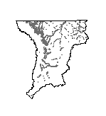
| Aquifer Sensitivity (2002) |
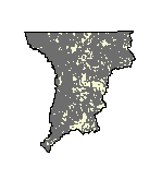 |
| This data contains relative surficial aquifer sensitivity to contaminants applied on or near the land surface for the Powder/Tongue River Basin Planning Area at 1:100,000-scale. |
|
| Metadata |
Scale: 1:100,000 |
Wyoming Geographic Science Center |
| Shapefile |
Compressed: 1,264kb |
GCS North American Datum of 1927 |
Polygon/Decimal Degrees |
|
| Average Annual and Monthly Precipitation from 1961-1990 (2002) |
 |
| This dataset contains the polygon coverage/shapefile of average annual precipitation for the climatological period 1961-1990. Parameter-elevation Regressions on Independent Slopes Model (PRISM) derived raster data is the underlying dataset from which the polygons were created. PRISM is an analytical model that uses point data and a digital elevation model (DEM) to generate gridded estimates of annual, monthly, and event-based climatic parameters. Detailed descriptions of the PRISM raster data can be found on the online PRISM homepage at http://www.ocs.orst.edu/prism/prism_new.html. |
|
| Metadata |
Scale: unknown |
PRISM Group |
| Shapefile |
Compressed: 938kb |
GCS North American Datum of 1927 |
Polygon/Decimal Degrees |
|
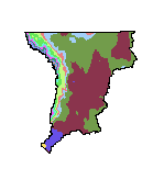
| Bedrock Geology (2002) |
 |
| This dataset represents bedrock geology for the Powder/Tongue River Basin Planning Area at 1:500,000-scale. The geologic map was digitized from original scribe sheets used to prepare the published Geologic Map of Wyoming (Love and Christiansen, 1985), consequently at a 1:500,000-scale. |
|
| Metadata |
Scale: 1:500,000 |
Wyoming State Geological Survey |
| Shapefile |
Compressed: 813kb |
GCS North American Datum of 1927 |
Polygon/Decimal Degrees |
|
| Climatic Area Boundaries (2002) |
 |
| This dataset contains 1:250,000-scale climatic area boundaries for the Powder/Tongue River Basin Planning Area. These boundaries are primarily based on the 1:250,000-scale hydrologic unit code level 4 boundaries developed by the USGS. Some of the HUCs are unchanged, others have been merged, and still others have been subdivided. Where two climate stations are assigned to one feature, the stations are weighted 50-50 when determining irrigation demands (consumptive irrigation requirements, consumptive use, irrigation diversion amount, etc). |
|
| Metadata |
Scale: 1:250,000 |
U.S. Geological Survey |
| Shapefile |
Compressed: 84kb |
GCS North American Datum of 1927 |
Polygon/Decimal Degrees |
|
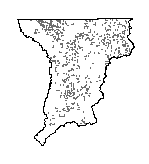
| Ground Water Vulnerability (2002) |
 |
| This data contains relative surficial aquifer vulnerability to agricultural pesticides for the Powder/Tongue River Basin Planning Area at 1:100,000-scale. |
|
| Metadata |
Scale: 1:100,000 |
Wyoming Geographic Science Center |
| Shapefile |
Compressed: 20,818kb |
GCS North American Datum of 1927 |
Polygon/Decimal Degrees |
|
| Hydrologic Unit Code Level 4 Boundaries (2002) |
 |
| This dataset contains 1:250,000-scale hydrologic unit code level 4 boundaries for those cataloging units comprising the Powder/Tongue River Basin Planning Area - this dataset is clipped to the planning area. The Geographic Information Retrieval and Analysis System (GIRAS) was developed in the mid-70s to put into digital form a number of data layers which were of interest to the USGS. One of these data layers was the Hydrologic Units. The map is based on the Hydrologic Unit Maps published by the USGS Office of Water Data Coordination, together with the list descriptions and name of region, subregion, accounting units, and cataloging units. The hydrologic units are encoded with an eight-digit number that indicates the hydrologic region (first two digits), hydrologic subregion (second two digits), accounting unit (third two digits), and cataloging unit (fourth two digits). The data produced by GIRAS was originally collected at a scale of 1:250,000. Some areas, notably major cities in the west, were recompiled at a scale of 1:100,000. In order to join the data together and use the data in a geographic information system (GIS) that data were processed in the ARC/INFO GIS software package. Within the GIS, the data were edgematched and the neatline boundaries between maps were removed to create a single data sest for the conterminous United States. |
|
| Metadata |
Scale: 1:250,000 |
U.S. Geological Survey |
| Shapefile |
Compressed: 73kb |
GCS North American Datum of 1927 |
Polygon/Decimal Degrees |
|
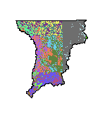
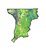
| Irrigated Lands (2002) |
 |
| This dataset contains the irrigated lands mapped for the Powder/Tongue River Basin Plan. All man induced irrigation or subirrigation was delineated. Natural subirrigated fields were not delineated unless some benefit was being received from a man made system. Irrigated lands were divided into the following categories based on visual interpretations of the quality of the irrigation, types of crops supported, and the type and condition of the irrigation delivery systems and on-farm systems used to serve these lands: A - Full service irrigation (typically receives a full water supply); B - Partial service irrigation (typically receives a reduced water supply due to limited water availability or the inability to provide complete field coverage); C - Man induced subirrigation (beneficial use resulting from incidental irrigation such as ditch seepage to areas below a canal); E - Idle irrigation (lands not currently receiving water, typically due to nonfunctional delivery facilities); S - Spreader dike irrigation (dikes constructed across ephemeral streams to spread infrequent flows over the land to increase beneficial use); H - Minor beneficial use (lands that receive some beneficial use on occasion such as lands served by "kick-out" ditches on ephemeral streams); AD, BD, and ED - A, B, or E lands that have undergone or are currently undergoing residential development. |
|
| Metadata |
Scale: 1:24,000 |
HKM Engineering Inc. |
| Shapefile |
Compressed: 3,642kb |
GCS North American Datum of 1927 |
Polygon/Decimal Degrees |
|
| Lakes (2002) |
 |
| These datasets consist of the 1:24,000-scale baselayers obtained by digitizing USGS 7.5-Minute Quadrangles for selected portions of the Powder/Tongue River Basin Planning Area. All text, hydrography, transportation, vegetation, public land survey, and man-made features are contained in one of the datasets provided. |
|
| Metadata |
Scale: 1:24,000 |
HKM Engineering Inc. |
| Shapefile |
Compressed: 3,572kb |
GCS North American Datum of 1927 |
Polygon/Decimal Degrees |
|
| Major Hydrologic Basin Boundaries (2002) |
 |
| This dataset contains 1:250,000-scale major hydrologic basin boundaries for the Powder/Tongue River Basin Planning Area. The Geographic Information Retrieval and Analysis System (GIRAS) was developed in the mid-70s to put into digital form a number of data layers which were of interest to the USGS. One of these data layers was the Hydrologic Units. The map is based on the Hydrologic Unit Maps published by the USGS Office of Water Data Coordination, together with the list descriptions and name of region, subregion, accounting units, and cataloging units. The hydrologic units are encoded with an eight-digit number that indicates the hydrologic region (first two digits), hydrologic subregion (second two digits), accounting unit (third two digits), and cataloging unit (fourth two digits). The data produced by GIRAS was originally collected at a scale of 1:250,000. Some areas, notably major cities in the west, were recompiled at a scale of 1:100,000. In order to join the data together and use the data in a geographic information system (GIS) that data were processed in the ARC/INFO GIS software package. Within the GIS, the data were edgematched and the neatline boundaries between maps were removed to create a single data sest for the conterminous United States. |
|
| Metadata |
Scale: 1:250,000 |
U.S. Geological Survey |
| Shapefile |
Compressed: 53kb |
GCS North American Datum of 1927 |
Polygon/Decimal Degrees |
|
| Major Reservoirs (2002) |
 |
| This dataset contains the 14 major reservoirs in the Powder/Tongue River Basin Planning Area. All surface water storage in structures containing more than 50 acre-feet of storage or more than 20 feet high (meeting the minimum standards for inclusion in the Dam Safety database) were initially selected. These selection criteria produced a set of 189 surface water storage facilities. The State Engineer's Office Water Division Two commissioners agreed that a further set of criteria should be introduced to provide a list from which the dams of particular significance to the basin could be developed. Commissioners agreed that in almost all cases, a limit of 1,000 acre-feet capacity and "serving multiple users" produced a list of reservoirs significant to the basins. The only recommended exception was Cross Creek Reservoir, which has a normal capacity of 798 acre-feet. This inclusion brought the secondary selection list to 14. This dataset shows the locations of the 14 significant reservoirs and, with the complementary Major Reservoirs Water Rights dataset (a dbase table), contains the pertinent water rights and storage information for each reservoir. |
|
| Metadata |
Scale: 1:24,000 |
HKM Engineering Inc. |
| Shapefile |
Compressed: 6kb |
GCS North American Datum of 1927 |
Polygon/Decimal Degrees |
|
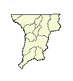
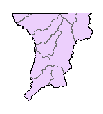
| Planning Area Boundary (2002) |
 |
| This dataset contains 1:250,000-scale planning area boundary for the Powder/Tongue River Basin Planning Area. |
|
| Metadata |
Scale: 1:250,000 |
U.S. Geological Survey |
| Shapefile |
Compressed: 30kb |
GCS North American Datum of 1927 |
Polygon/Decimal Degrees |
|
| Surficial Geology (2002) |
 |
| This dataset represents surficial geology for the Powder/Tongue River Basin Planning Area at 1:500,000-scale. The layer contains surficial feature (landforms) and deposit descriptions present on the surface in the planning area. |
|
| Metadata |
Scale: 1:500,000 |
Wyoming State Geological Survey |
| Shapefile |
Compressed: 4,811kb |
GCS North American Datum of 1927 |
Polygon/Decimal Degrees |
|
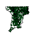
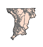
| Hydrography (2002) |
 |
| This dataset contains 1:100,000-scale linear hydrography features for the Powder/Tongue River Basin Planning Area. Attribute fields describe perennial and intermittent designations and Strahler stream order. This dataset does not contain man-made ditches, canals and aqueducts. The data was originally produced by the USGS, a digital line graph (DLG) product, and was enhanced (edgematched, some linework and attributes corrected, stream order added) for the Wyoming Gap Analysis. |
|
| Metadata |
Scale: 1:100,000 |
Wyoming Geographic Science Center |
| Shapefile |
Compressed: 4,891kb |
GCS North American Datum of 1927 |
Polyline/Decimal Degrees |
|
| National Wetlands Inventory (NWI) (2002) |
 |
| National Wetlands Inventory (NWI) digital data files are records of wetlands location and classification as defined by the U.S. Fish & Wildlife Service. This dataset is a composite of all available NWI 1:24,000-scale dataset within the Powder/Tongue River Basin Planning Area. The dataset contains ground planimetric coordinates of wetlands linear features and wetland attributes with a field for use in displaying general wetland characteristics (example: all "aquatic bed wetland" features are assigned a display code of 'AB'). |
|
| Metadata |
Scale: 1:24,000 |
U.S. Fish and Wildlife |
| Shapefile |
Compressed: 38,054kb |
GCS North American Datum of 1927 |
Polyline/Decimal Degrees |
|
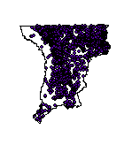
| Streams (2002) |
 |
| These datasets consist of the 1:24,000-scale baselayers obtained by digitizing USGS 7.5-Minute Quadrangles for selected portions of the Powder/Tongue River Basin Planning Area. All text, hydrography, transportation, vegetation, public land survey, and man-made features are contained in one of the datasets provided. |
|
| Metadata |
Scale: 1:24,000 |
HKM Engineering Inc. |
| Shapefile |
Compressed: 15,548kb |
GCS North American Datum of 1927 |
Polyline/Decimal Degrees |
