|
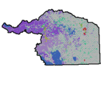
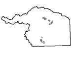
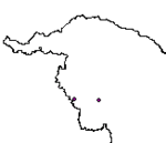
| Aquatic Habitat Enhancement Priority Areas (2016) |
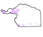 |
| This dataset contains aquatic habitat enhancement priority areas within Wyoming's Platte River Basin. |
|
| Metadata |
Scale: 1:24,000 |
Wyoming Geographic Science Center |
| Shapefile |
Compressed: 636kb |
NAD 1983 State Plane Wyoming East FIPS 4901 |
Polygon/Feet |
|
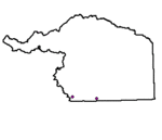
| Platte River Basin County Boundaries (2003) |
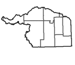 |
| This dataset contains information on the county boundaries and names for Wyoming mapped at a 1:100,000 scale. |
|
| Metadata |
Scale: 1:100,000 |
Wyoming Geographic Science Center |
| Shapefile |
Compressed: 48kb |
GCS North American Datum of 1927 |
Polygon/Decimal Degrees |
|
| Crucial Stream Corridors (2016) |
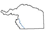 |
| This dataset contains crucial stream corridors within the Above Pathfinder Subbasin within Wyoming's Platte River Basin. |
|
| Metadata |
Scale: 1:24,000 |
Wyoming Geographic Science Center |
| Shapefile |
Compressed: 400kb |
NAD 1983 State Plane Wyoming East FIPS 4901 |
Polyline/Feet |
|
| Instream Flow Segments (2016) |
 |
| This dataset contains instream flow segements within Wyoming's Platte River Basin. |
|
| Metadata |
Scale: 1:24,000 |
Wyoming Geographic Science Center |
| Shapefile |
Compressed: 22kb |
NAD 1983 State Plane Wyoming East FIPS 4901 |
Polyline/Feet |
|
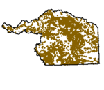
| Land Ownership (2016) |
 |
| This dataset contains land ownership boundaries within Wyoming's Platte River Basin. |
|
| Metadata |
Scale: 1:24,000 |
Wyoming Geographic Science Center |
| Shapefile |
Compressed: 8,547kb |
NAD 1983 State Plane Wyoming East FIPS 4901 |
Polygon/Feet |
|
| Major Lakes (2016) |
 |
| U.S. Water Bodies represents the major lakes, reservoirs, large rivers, lagoons and estuaries in the United States. |
|
| Metadata |
Scale: unknown |
ESRI |
| Shapefile |
Compressed: 389kb |
NAD 1983 UTM Zone 13N |
Polygon/Meters |
|
| Platte Basin Irrigation Districts (2014) |
 |
| This dataset represents the exterior boundaries of Wyoming Irrigation districts based on headquarter State Engineer data. |
|
| Metadata |
Scale: 1:250,000 |
Wyoming State Engineers Office |
| Shapefile |
Compressed: 108,161kb |
GCS North American Datum of 1983 |
Polygon/Decimal Degrees |
|
| Platte Wetlands (2016) |
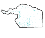 |
| This dataset contains wetlands within Wyoming's Platte River Basin. |
|
| Metadata |
Scale: 1:24,000 |
Wyoming Geographic Science Center |
| Shapefile |
Compressed: 19kb |
NAD 1983 State Plane Wyoming East FIPS 4901 |
Polygon/Feet |
|
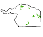
| Roadless Areas (2016) |
 |
| This dataset contains roadless areas within Wyoming's Platte River Basin. |
|
| Metadata |
Scale: 1:24,000 |
Wyoming Geographic Science Center |
| Shapefile |
Compressed: 147kb |
NAD 1983 State Plane Wyoming East FIPS 4901 |
Polygon/Feet |
|
| Streams (2016) |
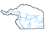 |
| This dataset contains streams within Wyoming's Platte River Basin. |
|
| Metadata |
Scale: 1:24,000 |
Wyoming Geographic Science Center |
| Shapefile |
Compressed: 727kb |
NAD 1983 State Plane Wyoming East FIPS 4901 |
Polyline/Feet |
|
| Surface Water Diversions (2016) |
 |
| This dataset contains surface water diversions within Wyoming's Platte River Basin. |
|
| Metadata |
Scale: 1:24,000 |
Wyoming Geographic Science Center |
| Shapefile |
Compressed: 2,062kb |
NAD 1983 State Plane Wyoming East FIPS 4901 |
Point/Feet |
|
| Trout Stream Classification (2016) |
 |
| This dataset contains trout stream classifications within Wyoming's Platte River Basin. |
|
| Metadata |
Scale: 1:24,000 |
Wyoming Geographic Science Center |
| Shapefile |
Compressed: 8,680kb |
NAD 1983 State Plane Wyoming East FIPS 4901 |
Polyline/Feet |
|
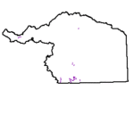
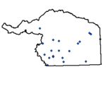
| Trout Unlimited Projects (2016) |
 |
| This dataset contains Trout Unlimited projects within Wyoming's Platte River Basin. |
|
| Metadata |
Scale: 1:24,000 |
Wyoming Geographic Science Center |
| Shapefile |
Compressed: 5kb |
NAD 1983 State Plane Wyoming East FIPS 4901 |
Point/Feet |
|
| USGS Stream Gages (2016) |
 |
| This dataset contains United States Geologic Survey stream gage locations within Wyoming's Platte River Basin. |
|
| Metadata |
Scale: 1:24,000 |
Wyoming Geographic Science Center |
| Shapefile |
Compressed: 20kb |
NAD 1983 State Plane Wyoming East FIPS 4901 |
Point/Feet |
|
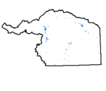
| White Water (2016) |
 |
| This dataset contains named whitewater recreation reaches within Wyoming's Platte River Basin. |
|
| Metadata |
Scale: 1:24,000 |
Wyoming Geographic Science Center |
| Shapefile |
Compressed: 21kb |
NAD 1983 State Plane Wyoming East FIPS 4901 |
Polyline/Feet |
