|
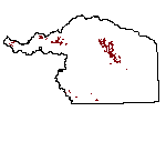
| Weather Stations (2006) |
 |
| This data set contains a subset of the 171 wether stations scattered throughout the state of Wyoming. |
|
| Metadata |
Scale: unknown |
Wyoming Geographic Science Center |
| Shapefile |
Compressed: 183kb |
GCS North American Datum of 1983 |
Point/Decimal Degrees |
|
| Wells (2006) |
 |
| Contains approximately 38,447 point locations of Wyoming well permit locations on file with the Wyoming State Engineer's Office. The wells have been located to the to the nearest 40 acre parcel. All locational information and attributes were imported from the Wyoming State Engineer's Office Well Permits Database stored in SQL-Server. |
|
| Metadata |
Scale: unknown |
Wyoming State Engineer's Office |
| Shapefile |
Compressed: 2210kb |
GCS North American Datum of 1994 |
Point/Decimal Degrees |
|
| Wells - 50 gpm (2006) |
 |
| Contains approximately 38,447 point locations of Wyoming well permit locations on file with the Wyoming State Engineer's Office. The wells have been located to the to the nearest 40 acre parcel. All locational information and attributes were imported from the Wyoming State Engineer's Office Well Permits Database stored in SQL-Server |
|
| Metadata |
Scale: unknown |
Wyoming State Engineer's Office |
| Shapefile |
Compressed: 168kb |
GCS North American Datum of 1996 |
Point/Decimal Degrees |
|
| Wells - CBM (2006) |
 |
| Contains approximately 38,447 point locations of Wyoming well permit locations on file with the Wyoming State Engineer's Office. The wells have been located to the to the nearest 40 acre parcel. All locational information and attributes were imported from the Wyoming State Engineer's Office Well Permits Database stored in SQL-Server |
|
| Metadata |
Scale: unknown |
Wyoming State Engineer's Office |
| Shapefile |
Compressed: 7kb |
GCS North American Datum of 2000 |
Point/Decimal Degrees |
|
| Wells - Domestic (2006) |
 |
| Contains approximately 38,447 point locations of Wyoming well permit locations on file with the Wyoming State Engineer's Office. The wells have been located to the to the nearest 40 acre parcel. All locational information and attributes were imported from the Wyoming State Engineer's Office Well Permits Database stored in SQL-Server |
|
| Metadata |
Scale: unknown |
Wyoming State Engineer's Office |
| Shapefile |
Compressed: 7kb |
GCS North American Datum of 1995 |
Point/Decimal Degrees |
|
| Wells - Industrial (2006) |
 |
| Contains approximately 38,447 point locations of Wyoming well permit locations on file with the Wyoming State Engineer's Office. The wells have been located to the to the nearest 40 acre parcel. All locational information and attributes were imported from the Wyoming State Engineer's Office Well Permits Database stored in SQL-Server |
|
| Metadata |
Scale: unknown |
Wyoming State Engineer's Office |
| Shapefile |
Compressed: 22kb |
GCS North American Datum of 1997 |
Point/Decimal Degrees |
|
| Wells - Irrigation (2006) |
 |
| Contains approximately 38,447 point locations of Wyoming well permit locations on file with the Wyoming State Engineer's Office. The wells have been located to the to the nearest 40 acre parcel. All locational information and attributes were imported from the Wyoming State Engineer's Office Well Permits Database stored in SQL-Server |
|
| Metadata |
Scale: unknown |
Wyoming State Engineer's Office |
| Shapefile |
Compressed: 124kb |
GCS North American Datum of 1998 |
Point/Decimal Degrees |
|
| Wells - Municipal (2006) |
 |
| Contains approximately 38,447 point locations of Wyoming well permit locations on file with the Wyoming State Engineer's Office. The wells have been located to the to the nearest 40 acre parcel. All locational information and attributes were imported from the Wyoming State Engineer's Office Well Permits Database stored in SQL-Server |
|
| Metadata |
Scale: unknown |
Wyoming State Engineer's Office |
| Shapefile |
Compressed: 18kb |
GCS North American Datum of 1999 |
Point/Decimal Degrees |
|
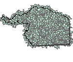
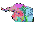
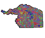
| Bedrock Geology (2006) |
 |
| The geologic map was digitized from original scribe sheets used to prepare the published Geologic Map of Wyoming (Love and Christiansen, 1985), consequently at a 1:500,000 scale. Stable base contact prints of the scribe sheets were scannned on a Tektronix 4991 digital scanner. The scanner automatically converts the scanned image to an ASCII vector format. These vectors were transferred to a VAX minicomputer, where they were loaded into Arc/Info. The dataset includes both linear and polygon features, with attributes derived from the original 1985 map. |
|
| Metadata |
Scale: 1:500,000 |
U.S. Geological Survey |
| Shapefile |
Compressed: 2,979kb |
GCS North American Datum of 1983 |
Polygon/Decimal Degrees |
|
| Deco Polygons (2006) |
 |
| This layer contains cartographic information supplemental to the Bedrock Geology of Wyoming digital layer. Please refer to metadata for the full bedrock geology layer as it also applies to this supplemental information. |
|
| Metadata |
Scale: 1:500,000 |
U.S. Geological Survey |
| Shapefile |
Compressed: 66kb |
GCS North American Datum of 1983 |
Polygon/Decimal Degrees |
|
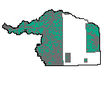
| Groundwater Control Areas (2006) |
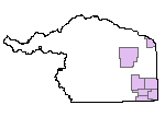 |
| Groundwater Control Areas for Wyoming. Data is of unknown source and unknown accuracy. |
|
| Metadata |
Scale: unknown |
Wyoming State Engineer's Office |
| Shapefile |
Compressed: 20kb |
GCS North American Datum of 1993 |
Polygon/Decimal Degrees |
|
| Hydrologic Unit Code Level 4 Boundaries (2006) |
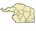 |
| The Geographic Information Retrieval and Analysis System (GIRAS) was developed in the mid 70s to put into digital form a number of data layers which were of interest to the USGS. One of these data layers was the Hydrologic Units. The map is based on the Hydrologic Unit Maps published by the U.S. Geological Survey Office of Water Data Coordination, together with the list descriptions and name of region, subregion, accounting units, and cataloging unit. The hydrologic units are encoded with an eight- digit number that indicates the hydrologic region (first two digits), hydrologic subregion (second two digits), accounting unit (third two digits), and cataloging unit (fourth two digits). The data produced by GIRAS was originally collected at a scale of 1:250,000. This data set is a modification for Wyoming of the original United States HUC data produced by the USGS. The primary modifications made in this data set by the Wyoming Water Resources Center include 1) removal of hydrologic units that do not drain witi Wyoming and 2) modification of the hydrologic unit boundaries to better encompass streams and lakes represented in the 1:100,000 scale Digital Line Graph (DLG) of surficial hydrography. The HUC boundaries have not been "clipped" to the Wyoming border, in order to maintain the natural boundaries of the units. This metadata has also been altered from original USGS metadata to be more specific for Wyoming. |
|
| Metadata |
Scale: unknown |
U.S. Geological Survey |
| Shapefile |
Compressed: 87kb |
GCS North American Datum of 1985 |
Polygon/Decimal Degrees |
|
| Hydrologic Unit Code Level 6 (2006) |
 |
| The Geographic Information Retrieval and Analysis System (GIRAS) was developed in the mid 70s to put into digital form a number of data layers which were of interest to the USGS. One of these data layers was the Hydrologic Units. The map is based on the Hydrologic Unit Maps published by the U.S. Geological Survey Office of Water Data Coordination, together with the list descriptions and name of region, subregion, accounting units, and cataloging unit. The hydrologic units are encoded with an eight- digit number that indicates the hydrologic region (first two digits), hydrologic subregion (second two digits), accounting unit (third two digits), and cataloging unit (fourth two digits). The data produced by GIRAS was originally collected at a scale of 1:250,000. This data set is a modification for Wyoming of the original United States HUC data produced by the USGS. The primary modifications made in this data set by the Wyoming Water Resources Center include 1) removal of hydrologic units that do not drain witi Wyoming and 2) modification of the hydrologic unit boundaries to better encompass streams and lakes represented in the 1:100,000 scale Digital Line Graph (DLG) of surficial hydrography. The HUC boundaries have not been "clipped" to the Wyoming border, in order to maintain the natural boundaries of the units. This metadata has also been altered from original USGS metadata to be more specific for Wyoming. |
|
| Metadata |
Scale: unknown |
U.S. Geological Survey |
| Shapefile |
Compressed: 8102kb |
GCS North American Datum of 1984 |
Polygon/Decimal Degrees |
|
| Lakes (2006) |
 |
| This dataset has both line (stream network) and polygon (lakes/reservoirs) topology. The dataset is served from the SDVC clearinghouse both in an entire statewide dataset and also tiled by 1:100,000 quadrangles, in Arc Export (e00) format and ArcView shapefile format. Statewide and tiled data: there is one export file, which when imported into ARC/INFO, will contain one coverage with both polygon (lakes, reservoirs) and line (streams) topology and two feature attribute files (.PAT and .AAT) along with three additional attribute files containing descriptive information. In shapefile format, there will be two shapefiles (polygons and lines separated), with all attribute files in Dbase format. |
|
| Metadata |
Scale: unknown |
U.S. Geological Survey |
| Shapefile |
Compressed: 1090kb |
GCS North American Datum of 1988 |
Polygon/Decimal Degrees |
|
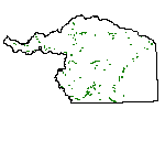
| National Wetlands Inventory (NWI) (2006) |
 |
| Wyoming Geographic Information Science Center - Original digital National Wetland Inventory quadrangles converted into Arc/Info coverages with matching attributes. |
|
| Metadata |
Scale: unknown |
U.S. Fish and Wildlife |
| Shapefile |
Compressed: 49344kb |
GCS North American Datum of 1992 |
Polygon/Decimal Degrees |
|
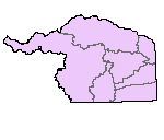
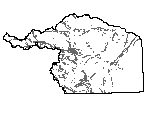
| Planning Area Boundary (2006) |
 |
|
| Metadata |
Scale: unknown |
U.S. Geological Survey |
| Shapefile |
Compressed: 28kb |
GCS North American Datum of 1985 |
Polygon/Decimal Degrees |
|
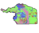
| Soils (2006) |
 |
| This dataset represents soils of Wyoming at 1:500,000-scale. The layer contains 45 separate soils descriptions across 10 Wyoming soil zones. The layer was compiled based on the five-factor soil forming model using digital surficial geology, bedrock geology, and elevation. This dataset is documented in the report: Munn, L.C. and C.S. Arneson, 1998. Soils of Wyoming: A Digital Statewide Map at 1:500,000-Scale. Agricultural Experiment Station Report B-1069. University of Wyoming, College of Agriculture, Laramie, Wyoming. |
|
| Metadata |
Scale: 1:500,000 |
Wyoming Geographic Science Center |
| Shapefile |
Compressed: 3,604kb |
GCS North American Datum of 1983 |
Polygon/Decimal Degrees |
|
| Subbasins (2006) |
 |
| This dataset contains Subbasins within Wyoming's Platte River Basin. |
|
| Metadata |
Scale: unknown |
Wyoming Gap Analysis |
| Shapefile |
Compressed: 686kb |
GCS North American Datum of 1986 |
Polygon/Decimal Degrees |
|
| Surficial Geology (2006) |
 |
| This dataset represents surficial geology of Wyoming at 1:500,000-scale. The layer contains 577 separate surficial feature (landforms) and deposit descriptions present on the surface in the state. Compiled from aerial photography and existing maps this layer represents the first comprehensive surficial geology map of Wyoming. |
|
| Metadata |
Scale: 1:500,000 |
Wyoming State Geological Survey |
| Shapefile |
Compressed: 11,673kb |
GCS North American Datum of 1983 |
Polygon/Decimal Degrees |
|
| Deco Lines (2006) |
 |
| This layer contains cartographic information supplemental to the Bedrock Geology of Wyoming digital layer. Please refer to metadata for the full bedrock geology layer as it also applies to this supplemental information. |
|
| Metadata |
Scale: 1:500,000 |
U.S. Geological Survey |
| Shapefile |
Compressed: 80kb |
GCS North American Datum of 1983 |
Polyline/Decimal Degrees |
|
| Dikes (2006) |
 |
| This layer contains cartographic information supplemental to the Bedrock Geology of Wyoming digital layer. Please refer to metadata for the full bedrock geology layer as it also applies to this supplemental information. |
|
| Metadata |
Scale: 1:500,000 |
U.S. Geological Survey |
| Shapefile |
Compressed: 21kb |
GCS North American Datum of 1983 |
Polyline/Decimal Degrees |
|
| Faults (2006) |
 |
| This layer contains cartographic information supplemental to the Bedrock Geology of Wyoming digital layer. Please refer to metadata for the full bedrock geology layer as it also applies to this supplemental information. |
|
| Metadata |
Scale: 1:500,000 |
U.S. Geological Survey |
| Shapefile |
Compressed: 172kb |
GCS North American Datum of 1983 |
Polyline/Decimal Degrees |
|
| Hyrography 100k (2006) |
 |
| This dataset has both line (stream network) and polygon (lakes/reservoirs) topology. The dataset is served from the SDVC clearinghouse both in an entire statewide dataset and also tiled by 1:100,000 quadrangles, in Arc Export (e00) format and ArcView shapefile format. Statewide and tiled data: there is one export file, which when imported into ARC/INFO, will contain one coverage with both polygon (lakes, reservoirs) and line (streams) topology and two feature attribute files (.PAT and .AAT) along with three additional attribute files containing descriptive information. In shapefile format, there will be two shapefiles (polygons and lines separated), with all attribute files in Dbase format. |
|
| Metadata |
Scale: unknown |
Wyoming Gap Analysis |
| Shapefile |
Compressed: 7618kb |
GCS North American Datum of 1987 |
Polyline/Decimal Degrees |
