| |
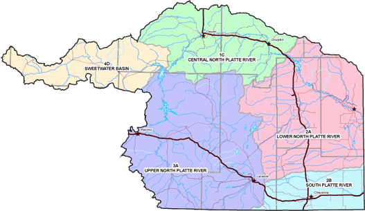
Wyoming ’s Platte River Basin lies within the federally-designated Central Flyway and is the area within which most Wyoming waterfowl hunting occurs. Based on a cooperative agreement between the State of Wyoming and the U.S. Fish and Wildlife Service, waterfowl harvest objectives and seasons in Wyoming are established on an annual basis. Annual waterfowl harvest objectives reflect seasonal changes in precipitation and the quantity of surface water available to support waterfowl. The Wyoming Game and Fish Department has divided the Platte River Basin into five waterfowl management areas, 1C, 2A, 2B, 3A, and 4D, which can be seen on the map below. The Above Pathfinder subbasin includes waterfowl management areas 3A, Sweetwater Basin, and 4D, Upper North Platte River. Click here to enlarge a map of Platte River Basin waterfowl management areas and print the map.

|
|
![]()