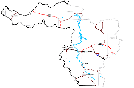
Municipalities within the Above Pathfinder subbasin include Rawlins, Saratoga, and Encampment. The Above Pathfinder subbasin lies within southern Fremont County, a southwest portion of Natrona County, most of Carbon County and a small portion of Albany County. Interstate Route I-80 runs east-west through the Above Pathfinder subbasin connecting Rawlins, Wyoming and Arlington, Wyoming. U.S. Route 30/287 runs through the subbasin connecting the Town of Walcott and the Town of Rock River, Wyoming through the Town of Medicine Bow. Wyoming State Route 130 runs south from Walcott to the Town of Saratoga, Wyoming, and then turns east to become a scenic byway over the Snowy Range Pass. State Route 230 runs southeast from the Towns of Riverside/Encampment, Wyoming to the Colorado border. State Route 70 runs southwest from Riverside/Encampment to the Colorado border. The Towns of Elk Mountain and Hanna, Wyoming are connected by State Route 72 which intersects Interstate 80 in the central portion of the Above Pathfinder subbasin. The northwest portion of the Above Pathfinder subbasin is serviced by U.S. Route 287 (also State Route 789). State Route 220, running northeast and southwest, intersects Route 287 in the northern portion of the subbasin.