|
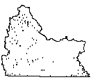
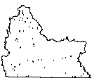
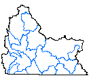
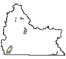
| Irrigation Wells (2001) |
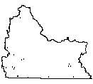 |
| This data set is a point coverage. It only contains those wells for which active irrigation is shown in the Green River Irrigated Lands Coverage of 2000. This entails all lands in the vicinity of Rock Springs and Baggs, Wyoming in the Green River Basin. The information was collected by Frank Carr of Water Rights Services, Inc. from the well permits and applications on file with the Wyoming State Engineer's Office. The points are approximately located by quarter quarter according to the SEO permit. The data structure for this data set is based on graph theory, in which a two-dimensional diagram is expressed as a set of spatial objects in a manner that explicitly expresses logical relationships. Applied to a map, this concept is used to encode the spatial relationships between the objects, including such concepts as adjacency and connectivity between objects. A topologically structured data file can support graphic applications, as well as computations and analyses involving the spatial objects and their spatial relationships. |
|
| Metadata |
Scale: unknown |
Wyoming State Engineer's Office |
| Shapefile |
Compressed: 3kb |
GCS North American Datum of 1927 |
Point/Decimal Degrees |
|
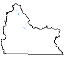
| Long & Short List Project Locations (2000) |
 |
| This data represents general locations of potential water development projects identified in the 2000 Green River Basin Water Planning Process. |
|
| Metadata |
Scale: unknown |
States West Water Resources Corporation |
| Shapefile |
Compressed: 2kb |
GCS North American Datum of 1927 |
Point/Decimal Degrees |
|
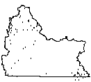
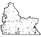
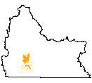
| Points of Diversion (2000) |
 |
| This data set is a point coverage. It only contains those points of diversion for which active irrigation is shown in the Green River Irrigated Lands Coverage of 2000. This entails all lands in the vicinity of Rock Springs and Baggs, Wyoming in the Green River Basin. The information was collected by Frank Carr of Water Rights Services, Inc. from the permit applications on file with the Wyoming State Engineer's Office. The points are approximately located along the subject canal . The data structure for this data set is based on graph theory, in which a two-dimensional diagram is expressed as a set of spatial objects in a manner that explicitly expresses logical relationships. Applied to a map, this concept is used to encode the spatial relationships between the objects, including such concepts as adjacency and connectivity between objects. A topologically structured data file can support graphic applications, as well as computations and analyses involving the spatial objects and their spatial relationships. |
|
| Metadata |
Scale: unknown |
Wyoming State Engineer's Office |
| Shapefile |
Compressed: 104kb |
GCS North American Datum of 1927 |
Point/Decimal Degrees |
|
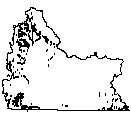
| SEO Ground Water Wells (1995) |
 |
| Contains just short of 80,000 point locations of Wyoming well permit locations on file with the Wyoming State Engineer's Office. They range in dates from the early 1900s to 1992, but are located only to the nearest 40 acre parcel. All locational information and attributes were imported from the Wyoming State Engineer's Office Well Permits Database stored in Advanced Revelation software. |
|
| Metadata |
Scale: 1:100,000 |
Wyoming State Engineer's Office |
| Shapefile |
Compressed: 469kb |
GCS North American Datum of 1927 |
Point/Decimal Degrees |
|
| USGS Gaging Stations (2000) |
 |
| This is a point coverage of USGS gaging stations in the Greater Green River Basin incorporating information from several facets of use through the Green River Basin Water Planning Process, including dissolved solids information, plus water quality, water conservation, and surface water modeling reference gage flags to indicate where used. |
|
| Metadata |
Scale: unknown |
U.S. Geological Survey |
| Shapefile |
Compressed: 8kb |
GCS North American Datum of 1927 |
Point/Decimal Degrees |
|
| USGS Ground Water Wells (2000) |
 |
| The water quality data was obtained from the USGS water quality database. The USGS provided some of the data that was available for the Bear River Basin. Additional water quality data is available through the USGS in the Cheyenne, Wyoming Office. |
|
| Metadata |
Scale: unknown |
U.S. Geological Survey |
| Shapefile |
Compressed: 231kb |
GCS North American Datum of 1927 |
Point/Decimal Degrees |
|
| USGS Springs (2000) |
 |
| The water quality data was obtained from the USGS water quality database. The USGS provided some of the data that was available for the Bear River Basin. Additional water quality data is available through the USGS in the Cheyenne, Wyoming Office. |
|
| Metadata |
Scale: unknown |
U.S. Geological Survey |
| Shapefile |
Compressed: 21kb |
GCS North American Datum of 1927 |
Point/Decimal Degrees |
|
| Water Right Permits (2000) |
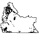 |
| This data set is a point coverage. It only contains those permits for which active irrigation is shown in the Green River Irrigated Lands Coverage of 2000. This entails all lands in the vicinity of Rock Springs and Baggs, Wyoming in the Green River Basin. The information was collected by Frank Carr of Water Rights Services, Inc. from the permit applications on file with the Wyoming State Engineer's Office. The points are located within the associated irrigated polygon. They are not placed according to tract information. The data structure for this data set is based on graph theory, in which a two-dimensional diagram is expressed as a set of spatial objects in a manner that explicitly expresses logical relationships. Applied to a map, this concept is used to encode the spatial relationships between the objects, including such concepts as adjacency and connectivity between objects. A topologically structured data file can support graphic applications, as well as computations and analyses involving the spatial objects and their spatial relationships. |
|
| Metadata |
Scale: unknown |
Wyoming State Engineer's Office |
| Shapefile |
Compressed: 157kb |
GCS North American Datum of 1927 |
Point/Decimal Degrees |
|
| Weather Station Locations (1999) |
 |
| This GIS dataset combines Wyoming, Utah, and Colorado weather stations in three networks: NOAA/NWS, NRCS Snotel,and Surface Airways. |
|
| Metadata |
Scale: unknown |
NOAA/NESDIS/NCDC |
| Shapefile |
Compressed: 7kb |
GCS North American Datum of 1927 |
Point/Decimal Degrees |
|
| Average Annual Precipitation (1961-1990) (1998) |
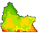 |
| This ftp site contains vector and polygon coverages of average monthly and annual precipitation for the climatological period 1961-90. Parameter-elevation Regressions on Independent Slopes Model (PRISM) derived raster data is the underlying data set from which the polygons and vectors were created. PRISM is an analytical model that uses point data and a digital elevation model (DEM) to generate gridded estimates of annual, monthly and event-based climatic parameters. Detailed descriptions of the PRISM raster data can be found with the accompanying raster data sets. For further information, the online PRISM homepage can be found at . |
|
| Metadata |
Scale: 1:250,000 |
PRISM Group |
| Shapefile |
Compressed: 303kb |
GCS North American Datum of 1927 |
Polygon/Decimal Degrees |
|
| Average Monthly Precipitation (1961-1990) (1998) |
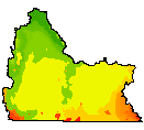 |
| This ftp site contains vector and polygon coverages of average monthly and annual precipitation for the climatological period 1961-90. Parameter-elevation Regressions on Independent Slopes Model (PRISM) derived raster data is the underlying data set from which the polygons and vectors were created. PRISM is an analytical model that uses point data and a digital elevation model (DEM) to generate gridded estimates of annual, monthly and event-based climatic parameters. Detailed descriptions of the PRISM raster data can be found with the accompanying raster data sets. For further information, the online PRISM homepage can be found at . |
|
| Metadata |
Scale: 1:250,000 |
PRISM Group |
| Shapefile |
Compressed: 806kb |
GCS North American Datum of 1927 |
Polygon/Decimal Degrees |
|
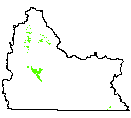
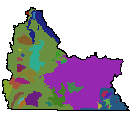
| Cropping Patterns (2001) |
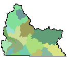 |
| This map represents crop distributions within collectively modeled sub-regions of the Greater Green River Basin, Wyoming. Crops include alfalfa, grass hay, and small grains. |
|
| Metadata |
Scale: unknown |
States West Water Resources Corporation |
| Shapefile |
Compressed: 39kb |
GCS North American Datum of 1927 |
Polygon/Decimal Degrees |
|
| Hydologic Unit Code Boundaries, 4th Level (1994) |
 |
| The Geographic Information Retrieval and Analysis System (GIRAS) was developed in the mid 70s to put into digital form a number of data layers which were of interest to the USGS. One of these data layers was the Hydrologic Units. The map is based on the Hydrologic Unit Maps published by the U.S. Geological Survey Office of Water Data Coordination, together with the list descriptions and name of region, subregion, accounting units, and cataloging unit. The hydrologic units are encoded with an eight- digit number that indicates the hydrologic region (first two digits), hydrologic subregion (second two digits), accounting unit (third two digits), and cataloging unit (fourth two digits). The data produced by GIRAS was originally collected at a scale of 1:250,000. This data set is a modification for Wyoming of the original United States HUC data produced by the USGS. The primary modifications made in this data set by the Wyoming Water Resources Center include 1) removal of hydrologic units that do not drain witi Wyoming and 2) modification of the hydrologic unit boundaries to better encompass streams and lakes represented in the 1:100,000 scale Digital Line Graph (DLG) of surficial hydrography. The HUC boundaries have not been "clipped" to the Wyoming border, in order to maintain the natural boundaries of the units. This metadata has also been altered from original USGS metadata to be more specific for Wyoming. |
|
| Metadata |
Scale: 1:250,000 |
U.S. Geological Survey/WyGISC |
| Shapefile |
Compressed: 49kb |
GCS North American Datum of 1927 |
Polygon/Decimal Degrees |
|
| Irrigable Lands (2000) |
 |
| Digital map of irrigable lands in the Green River Basin, Wyoming, from 1981 USBR mapping. |
|
| Metadata |
Scale: 1:1,000,000 |
U.S. Bureau of Reclamation |
| Shapefile |
Compressed: 11kb |
GCS North American Datum of 1927 |
Polygon/Decimal Degrees |
|
| Irrigable Soils (2000) |
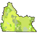 |
| GIS map and dataset of irrigable soils in the Green River Basin, Wyoming including designation of general climatic zone, dominant soil class, and soil class percentages. |
|
| Metadata |
Scale: 1:500,000 |
Wyoming State Engineer's Office/USDA/WWDA |
| Shapefile |
Compressed: 136kb |
GCS North American Datum of 1927 |
Polygon/Decimal Degrees |
|
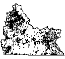
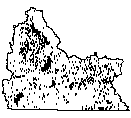
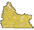
| Irrigated Land (2000) |
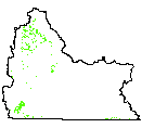 |
| This data set is a polygon coverage. It only contains irrigated acreage in the Green River, Little Snake, and Great Divide basin within Wyoming. The initial interpretation of irrigated lands due to the works of man was taken from 1982 and 1983 aerial infra-red photos. The interpretation was then revised with 1999infra-red satellite photography. Upon completion of digitizing these areas, StateEngineer personnel provided comments for proposed alterations to the delineation. The data structure for this data set is based on graph theory, in which a two-dimensional diagram is expressed as a set of spatial objects in a manner that explicitly expresses logical relationships. Applied to a map, this concept is used to encode the spatial relationships between the objects, including such concepts as adjacency and connectivity between objects. A topologically structured data file can support graphic applications,as well as computations and analyses involving the spatial objects and their spatialrelationships. Irrigated lands and sub-irrigated lands are differentiated. |
|
| Metadata |
Scale: 1:24,000 |
States West Water Resources Corporation |
| Shapefile |
Compressed: 867kb |
GCS North American Datum of 1927 |
Polygon/Decimal Degrees |
|
| Irrigation Districts (1999) |
 |
| Map of irrigation district boundaries in the Green River Basin as obtained from Wyoming State Engineer's Office maps and records. |
|
| Metadata |
Scale: 1:100,000 |
Wyoming State Engineer's Office |
| Shapefile |
Compressed: 36kb |
GCS North American Datum of 1927 |
Polygon/Decimal Degrees |
|
| Irrigation Reservoirs (2000) |
 |
| This data set is a polygon coverage. It only contains those reservoirs for which active irrigation is shown in the Green River Irrigated Lands Coverage of 2000. This entails all lands in the vicinity of Rock Springs and Baggs, Wyoming in the Green River Basin. The information was collected by Frank Carr of Water Rights Services, Inc. from the permit applications on file with the Wyoming State Engineer's Office. The data structure for this data set is based on graph theory, in which a two-dimensional diagram is expressed as a set of spatial objects in a manner that explicitly expresses logical relationships. Applied to a map, this concept is used to encode the spatial relationships between the objects, including such concepts as adjacency and connectivity between objects. A topologically structured data file can support graphic applications, as well as computations and analyses involving the spatial objects and their spatial relationships. |
|
| Metadata |
Scale: 1:100,000 |
Wyoming State Engineer's Office/WyGISC |
| Shapefile |
Compressed: 34kb |
GCS North American Datum of 1927 |
Polygon/Decimal Degrees |
|
| Sodium Leases & Trona Mines (2000) |
 |
| This is a combined polygon coverage of two maps obtained from the Bureau of Land Management entitled "Sodium Leases," and "Trona Mines." It represents mineral ownership of BLM lands in the Green River Basin of Wyoming. |
|
| Metadata |
Scale: 1:250,000 |
Bureau of Land Management |
| Shapefile |
Compressed: 10kb |
GCS North American Datum of 1927 |
Polygon/Decimal Degrees |
|
| Surficial Geology (1998) |
 |
| This dataset represents surficial geology of Wyoming at 1:500,000-scale. The layer contains 577 separate surficial feature (landforms) and deposit descriptions present on the surface in the state. Compiled from aerial photography and existing maps this layer represents the first comprehensive surficial geology map of Wyoming. |
|
| Metadata |
Scale: 1:500,000 |
WSGS/Wyoming Geographic Science Center |
| Shapefile |
Compressed: 3,997kb |
GCS North American Datum of 1927 |
Polygon/Decimal Degrees |
|
| Water Quality Classification of Streams (2000) |
 |
| This data represents water quality classifications for streams in the Green River Basin, based on Chapter 1 of the Wyoming Water Quality Rules. |
|
| Metadata |
Scale: 1:100,000 |
Wyoming Department of Environmental Quality |
| Shapefile |
Compressed: 44kb |
GCS North American Datum of 1927 |
Polygon/Decimal Degrees |
|
| Annual Lake Evaporation Contours (1999) |
 |
| Contour lines of gross lake evaporation in the Green River Basin, Wyoming |
|
| Metadata |
Scale: unknown |
Lewis, L.E. |
| Shapefile |
Compressed: 3kb |
GCS North American Datum of 1927 |
Polyline/Decimal Degrees |
|
| Annual Pan Evaporation Contours (1999) |
 |
| Contour lines of gross pan evaporation in the Green River Basin, Wyoming |
|
| Metadata |
Scale: unknown |
Lewis, L.E. |
| Shapefile |
Compressed: 3kb |
GCS North American Datum of 1927 |
Polyline/Decimal Degrees |
|
| Bedrock Geology (1985) |
 |
| The geologic map was digitized from original scribe sheets used to prepare the published Geologic Map of Wyoming (Love and Christiansen,1985), consequently at a 1:500,000 scale. The dataset has both polygon and line features (faults), with attributes derived from the 1985 map. |
|
| Metadata |
Scale: 1:500,000 |
U.S. Geological Survey |
| Shapefile |
Compressed: 2,273kb |
GCS North American Datum of 1927 |
Polyline/Decimal Degrees |
|
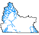
| Hydrography 100k (1996) |
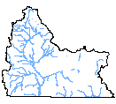 |
| Hydrographic features for Wyoming at 1:100,000-scale, including perennial and intermittent designations and Strahler stream order attributes for streams. Does not include man-made ditches, canals and aqueducts. The data was originally produced by USGS, a Digital Line Graph (DLG) product, though this product was enhanced (edgematched, some linework and attributes corrected, stream order attribute added). A subset of this dataset is also available for distribution, including only major streams (order 4 to 7) and major lakes and reservoirs. In order to reduce the size of this subset, the line segments were dissolved to remove unncessary segments. Both datasets are available in Arc export file and shapefile format for download (see Onlink_Linkage) Statewide and tiled data: there is one export file, which when imported into ARC/INFO, will contain one coverage with both polygon (lakes, reservoirs) and line (streams) topology and two feature attribute files (.PAT and .AAT) along with three additional attribute filecontaining descriptive information. In shapefile format, there will be two shapefiles (polygons and lines separated), with all attribute files in Dbase format. |
|
| Metadata |
Scale: 1:100,000 |
Wyoming Gap Analysis |
| Shapefile |
Compressed: 556kb |
GCS North American Datum of 1927 |
Polyline/Decimal Degrees |
|
| Mean Consumptive Use and Consumptive Irrigation Requirements (2000) |
 |
| The polygon coverage is a joined version of mean value, fully attributed isoline coverages that represent all variables of consumptive use or consumptive irrigation requirements, crop type (alfalfa hay, pasture grass & grass hay), month (april-october + seasonal), and mean, minimum and maximum values given in report 92-06. (92 coverages--april and october lack significant minimum consumptive irrigation requirements). Contours were generated using Softdesk version 7.50 with Autocad version 13. |
|
| Metadata |
Scale: unknown |
States West Water Resources Corporation |
| Shapefile |
Compressed: 285kb |
GCS North American Datum of 1927 |
Polyline/Decimal Degrees |
|
| Stream Reaches of Instream Flow Applications & Permits (2000) |
 |
| 1:100,000 stream coverages were clipped to approximate location of instream flow permit applications based on the public land sections referenced as the point of beginning and point of ending. All available attiribute information provided by the Wyoming State Engineer's Office was joined to the appropriate locations. |
|
| Metadata |
Scale: 1:100,000 |
Wyoming State Engineer's Office |
| Shapefile |
Compressed: 20kb |
GCS North American Datum of 1927 |
Polyline/Decimal Degrees |
|
| Trout Stream Classification (2000) |
 |
| This data represents trout stream classifications for streams in the Green River Basin, based on Wyoming Game and Fish Department 1991 Criteria. |
|
| Metadata |
Scale: 1:100,000 |
Wyoming Game and Fish |
| Shapefile |
Compressed: 593kb |
GCS North American Datum of 1927 |
Polyline/Decimal Degrees |
|
| Wetlands Inventory (1997) |
 |
| Original digital National Wetland Inventory quadrangles converted into Arc/Info coverages with matching attributes. See graphic image for availability of these quadrangles in Wyoming. |
|
| Metadata |
Scale: 1:24,000 |
U.S. Fish and Wildlife |
| Shapefile |
Compressed: 68,563kb |
GCS North American Datum of 1927 |
Polyline/Decimal Degrees |
