|
| Gages (2003) |
 |
| This data set represents United States Geologic Survey (USGS) surface water stream gauge locations found within the Wind/Bighorn river basin planning area. The stream gage locational data was downloaded from the USGS National Water Information System (NWIS) website on November 28, 2001. Historic stream flow data can be downloaded from the USGS National Water Information System (NWIS) website and linked to this data set. |
|
| Metadata |
Scale: unknown |
U.S. Geological Survey |
| Shapefile |
Compressed: 21kb |
GCS North American Datum of 1927 |
Point/Decimal Degrees |
|
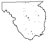
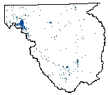
| Groundwater Wells (2003) |
 |
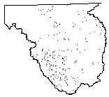
| Contains approximately 15,600 point locations of Wyoming well permit locations on file with the Wyoming State Engineer's Office. The wells have been located to the to the nearest 40 acre parcel. All locational information and attributes were imported from the Wyoming State Engineer's Office Well Permits Database stored in SQL-Server. |
|
| Metadata |
Scale: 1:24,000 |
Wyoming State Engineer's Office |
| Shapefile |
Compressed: 1,383kb |
GCS North American Datum of 1927 |
Point/Decimal Degrees |
|
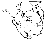
| Industrial wells > 50 gpm (2003) |
 |
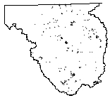
| Contains a subset of the approximately 15,600 point locations of Wyoming well permit locations on file with the Wyoming State Engineer's Office for the Wind/Bighorn Basin. This layer contains only those Industrial wells for the basin that have a yield higher than 50 gallons per minute. All cancelled and abandoned wells have been excluded from this data set. The wells are located to the nearest 40 acre parcel. All locational information and attributes were imported from the Wyoming State Engineer's Office Well Permits Database stored in SQL-Server. |
|
| Metadata |
Scale: 1:24,000 |
Wyoming State Engineer's Office |
| Shapefile |
Compressed: 22kb |
GCS North American Datum of 1927 |
Point/Decimal Degrees |
|
| Irrigation Points of Diversion (2003) |
 |
| This dataset contains digital points of diversion of the irrigated agricultural lands mapped for the Wind/Bighorn River Basin Plan. A point of diversion or service area point defines the location of the water right that services the irrigated lands. A point of diversion was created for only those water rights that divert more than 10 cfs (cubic feet per second). The points of diversion were obtained by digitizing points placed on 1:24,000-scale USGS 7.5-Minute Quadrangles. |
|
| Metadata |
Scale: 1:24,000 |
Wyoming State Engineer's Office |
| Shapefile |
Compressed: 33kb |
GCS North American Datum of 1927 |
Point/Decimal Degrees |
|
| Long List of Water Use Opportunities (2003) |
 |
| This layer represents water development opportunities within the Wind/Bighorn Basin. This "Long List" of water use opportunities was compiled from research of existing literature or recommendations by the Basin Advisory Group (BAG). These opportunities were then ranked and sorted to create a "Short List" of sites that merit additional study. |
|
| Metadata |
Scale: 1:24,000 |
TriHydro Corporation |
| Shapefile |
Compressed: 19kb |
GCS North American Datum of 1927 |
Point/Decimal Degrees |
|
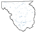
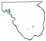
| Weather Stations (2003) |
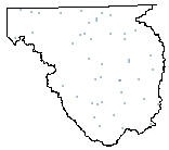 |
| This data set contains a subset of the 171 weather stations scattered throughout the state of Wyoming. |
|
| Metadata |
Scale: unknown |
National Climatic Data Center |
| Shapefile |
Compressed: 15kb |
GCS North American Datum of 1927 |
Point/Decimal Degrees |
|
| Wells > 50 gpm (2003) |
 |
| Contains a subset of the approximately 15,600 point locations of Wyoming well permit locations on file with the Wyoming State Engineer's Office for the Wind/Bighorn Basin. This layer contains only those wells for the basin that have a yield higher than 50 gallons per minute. All cancelled and abandoned wells have been excluded from this data set. The wells are located to the nearest 40 acre parcel. All locational information and attributes were imported from the Wyoming State Engineer's Office Well Permits Database stored in SQL-Server. |
|
| Metadata |
Scale: 1:24,000 |
Wyoming State Engineer's Office |
| Shapefile |
Compressed: 49kb |
GCS North American Datum of 1927 |
Point/Decimal Degrees |
|
| Bedrock Geology (2003) |
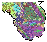 |
| The geologic map was digitized from original scribe sheets used to prepare the published Geologic Map of Wyoming (Love and Christiansen, 1985), consequently at a 1:500,000 scale. Stable base contact prints of the scribe sheets were scannned on a Tektronix 4991 digital scanner. The scanner automatically converts the scanned image to an ASCII vector format. These vectors were transferred to a VAX minicomputer, where they were loaded into Arc/Info. The dataset includes both linear and polygon features, with attributes derived from the original 1985 map. |
|
| Metadata |
Scale: 1:500,000 |
U.S. Geological Survey |
| Shapefile |
Compressed: 3,862kb |
GCS North American Datum of 1927 |
Polygon/Decimal Degrees |
|
| Hydrologic Unit Code - Level 4 Boundaries (2003) |
 |
| The Geographic Information Retrieval and Analysis System (GIRAS) was developed in the mid 70s to put into digital form a number of data layers which were of interest to the USGS. One of these data layers was the Hydrologic Units. The map is based on the Hydrologic Unit Maps published by the U.S. Geological Survey Office of Water Data Coordination, together with the list descriptions and name of region, subregion, accounting units, and cataloging unit. The hydrologic units are encoded with an eight- digit number that indicates the hydrologic region (first two digits), hydrologic subregion (second two digits), accounting unit (third two digits), and cataloging unit (fourth two digits). The data produced by GIRAS was originally collected at a scale of 1:250,000. This data set is a modification for Wyoming of the original United States HUC data produced by the USGS. The primary modifications made in this data set by the Wyoming Water Resources Center include 1) removal of hydrologic units that do not drain witi Wyoming and 2) modification of the hydrologic unit boundaries to better encompass streams and lakes represented in the 1:100,000 scale Digital Line Graph (DLG) of surficial hydrography. The HUC boundaries have not been "clipped" to the Wyoming border, in order to maintain the natural boundaries of the units. This metadata has also been altered from original USGS metadata to be more specific for Wyoming. |
|
| Metadata |
Scale: 1:100,000 |
U.S. Geological Survey |
| Shapefile |
Compressed: 60kb |
GCS North American Datum of 1927 |
Polygon/Decimal Degrees |
|
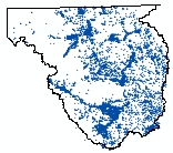
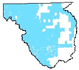
| Irrigated Lands (2003) |
 |
| This dataset contains the irrigated lands mapped for the Wind/Bighorn River Basin Plan. Irrigated lands were divided into the following categories: Irrigated Lands, Sub-irrigated Lands, and Water Awards. All previously unmapped areas were assigned to either Irrigated Lands or Sub-Irrigated Lands based on the visual interpretation of Digital Ortho Quarter Quadrangles (DOQQs) and 1999 Landsat color-infrared satellite imagery. Identified lands were then transposed onto USGS 1:24,000-scale, 7.5 Minute Quadrangle maps, attributed with water rights, digitized and placed into an ArcView 3.2a shapefile. Verification of irrigated versus sub-irrigated lands occurred during the assignment of water right attributes. Previously mapped lands - obtained from the Wyoming State Engineer's Office - were then incorporated into the irrigated lands shapefile and assigned to the appropriate category based on existing attributes. |
|
| Metadata |
Scale: 1:24,000 |
TriHydro Corporation |
| Shapefile |
Compressed: 6933kb |
GCS North American Datum of 1927 |
Polygon/Decimal Degrees |
|
| Major Reservoirs (2003) |
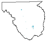 |
| This dataset contains the major reservoirs within the Wind/Bighorn River Basin Plan that have attached water rights of 500 acre-feet or greater. The attached water rights were identified by Water Rights Services, LLC using water right records located at the Wyoming State Engineer's Office. The reservoir polygons were obtained from either the water bodies dataset created specifically for the Wind/Bighorn River Basin Plan (see the metadata for wbhwtrbodies for further details) or they were digitized from United States Geologic Survey (USGS) 1:24,000-scale, 7.5 minute Digital Raster Graphics. |
|
| Metadata |
Scale: 1:24,000 |
U.S. Geological Survey |
| Shapefile |
Compressed: 233kb |
GCS North American Datum of 1927 |
Polygon/Decimal Degrees |
|
| Surficial Geology (2003) |
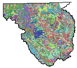 |
| This dataset represents surficial geology of Wyoming at 1:500,000-scale. The layer contains 577 separate surficial feature (landforms) and deposit descriptions present on the surface in the state. Compiled from aerial photography and existing maps this layer represents the first comprehensive surficial geology map of Wyoming. |
|
| Metadata |
Scale: 1:500,000 |
Wyoming State Geological Survey |
| Shapefile |
Compressed: 17,021kb |
GCS North American Datum of 1927 |
Polygon/Decimal Degrees |
|
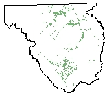
| Water Bodies (2003) |
 |
| This layer is a composite of multiple 1:24,000-scale sources of lakes for the Wind/Bighorn river basin. Full basin coverage does not exist for this layer because digital data for for portions of the basin at a scale of 1:24,000. Attributes include lake name, source, and lake type (when available). |
|
| Metadata |
Scale: 1:24,000 |
U.S. Geological Survey |
| Shapefile |
Compressed: 1,019kb |
GCS North American Datum of 1927 |
Polygon/Decimal Degrees |
|
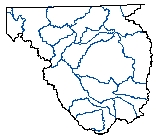
| Hydrography (2003) |
 |
| This layer is a composite of multiple 1:24,000-scale sources of hydrography within the Wind/Bighorn River Basin. This layer is incomplete because 1:24,000 digital hydrography data does not exist for all areas within the basin. Attributes include stream name, source, and stream type when available. |
|
| Metadata |
Scale: 1:24,000 |
U.S. Geological Survey |
| Shapefile |
Compressed: 45,365kb |
GCS North American Datum of 1927 |
Polyline/Decimal Degrees |
|
| National Wetlands Inventory (NWI) (2003) |
 |
| Wyoming Geographic Information Science Center - Original digital National Wetland Inventory quadrangles converted into Arc/Info coverages with matching attributes. Yellowstone National Park Data - The wetlands of Yellowstone National Park are records of wetlands location and classification as defined by the U.S. Fish & Wildlife Service. This dataset is one of a series available in 7.5 minute by 7.5 minute blocks containing ground planimetric coordinates of wetlands point, line, and area features and wetlands attributes. Data were assembled and edgematched by staff at Yellowstone National Park's Spatial Analysis Center to provide a seamless coverage. |
|
| Metadata |
Scale: unknown |
U.S. Fish and Wildlife Service |
| Shapefile |
Compressed: 35,244kb |
GCS North American Datum of 1927 |
Polyline/Decimal Degrees |
