|
| Points of Diversion (1999) |
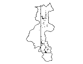 |
| Contains the point of diversions for irrigation, industrial, and municipal water rights in the Bear River Basin. May not contain all points of diversions in the Bear River Basin. All data was obtained from the Wyoming State Engineer's Office water rights files. The point of diversions are located either to the nearest 40-acre parcel or to the associated irrigated land. |
|
| Metadata |
Scale: unknown |
Wyoming State Engineer's Office |
| Shapefile |
Compressed: 16kb |
GCS North American Datum of 1927 |
Point/Decimal Degrees |
|
| Reservoir Water Right Permits (1999) |
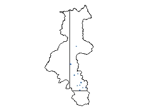 |
| Contains the reservoir water rights in the Bear River Basin. All data was obtained from the Wyoming State Engineer's Office water rights files. The water rights are located either to the nearest 40-acre parcel or to the associated irrigated land. |
|
| Metadata |
Scale: unknown |
Wyoming State Engineer's Office |
| Shapefile |
Compressed: 4kb |
GCS North American Datum of 1927 |
Point/Decimal Degrees |
|
| SEO Ground Water Wells (1999) |
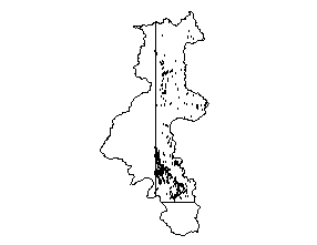 |
| Contains approximately 84,000 point locations of Wyoming well permit locations on file with the Wyoming State Engineer's Office. They range in dates from the early 1900s to 1999, but are located only to the nearest 40 acre parcel. All locational information and attributes were imported from the Wyoming State Engineer's Office Well Permits Database stored in a MS Access database. |
|
| Metadata |
Scale: unknown |
Wyoming State Engineer's Office |
| Shapefile |
Compressed: 68kb |
GCS North American Datum of 1927 |
Point/Decimal Degrees |
|
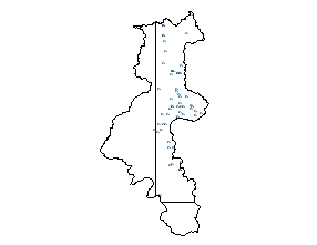
| USGS Gaging Stations (2000) |
 |
| The USGS Gage coverage was built to aid in the surface water modeling tasks. The database includes the name of the gage, the HUC code, drainage area, and period of record. |
|
| Metadata |
Scale: unknown |
U.S. Geological Survey |
| Shapefile |
Compressed: 2kb |
GCS North American Datum of 1927 |
Point/Decimal Degrees |
|
| USGS Ground Water Quality (2000) |
 |
| The water quality data was obtained from the USGS water quality database. The USGS provided some of the data that was available for the Bear River Basin. Additional water quality data is available through the USGS in the Cheyenne, Wyoming Office. |
|
| Metadata |
Scale: unknown |
U.S. Geological Survey |
| Shapefile |
Compressed: 17kb |
GCS North American Datum of 1927 |
Point/Decimal Degrees |
|
| USGS Ground Water Wells (2000) |
 |
| The well data was obtained through the USGS. The USGS provided requested data that was available for the Bear River Basin, Wyoming. Additional well data is available through the USGS office in Cheyenne, Wyoming. Additional data may exist that is not in the Ground Water Site Inventory (GWSI). |
|
| Metadata |
Scale: unknown |
U.S. Geological Survey |
| Shapefile |
Compressed: 24kb |
GCS North American Datum of 1927 |
Point/Decimal Degrees |
|
| USGS Springs (2000) |
 |
| The spring data was obtained through the USGS. The USGS provided requested data that was available for the Bear River Basin, Wyoming. Additional spring data is available through the USGS office in Cheyenne, Wyoming. Additional data may exist that is not in the Ground Water Site Inventory (GWSI). |
|
| Metadata |
Scale: unknown |
U.S. Geological Survey |
| Shapefile |
Compressed: 9kb |
GCS North American Datum of 1927 |
Point/Decimal Degrees |
|
| USGS Surface Water Quality (2000) |
 |
| The water quality data was obtained from the USGS water quality database. The USGS provided some of the data that was available for the Bear River Basin. Additional water quality data is available through the USGS in the Cheyenne, Wyoming Office. |
|
| Metadata |
Scale: unknown |
U.S. Geological Survey |
| Shapefile |
Compressed: 24kb |
GCS North American Datum of 1927 |
Point/Decimal Degrees |
|
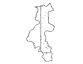
| Water Right Permits (1999) |
 |
| Contains some irrigation, industrial, reservoir, and municipal water rights in the Bear River Basin. Does not contain all water right permits in the Bear River Basin. All data was obtained from the Wyoming State Engineer's Office water rights files. The water rights are located either to the nearest 40-acre parcel or to the associated irrigated land. |
|
| Metadata |
Scale: unknown |
Wyoming State Engineer's Office |
| Shapefile |
Compressed: 51kb |
GCS North American Datum of 1927 |
Point/Decimal Degrees |
|
| Well Water Rights (1999) |
 |
| Contains some irrigation, industrial, and municipal well water rights in the Bear River Basin. The criteria was all wells permitted over 50 gpm or with use other than domestic. This coverage does not contain all well water right permits in the Bear River Basin. All data was obtained from the Wyoming State Engineer's Office water rights files. The water rights are located either to the nearest 40-acre parcel or to the associated irrigated land. |
|
| Metadata |
Scale: unknown |
Wyoming State Engineer's Office |
| Shapefile |
Compressed: 9kb |
GCS North American Datum of 1927 |
Point/Decimal Degrees |
|
| Bear River Basin Boundary (1994) |
 |
| The Geographic Information Retrieval and Analysis System (GIRAS) was developed in the mid 70s to put into digital form a number of data layers which were of interest to the USGS. One of these data layers was the Hydrologic Units. The map is based on the Hydrologic Unit Maps published by the U.S. Geological Survey Office of Water Data Coordination, together with the list descriptions and name of region, subregion, accounting units, and cataloging unit. The hydrologic units are encoded with an eight- digit number that indicates the hydrologic region (first two digits), hydrologic subregion (second two digits), accounting unit (third two digits), and cataloging unit (fourth two digits). The data produced by GIRAS was originally collected at a scale of 1:250,000. This data set is a modification for Wyoming of the original United States HUC data produced by the USGS. The primary modifications made in this data set by the Wyoming Water Resources Center include 1) removal of hydrologic units that do not drain witi Wyoming and 2) modification of the hydrologic unit boundaries to better encompass streams and lakes represented in the 1:100,000 scale Digital Line Graph (DLG) of surficial hydrography. The HUC boundaries have not been "clipped" to the Wyoming border, in order to maintain the natural boundaries of the units. This metadata has also been altered from original USGS metadata to be more specific for Wyoming. |
|
| Metadata |
Scale: 1:250,000 |
U.S. Geological Survey |
| Shapefile |
Compressed: 8kb |
GCS North American Datum of 1927 |
Polygon/Decimal Degrees |
|
| Bear River Basin Boundary, Wyoming (1994) |
 |
| The Geographic Information Retrieval and Analysis System (GIRAS) was developed in the mid 70s to put into digital form a number of data layers which were of interest to the USGS. One of these data layers was the Hydrologic Units. The map is based on the Hydrologic Unit Maps published by the U.S. Geological Survey Office of Water Data Coordination, together with the list descriptions and name of region, subregion, accounting units, and cataloging unit. The hydrologic units are encoded with an eight- digit number that indicates the hydrologic region (first two digits), hydrologic subregion (second two digits), accounting unit (third two digits), and cataloging unit (fourth two digits). The data produced by GIRAS was originally collected at a scale of 1:250,000. This data set is a modification for Wyoming of the original United States HUC data produced by the USGS. The primary modifications made in this data set by the Wyoming Water Resources Center include 1) removal of hydrologic units that do not drain witi Wyoming and 2) modification of the hydrologic unit boundaries to better encompass streams and lakes represented in the 1:100,000 scale Digital Line Graph (DLG) of surficial hydrography. The HUC boundaries have not been "clipped" to the Wyoming border, in order to maintain the natural boundaries of the units. This metadata has also been altered from original USGS metadata to be more specific for Wyoming. |
|
| Metadata |
Scale: 1:250,000 |
U.S. Geological Survey |
| Shapefile |
Compressed: 5kb |
GCS North American Datum of 1927 |
Polygon/Decimal Degrees |
|
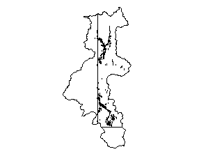
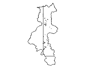
| Irrigated Land (1999) |
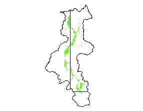 |
| This data set is a polygon coverage. It only contains irrigated acreage in the Bear River Basin within or near Wyoming. The interpretation of irrigated lands due to the works of man was taken from 1982 and 1983 aerial infra-red photos. Upon completion of digitizing these areas, Wyoming State Engineer's Office field personnel updated the lands and checked the accuracy of the delineation. Their check was completed in the fall of 1998. The data structure for thi data set is based on graph theory, in which a two-dimensional diagram is expressed as a set of spatial objects in a manner that explicitly expresses logical relationships. Applied to a map, this concept is used to encode the spatial relationships between the objects, including such concepts as adjacency and connectivity between objects. A topologically structured data file can support graphic applications, as well as computations and analyses involving the spatial objects and their spatial relationships. |
|
| Metadata |
Scale: 1:24,000 |
States West Water Resources Corporation |
| Shapefile |
Compressed: 140kb |
GCS North American Datum of 1927 |
Polygon/Decimal Degrees |
|
| Surficial Geology (1998) |
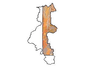 |
| This dataset represents surficial geology of Wyoming at 1:500,000-scale. The layer contains 577 separate surficial feature (landforms) and deposit descriptions present on the surface in the state. Compiled from aerial photography and existing maps this layer represents the first comprehensive surficial geology map of Wyoming. |
|
| Metadata |
Scale: 1:500,000 |
Wyoming State Geological Survey |
| Shapefile |
Compressed: 149kb |
GCS North American Datum of 1927 |
Polygon/Decimal Degrees |
|
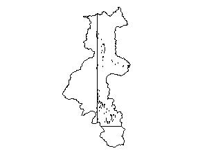
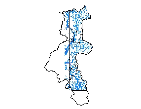
| Major Rivers (1999) |
 |
| Basemaps taken from ESRI Freeware. |
|
| Metadata |
Scale: unknown |
ESRI |
| Shapefile |
Compressed: 94kb |
GCS North American Datum of 1927 |
Polyline/Decimal Degrees |
|
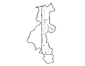
| Stream Reaches of Instream Flow Applications & Permits (1999) |
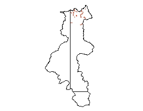 |
| Stream Reaches of Instream Flow Applications & Permits |
|
| Metadata |
Scale: 1:100,000 |
Wyoming State Engineer's Office |
| Shapefile |
Compressed: 8kb |
GCS North American Datum of 1927 |
Polyline/Decimal Degrees |
|
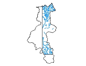
| Wetlands Inventory (1997) |
 |
| Original digital National Wetland Inventory quadrangles converted into Arc/Info coverages with matching attributes. See graphic image for availability of these quadrangles in Wyoming. |
|
| Metadata |
Scale: 1:24,000 |
U.S. Fish and Wildlife |
| Shapefile |
Compressed: 1,248kb |
GCS North American Datum of 1927 |
Polyline/Decimal Degrees |
